Four Legs That Can’t Pedal: Adventures in Biking with a Dog

There are a two types of dog owners: ones that take their dogs with them on adventures and ones that leave their dogs behind. Now I’m not hating on those that hire dog sitters when they go out of town, because these are the folks that helped me build my side gig and make a few extra thousand dollars here and there.

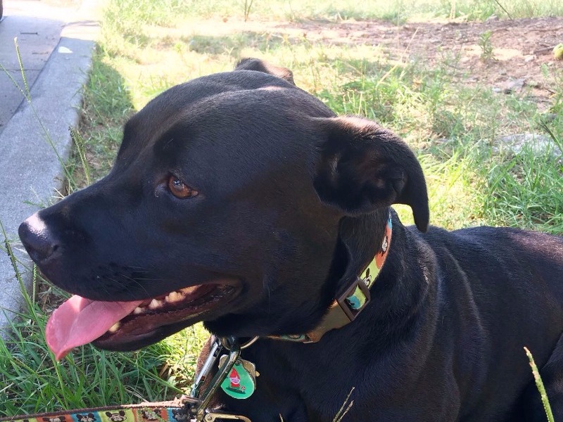
But when we adopted Monkey, I knew that I wanted her to be as much a part of our travel adventures as humanly and canine-ly possible. That’s why when we recently took a trip to New Mexico and planned to put some serious miles on the bikes, I knew it was time to invest in some new equipment.

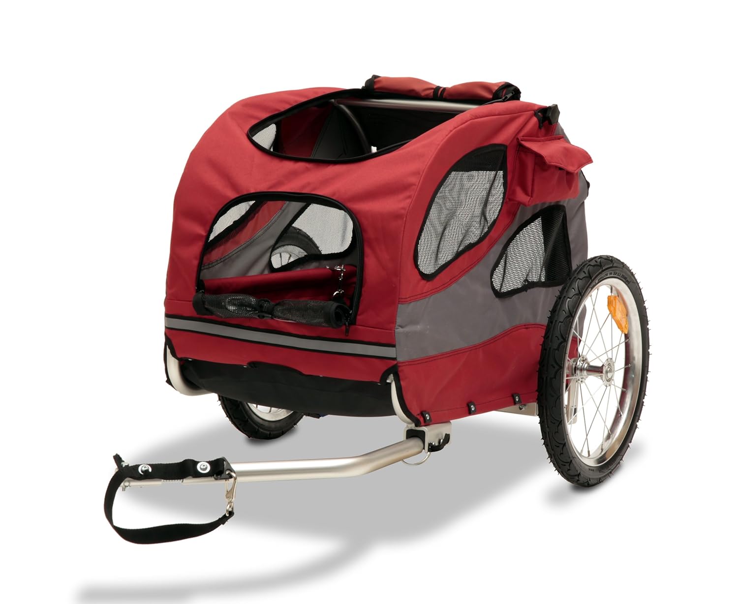
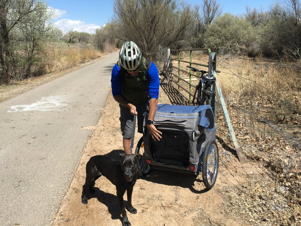
Just a few days before leaving Atlanta, we Amazon Primed a red-colored, medium sized Solvit HoundAbout Pet Bicycle Trailer to our apartment. We tried to coax Monkey inside it in the living room with toys and treats, but she was just not having it. After a while, we gave her a little push to see if she’d get used to it. But it was immediately clear that either she was too big or the trailer was too small, because it was so cramped in there that she could barely sit down. It was great quality, but just too small for a 43-pound dog.

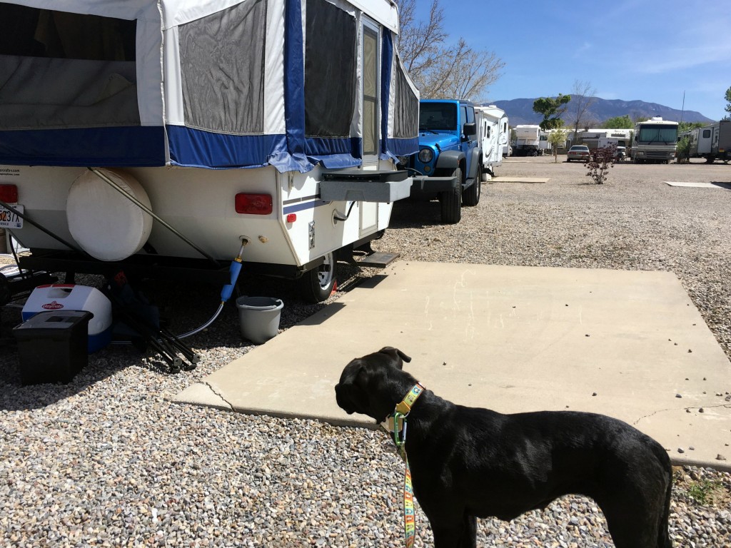
We promptly returned the trailer with no remaining days to spare before hitting the road on an epic five-week camping trip. Fortunately these days, you don’t have to stay in one place to receive packages, and we arranged to have a larger bike trailer shipped to a UPS store in Albuquerque.

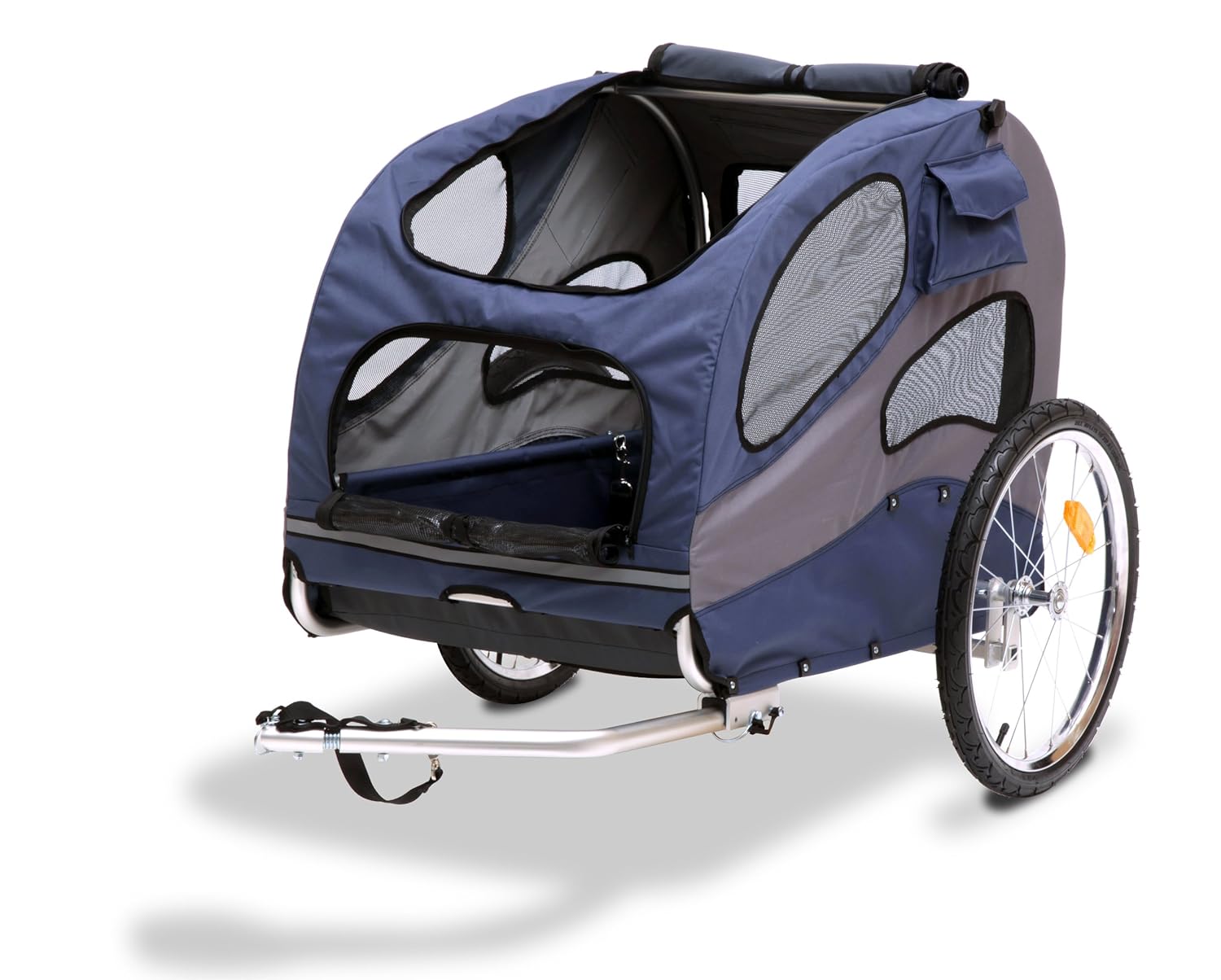
This new blue Solvit HoundAbout Pet Bicycle Trailer was a size large with a lightweight aluminum frame. The product description said it would be suitable for a pet up to 110 pounds, but I’m not sure how the heck that would work. For 43-pound Monkey, this was much better though.

ABQ Ride 1
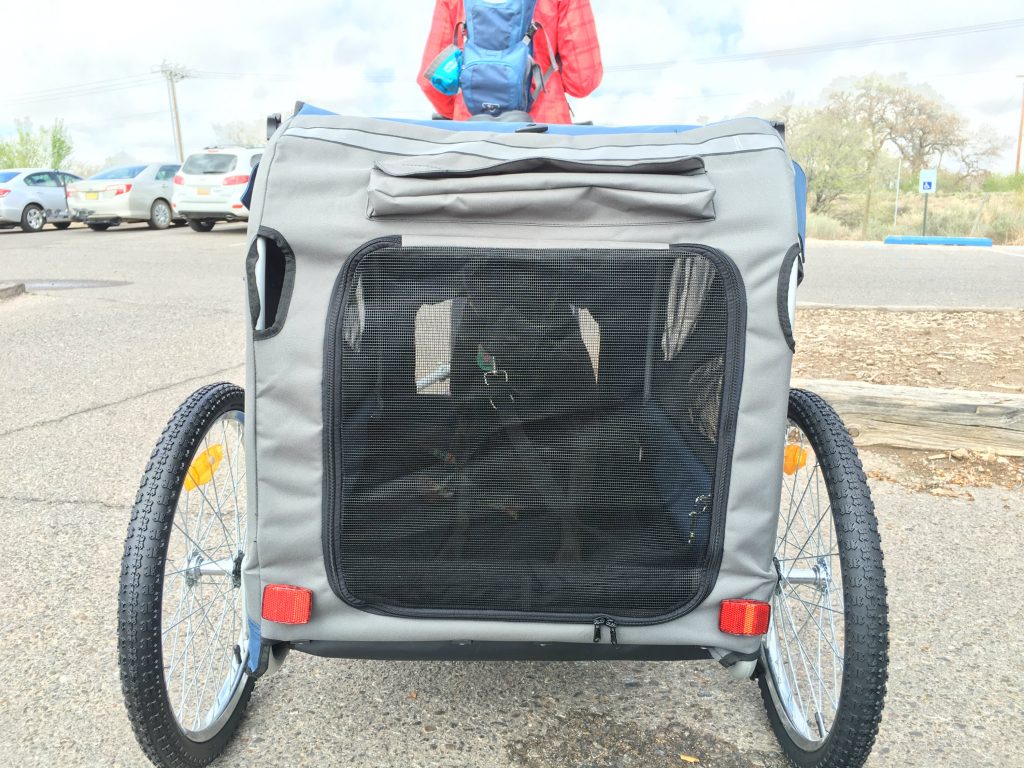
The trailer folds down for storage and the wheels come off and stow inside. It’s actually pretty easy put together after you’ve done it a couple times, and there are mesh screens to boost air flow. It came with a black cushion pad, but I whipped out my sewing machine and made her a cushier one to entice her to ride a bit more. She loves soft things.

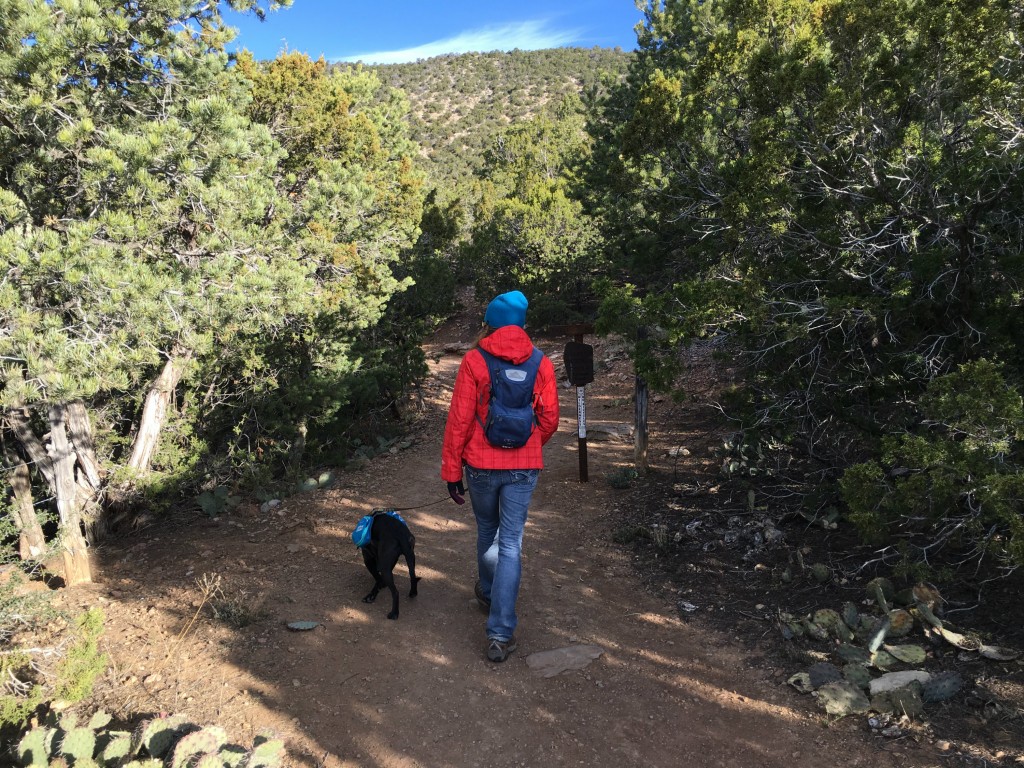
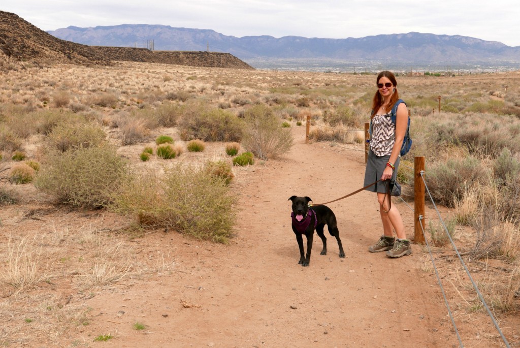
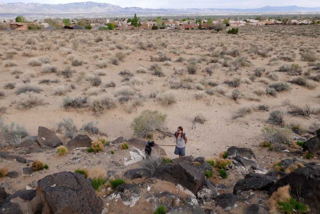
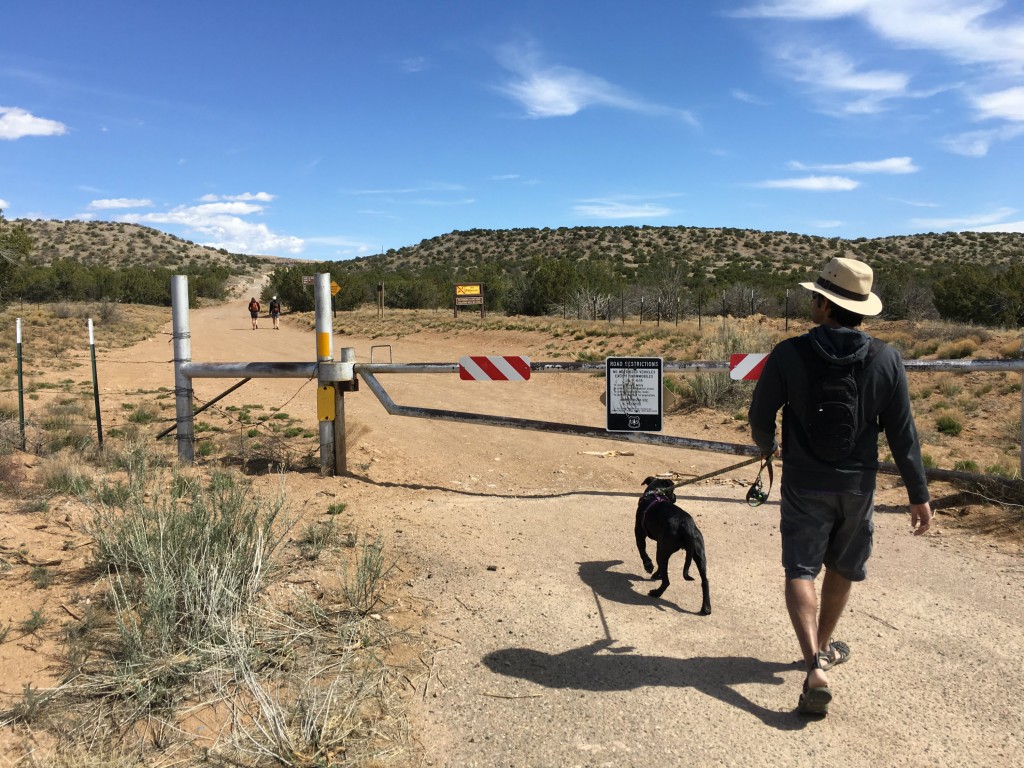
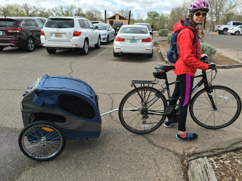
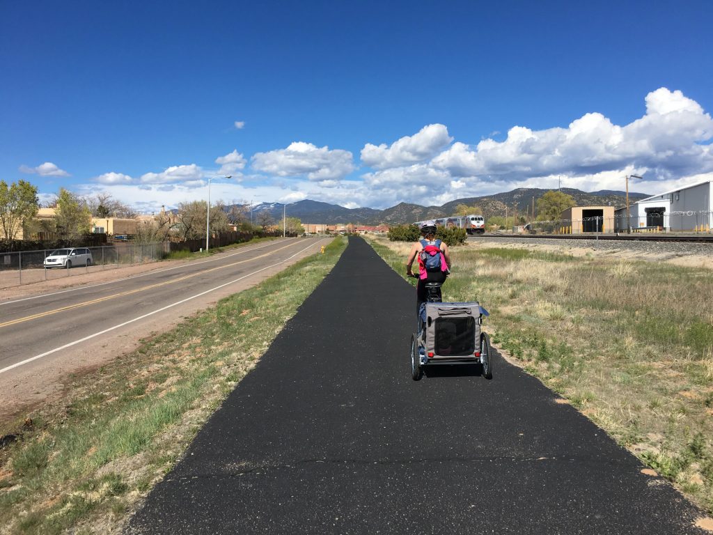
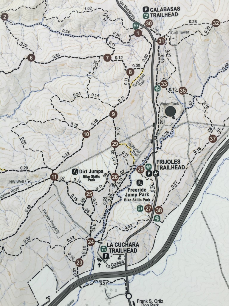
Admittedly, the first ride or two had their challenges. I had to pick her up to get her inside the trailer the first couple times, but these days she just walks right in on her own and plops down. Whew! ABQ Ride 2
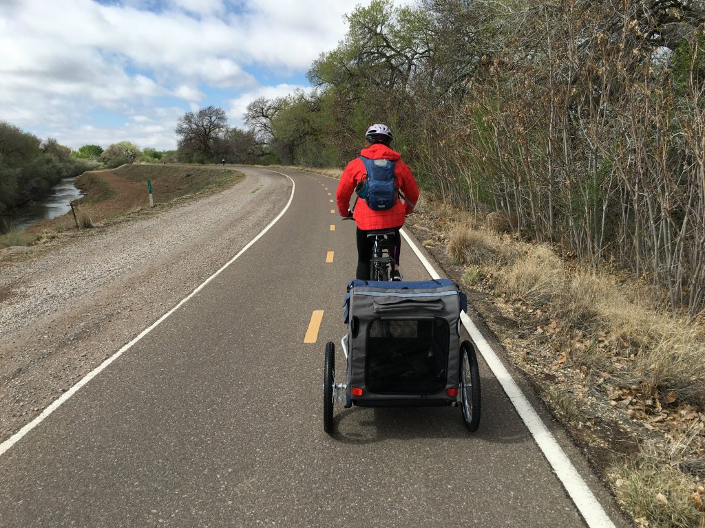
Our very first ride was on the Paseo del Bosque Trail in Albuquerque, which is a multi-use 16-mile paved trail goes from the north to the south edges of the metro area through the Rio Grande’s cottonwood forest. There are lots of access points with free parking listed on the City of ABQ’s website.

ABQ Ride 5

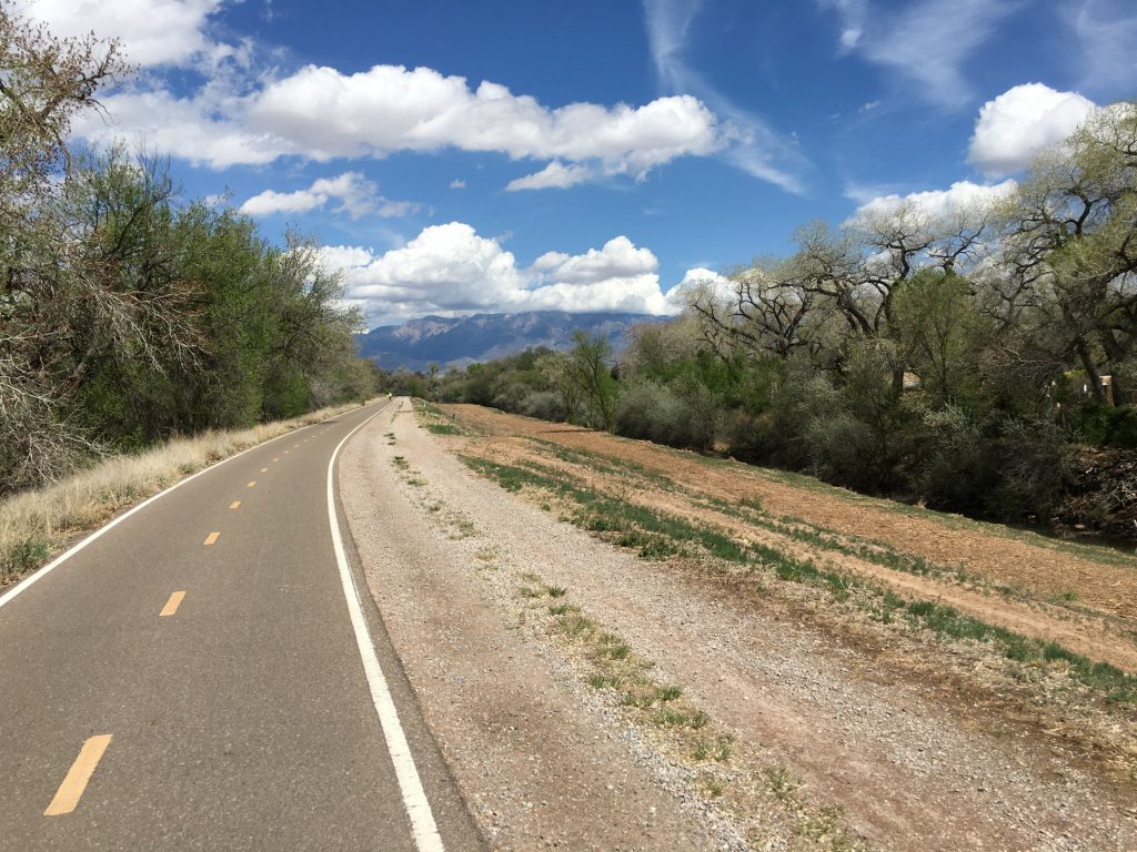
This was an amazing trail for a first dog trailer ride because it was flat, smooth, wide, and not too crowded. With the equipment we have, the trailer only connects well to my bike, so we switch bikes halfway through the ride to break up the labor. This also gives Monkey a break to get out and stretch her legs.
ABQ Ride 3On this particular day, it was lovely weather in the low-70s, and we cranked out a total of about 26 miles round-trip. Afterwards, we let Monkey hike around a bit on a nature trail and then got drive-in milkshakes at Sonic. It was just too-conveniently located right off the trail and too tempting to just gain back the calories we’d just burned. Ice cream and fro yo are my ultimate junk food weakness.ABQ Ride 4 
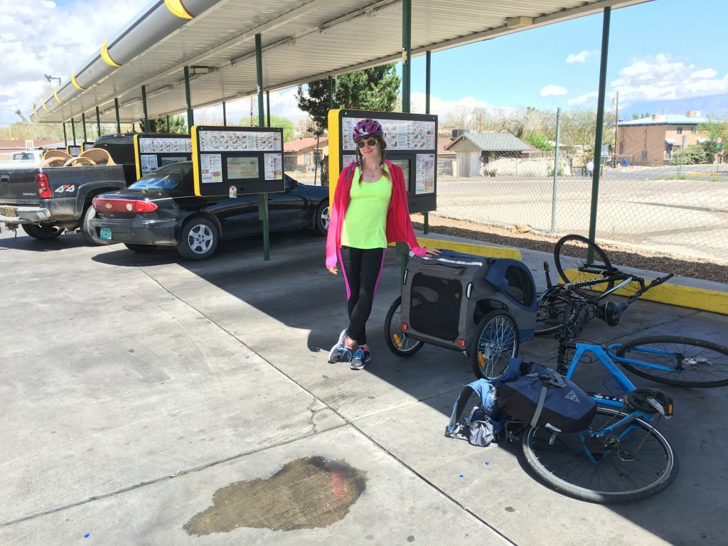
She was a real trooper on this ride, and I felt better about bringing her along than leaving her along in a strange campsite to fend for herself. I don’t believe in keeping dogs in cages at home, especially if they’ve already put in plenty of cage time in a shelter. But I hope the pretty scenery whipping by and the fresh air flowing in are fun for her inside that trailer…especially when we pass by other dogs huffing and puffing by with jealous looks on their faces.
ABQ Ride 6

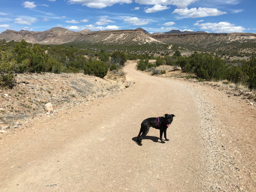
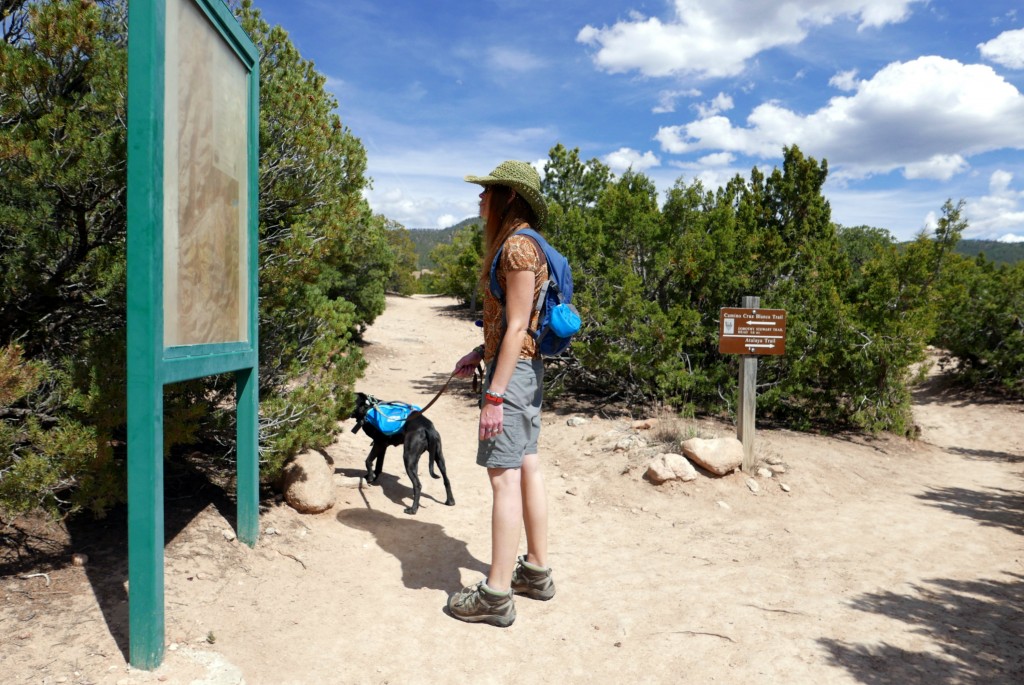
The next time we broke out the bike trailer on the New Mexico adventure was in Santa Fe, on the Santa Fe Rail Trail. This trail posed a different kind of challenge because it was not paved and quite hilly.

Santa Fe ride 1
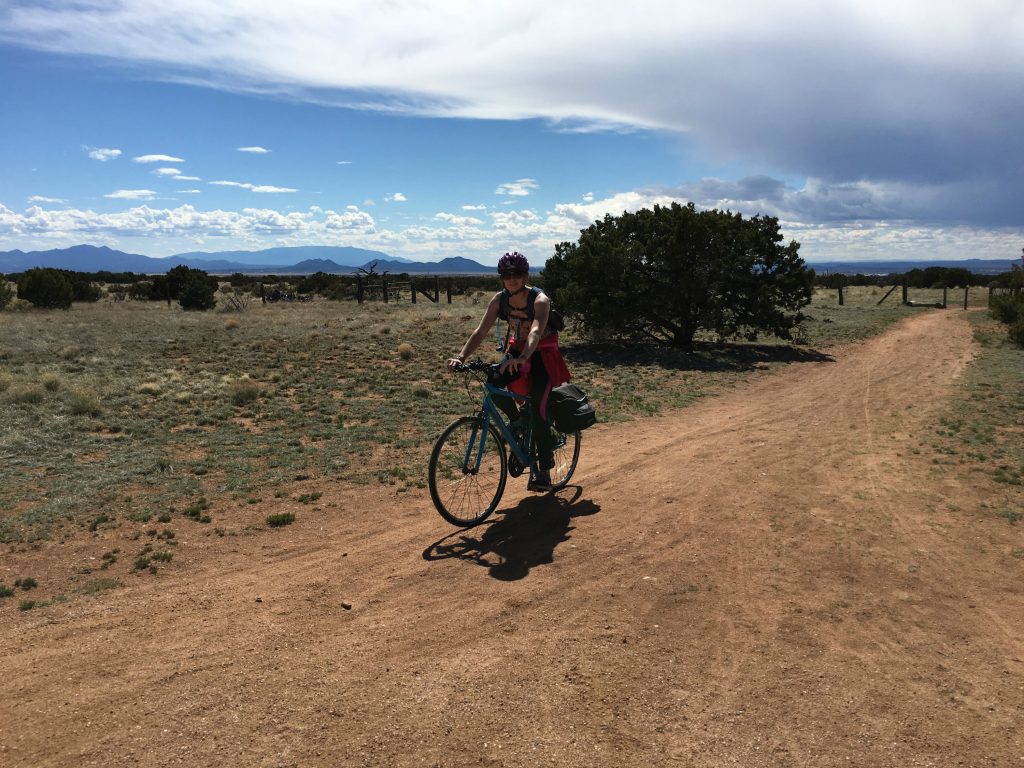
This 17-mile trail follows the old Atchinson, Topeka and Santa Fe Railway line from the Railyard park in Santa Fe to the tracks, Highway 285, El Dorado, Lamy. There’s a little bit of everything along this ride in urban, suburban and rural surroundings. Santa Fe ride 2
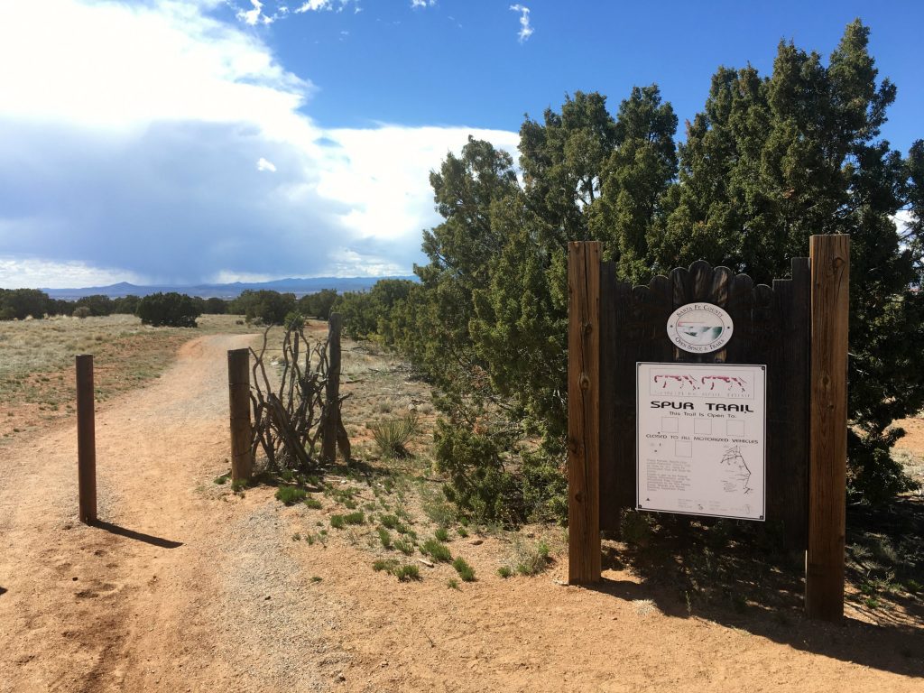
Where we started near our (highly recommended) campground, Rancheros de Santa Fe Campground, we encountered hilly, red-dirt terrain in the countryside with yucca and green junipers growing nearby. A 43-pound dog in a trailer feels incredibly heavy after lugging it up and down hills and over rocks with a pretty standard hybrid bike.Santa Fe ride 3But after a grueling while of this, the dirt suddenly transformed into pavement, and we were smooth-sailing again down the trail. Those first few pedals after the dirt felt like flying!
Santa Fe ride 4We took our mid-bike pit stop at Second Street Brewery, which unfortunately wasn’t really all that dog-friendly and had some questionable happy hour rules. But a cold brew after that challenging ride tasted delicious nonetheless. A local commuter train called the Rail Runner ran alongside the bike trail and the brewery, which we checked out while giving Monkey a bike break.Santa Fe ride 5
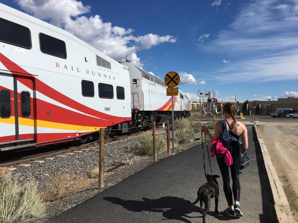
The sun was starting to set by the time we made it back to the Jeep, which was perfect timing to collapse the trailer and hit up a local grocery store to cook dinner. The sunsets here really are pretty amazing.Santa Fe ride 6

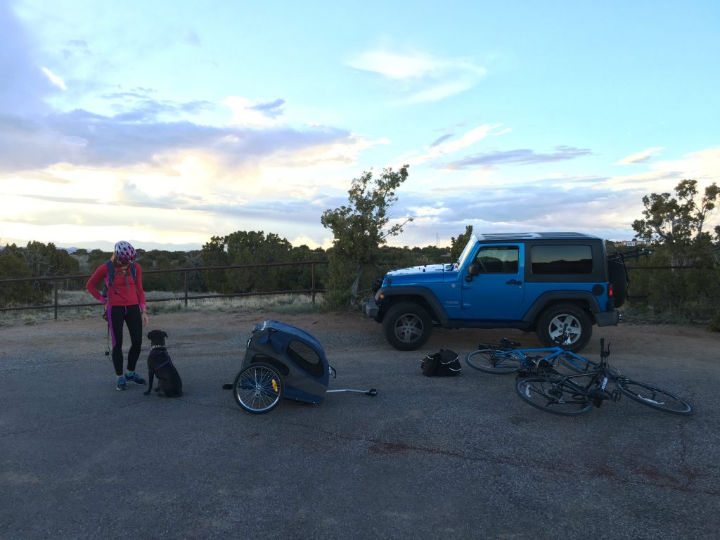
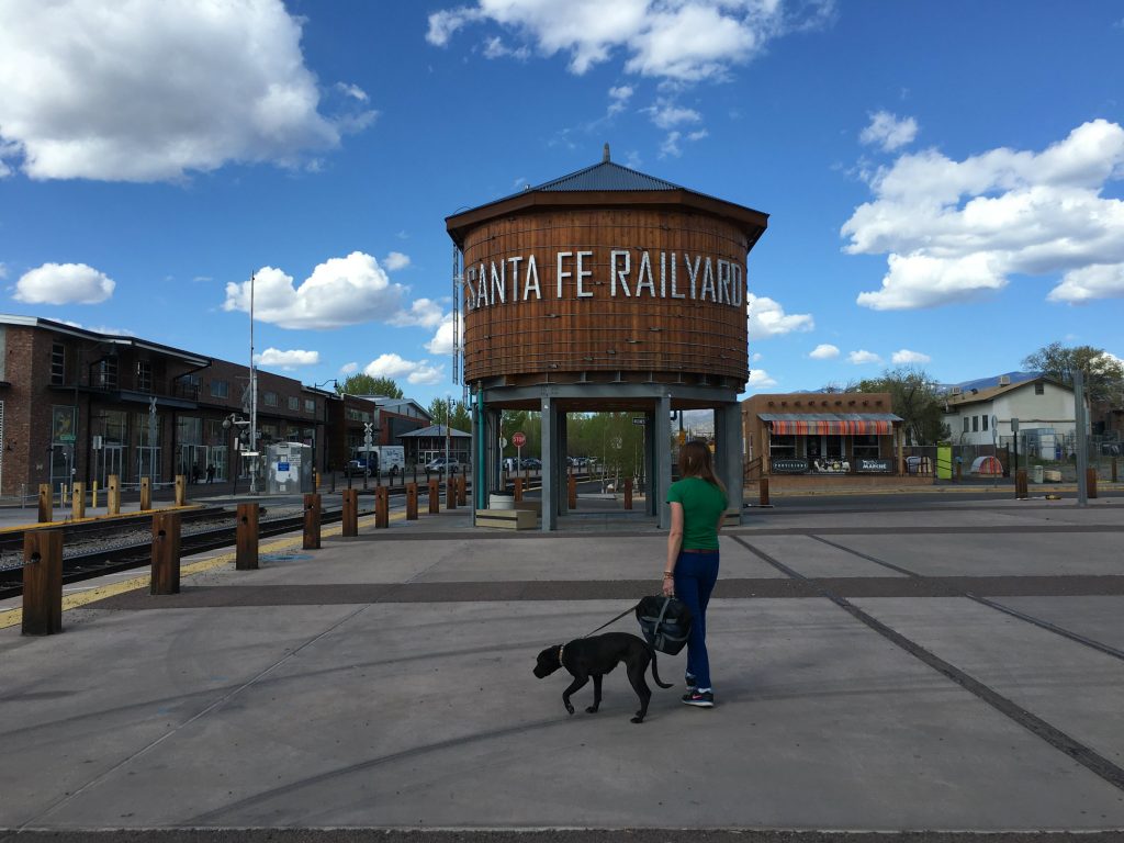
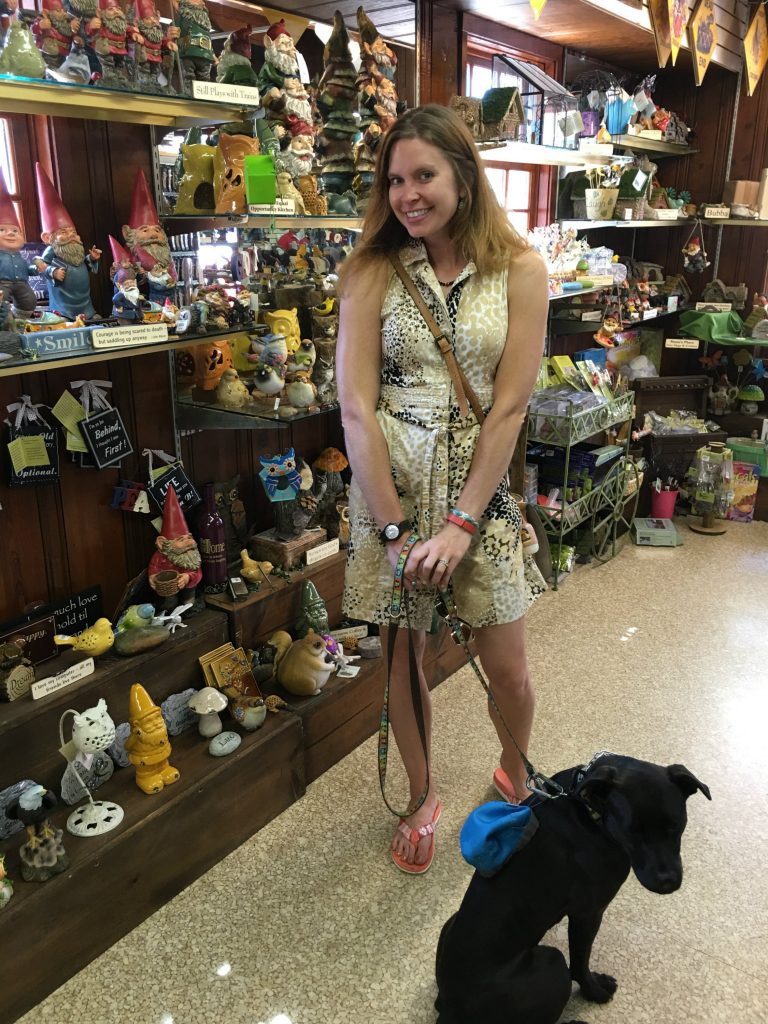
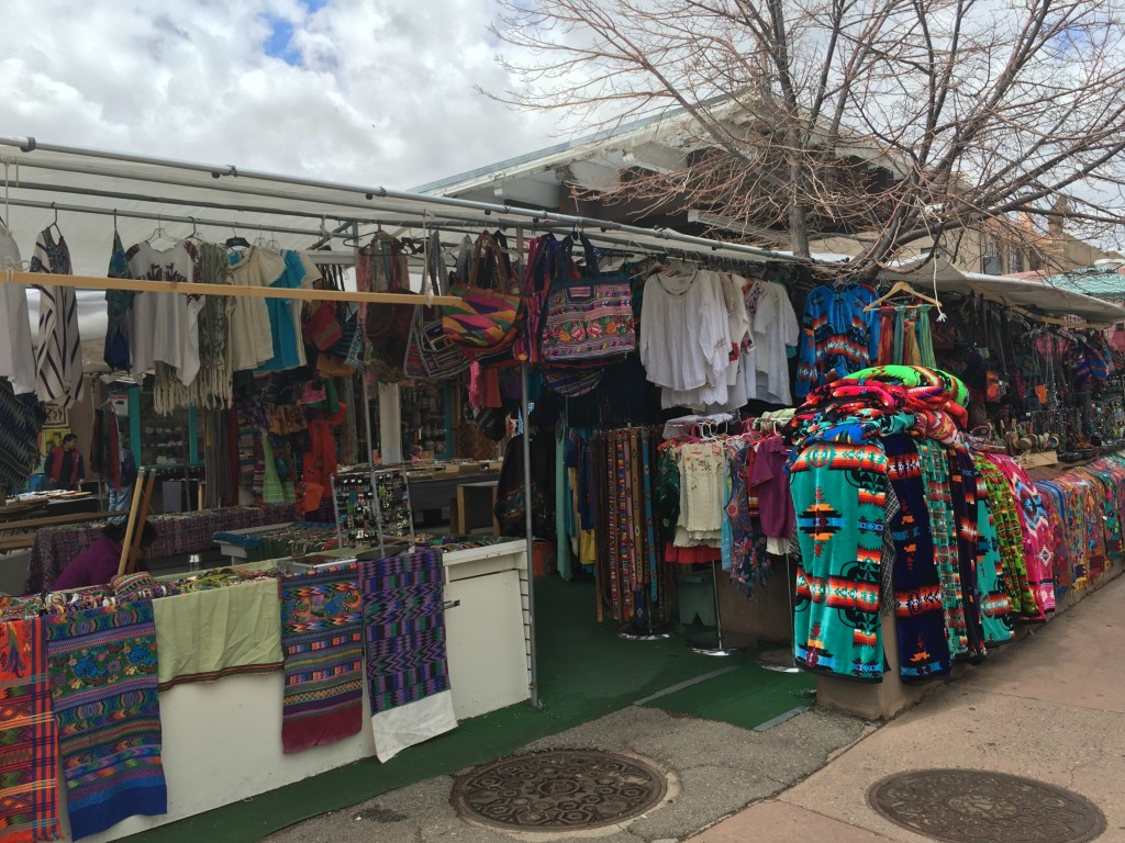
Another bike trip we did in Santa Fe was to the Santa Fe Railyard. This was a shorter and more paved ride we did, with the intent of sightseeing and walking around a bit more with Monkey. From what I’d read about this neighborhood, I was surprised to see it not crowded and quite a few of the shops actually out of business and moved out. But it’s still a really walkable area, and I think Monkey enjoyed a little more time out and about.

Santa Fe Railyard

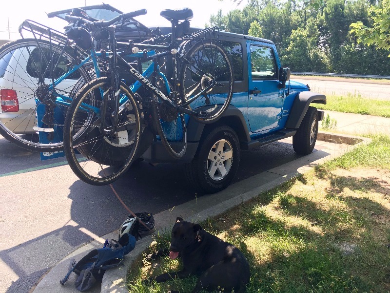
Since returning back home to Atlanta, we’ve taken out the bike trailer a few more times, and these days Monkey’s a pro at riding in style. We took her on a ride on the Big Creek Greenway between Roswell and Alpharetta, Georgia a couple weeks ago, which was super chill. This is mostly a 12-foot wide paved path that runs through the deciduous woods along Big Creek. But there are also dirt mountain biking trails nearby on the east side of the creek. Monkey and I haven’t been adventurous enough to try those out with the trailer just yet.

Another local spot we biked on the 4th of July to “celebrate our independence from motor vehicles” was the Silver Comet Trail. This trail picks up about 13 miles northwest of Atlanta and extends for a whopping 61.5 miles and ends at the Georgia/Alabama state line. And it doesn’t stop there! Once you cross over into Alabama, you can keep going to Anniston, Alabama for a total of 94.5 miles if you start in Smyrna.

But we took it easy clocked in at just over a leisurely 20 miles to get some fresh air and exercise. This is another wonderfully paved and shaded trail that you can squeeze into a morning ride, even when the day’s high temperatures are going to be 100 degrees.

IMG_3534 (1)

I have this bad habit of never taking photos or writing about the places I’m living in, which is unfortunate and something I want to work on. I lived in Chicago for over 6 years and now Atlanta for 1.5 years and haven’t written or photographed much of anything in either city. When I’m traveling, everything seems more blog-worthy and photo-worthy, but these places have treated me well too, and I apologize deeply to them for leaving them out of the mix. Perhaps someday I’ll visit them in the future when I’m living somewhere else and then they’ll make the cut.

Unfortunately, there’s not room in the Jeep or camper to bring the bikes and Monkey’s trailer on our next big adventure, which kicks off in just eight days. This is mostly because it’s summer and we’ll be focusing on water sports instead, like kayaking and SUP. Sadly, a tiny pop-up camper only has a limited amount of room for sporting goods storage, so choices must be made. But come fall, I’m hoping to retrieve the bike gear and introduce Monkey to some new trails that we can explore together on wheels.

IMG_3529 (1)Final Closing Tips for Dog Biking

  • Try before you buy (companies often claim trailers are rated for way more poundage of dog than actually comfortable)
  • Pick a trailer with good pockets for her water bowl, treats, and poop bags
  • Make the trailer as cozy as possible with a soft pillow and favorite toys
  • Be patient, but not afraid to shove her in after a fair number of tries
  • Start with short rides and build up to longer ones
  • Stick to paved trails, at least at first
  • Don’t put a dog in a trailer when it’s crazy hot outside
  • If biking in a pair, let the bike with the dog go first to set the pace and so she can see the other person behind her and feel more comfortable
  • Allow time for stretching and walking breaks
  • Adjust your biking expectations and be prepared to ride slower and not as far with a trailer
  • Scope out dog-friendly breweries to celebrate the end of your ride together!

The Antique Gnomes of Rock City – Chattanooga, Tennessee

On a recent drive from Illinois to Georgia, I made a pit stop in Chattanooga, Tennessee and decided to check out the famous attraction advertised on all the highway billboards: Rock City. Much to my delight, the nature paths and caves here are filled with gnomes!

I knew I was in for something special when the road leading up to Rock City was called “Ochs Highway.” No joke. Clearly, this place was meant for me.

IMG_3146

History of the Rock City Gnomes

In the late 1920s, Garnet and Frieda Carter began developing a walkable garden on their private estate to share their love for the region’s rock formations and native plants with the public.

IMG_5661

The husband-wife team opened Rock City Gardens during the Great Depression and had over 800 barns painted to advertise and attract tourists to Chattanooga. They gave the attraction its name because the rocks on top of Lookout Mountain looked like city buildings and the natural pathways like streets.

IMG_5489

Frieda Carter loved European folklore and fairytales, and she was an avid gnome collector. So naturally, many of her gnomes made it into the local attraction.

Gnomes Along the Enchanted Trail

Your gnome journey begins at the new Gnome Valley installation, which is a growing collection of whimsical space at the beginning of the Enchanted Trail.

IMG_5463

As you walk along the beautiful and easily accessible trail, you’ll notice even more gnomes peeking behind rocks to greet you.

IMG_5465

Keep an eye out for little red hats as you navigate the trail to Lover’s Leap, the 180-foot suspension bridge, Mother Goose Village, and the summit where you can see seven states on a clear day.

IMG_5526

Another awesome part about Rock City is that the whole place is dog friendly!

IMG_5523

The Gnomes of Fairyland Caverns

But by far, the best place to see gnomes is inside Fairyland Caverns, as this is home to Frieda’s collection of antique, imported German gnomes.

IMG_5581

Inside this cave, gnomes are situated into scenes that are illuminated by black lights.

IMG_5621

You instantly feel a sense of magic as you pass by the Castle of the Gnomes, Carnival of the Gnomes, the Moonshine-Brewing Gnomes, and many other displays.

IMG_5658

Admittedly, some of the scenes were a bit on the creepy side. But isn’t that what fairy tales are really all about anyway?

IMG_5614

Antique Gnome Restoration

Since the Rock City gnomes date back to the 1920s and 1930s, many of them were in desperate need of repair. Rock City’s resident art specialist, Matt Dutton, created a “Gnome Infirmary” to restore the residents to their original splendor.

Matt consults old photos to keep the gnomes’ coloring consistent, painting and repairing them as needed. He uses urethane resin and a hardener to fills his handmade molds to restore each little one’s unique personality.

The Gnome Mascot & Gift Shops

A red-hatted, white-bearded gnome named Rocky is the mascot for Rock City, and you might meet him walking around in costume! Yet no roadside attraction would be complete without a gift shop, and the one at Rock City is stocked with lots of gnomes you can take home as souvenirs.

IMG_5679

My souvenir of choice? A purple t-shirt that reads, “I’m a rock climbing, trail trekkin’, gnome lovin’ nature kinda girl.” I couldn’t have come up with a more perfect motto for myself!

IMG_5687 1

*A version of this story is scheduled to be published in the next issue of the International Gnome Club newsletter! 

Drinking Beer in New Mexico & the Tragic Decline of Brewery Blogging

Back in 2012 when I started this blog, local craft breweries were still something of an anomaly. Coincidentally, this is also when I really started to travel and get into beer culture. Four years ago, it was incredibly exciting to stumble upon a brew house in a warehouse district, along the railroad tracks, or on Main Street downtown. But that’s when breweries were relatively few and far between in general, and definitely still new to me.

I celebrated each brewery with a strict attention to detail, with a trusty notebook in hand and a camera-toting boyfriend in the other. I used to write about each and every individual brewery I visited, noting the ambiance, the service, and casually rating my favorite and least favorite flavors.

Reminisce with me for a moment…

Fast forward to mid-2016, when every small town on the map has it’s own brewery and every big city has about a dozen. I certainly don’t love beer any less than I did four years ago, but the suddenly overcrowded marketplace has made that initial excitement wear off a bit.

Don’t get me wrong, I still incorporate breweries into my travels and plan to check out at least one in each new place I visit. But I just can’t muster up the energy to write about each and every one of them anymore. It’s a daunting task that I’m just not up for…or getting paid for! So just like every other random craft beer fan out there, these days I simply plop down, pick my poison, and leave it at that.

Okay, so maybe I’m being a bit over-dramatic. I still do jot down travel notes and try to snap a photo of brew houses I visit after hikes or for an afternoon break. But after days of writing full-time for my day job, I just can’t bring myself to write more, especially about an ever-growing niche that I no longer have hope of conquering.

Then again, to bring things back into perspective…IT’S JUST BEER FOR GOD’S SAKE!

When I recently spent a month in New Mexico, not surprisingly, I visited lots of breweries to scope out the local beer scene. In no particular order, these are some of the breweries I managed to document in some way and little bits and pieces of the things I can remember about them.

Santa Fe Brewing Company, Santa Fe

This was a post-hiking brewery stop after checking out La Tienda Trails. We actually only got about 1.8 miles into the hike before a work emergency came up and we had to turn back for the laptops in the car.

Santa Fe Brewing Company 1
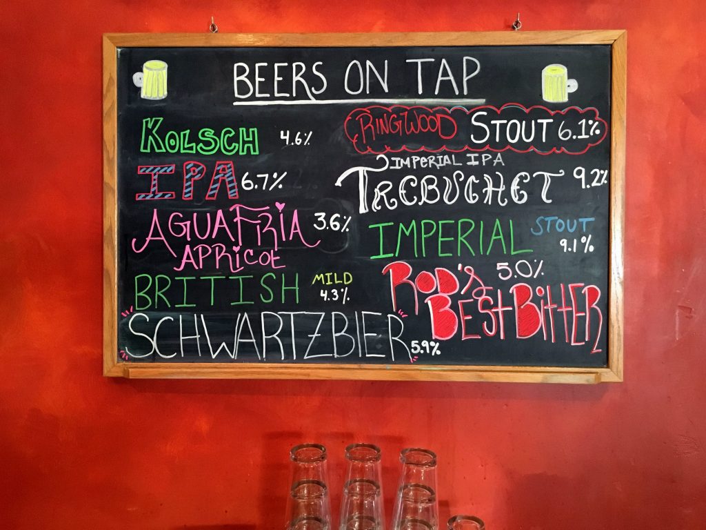
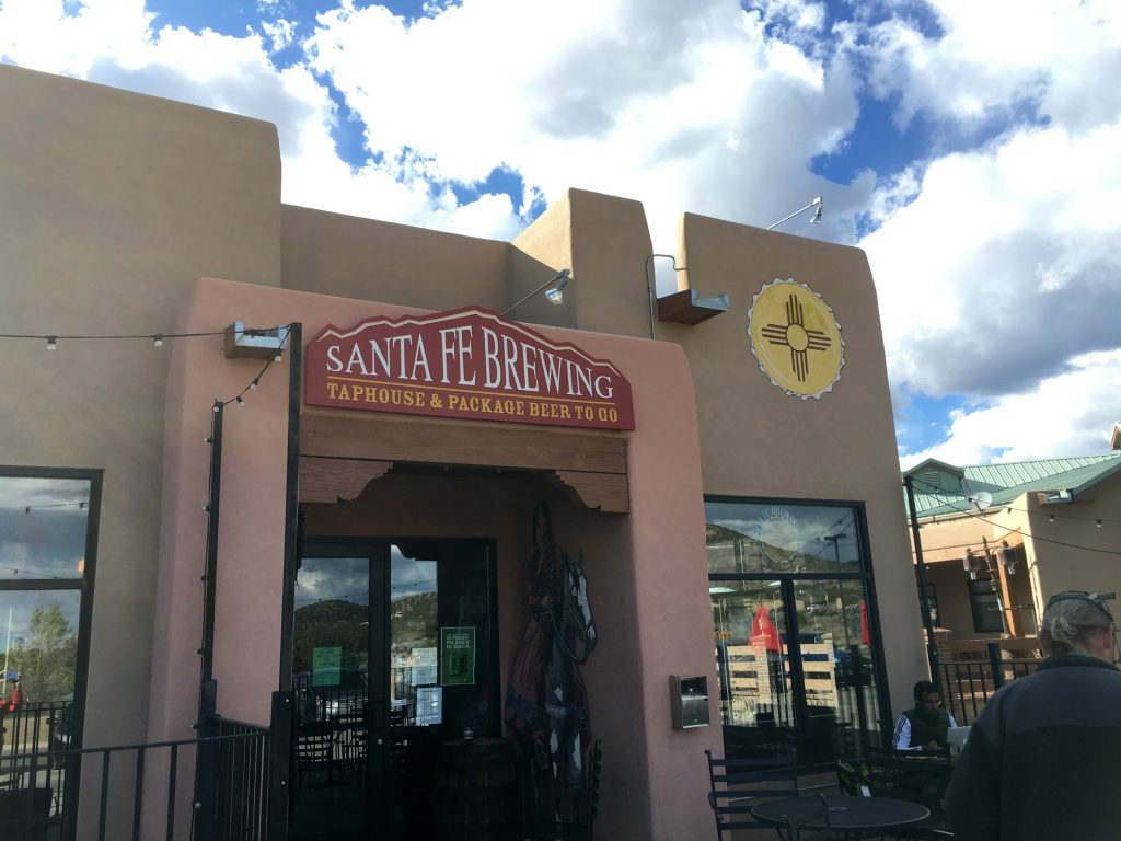
But fortunately, all the emergency required was a little attention and an internet connection. And Santa Fe Brewing Company was right around the corner. Santa Fe Brewing Company 3
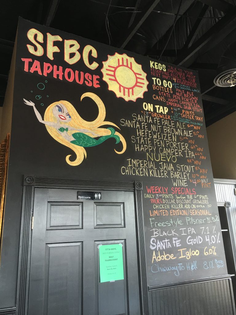
They had an insane number of beers on tap, but a terrible organization system for samplers. The reason I have so many photos of this place is because I actually had to compare and match up a photo of the beer listing board inside with faded abbreviations under tiny glasses, making about four trips back and forth from the bar to the patio.

But with 13 tiny beers in front of me, how seriously irritated could I really be? Santa Fe Brewing Company 4

Second Street Brewery, Santa Fe

This was a post-biking brewery stop in Santa Fe after pedaling along the hilly, dirt roads of the Santa Fe Rail Trail. This wasn’t one of my favorite breweries because of the questionable and inconsistent rules. Apparently, I’m getting a bit crotchety in my old age.

Their large patio was not dog-friendly, but we read online that people have brought dogs to the tiny smoker’s area and didn’t get bothered, so that’s what we did. The brewery advertised happy hour specials but they didn’t honor them for the beers we picked, and they couldn’t justify their sizing and pricing. Oh well, you can’t win every time.
Second Street Brewery Santa Fe 1

Spotted Dog Brewing, Mesilla

This was a great little brewery we visited after walking around Old Town Mesilla. There were lots of cute shops and historic buildings here, and the brewery was in walking distance from all that.

Here we powered up the laptops and cranked out a bit of writing over a sampler to finish off the day in an awesome way. As any good gnome collector will tell you, these little guys love gnome-sized beer and make the very best drinking companions.

Spotted Dog Brewing Mesilla

Red Door Brewery, Albuquerque

They really did have a red door! This was one of the first breweries we went to in Albuquerque after hiking the Sandia Mountains. I remember liking this place because it had a little outdoor patio that was completely empty and super chill. After sharing a sampler of 10 tiny beers, I grabbed our growlers from the jeep and got one filled up with the wit and the small one with the scotch ale.

Red Door Brewery ABQ 1

Sometimes I forget to snap a shot or two of the brewery I’m at to help me remember it, or I’m just not in that mindset at the time. Unfortunately, this was the case with three breweries in the Albuquerque area: Canteen BreweryMarble Brewery, and Turtle Mountain Brewing Company.

Canteen was a frustrating experience because Monkey was acting like a total nut-bag and stressed us out to an extreme degree. I barely even remember what the beers were because of that, but Canteen did have a nice side patio and an attentive server.

Marble Brewery had an amazing set-up but an awful smell. The city was doing sewer work just outside the brewery in the street, and some people nearby actually complained about getting sprayed by sewer stuff. If that wouldn’t have been doing on, this Albuquerque spot would have rocked. We stopped by after a DIY Breaking Bad tour around town. There were a couple food trucks with tacos out front and a stage with a band playing music despite the crowd avoiding the outdoor space due to smells and sprays.

Turtle Mountain Brewing Company is in a fast-growing suburb of ABQ called Rio Rancho. I didn’t get any pics of this place either for some reason, but we went here after biking about 26 miles on a very nicely paved trail along the Rio Grande. Like several other breweries we went to, this was a place that has a dog-friendly patio but no service out there. I actually prefer this arrangement because I don’t have to wait on a server to come out, allowing me to just walk my own two feet inside and up to the bar when I need something.

Taos Mesa Brewing, Taos

Hands down, this brewery had the best outdoor scene ever. The ski resort town was experiencing crazy high winds the day we visited, but that didn’t stop us from sitting outside to enjoy the mountain scenery.

Taos Mesa Brewing 1
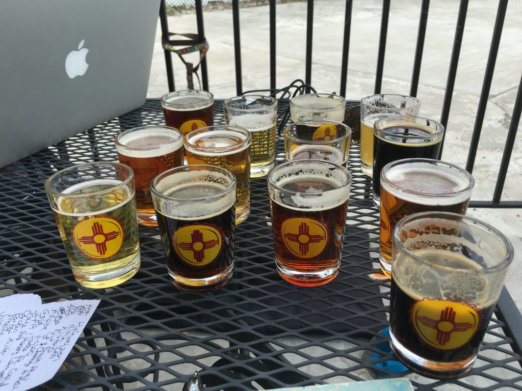
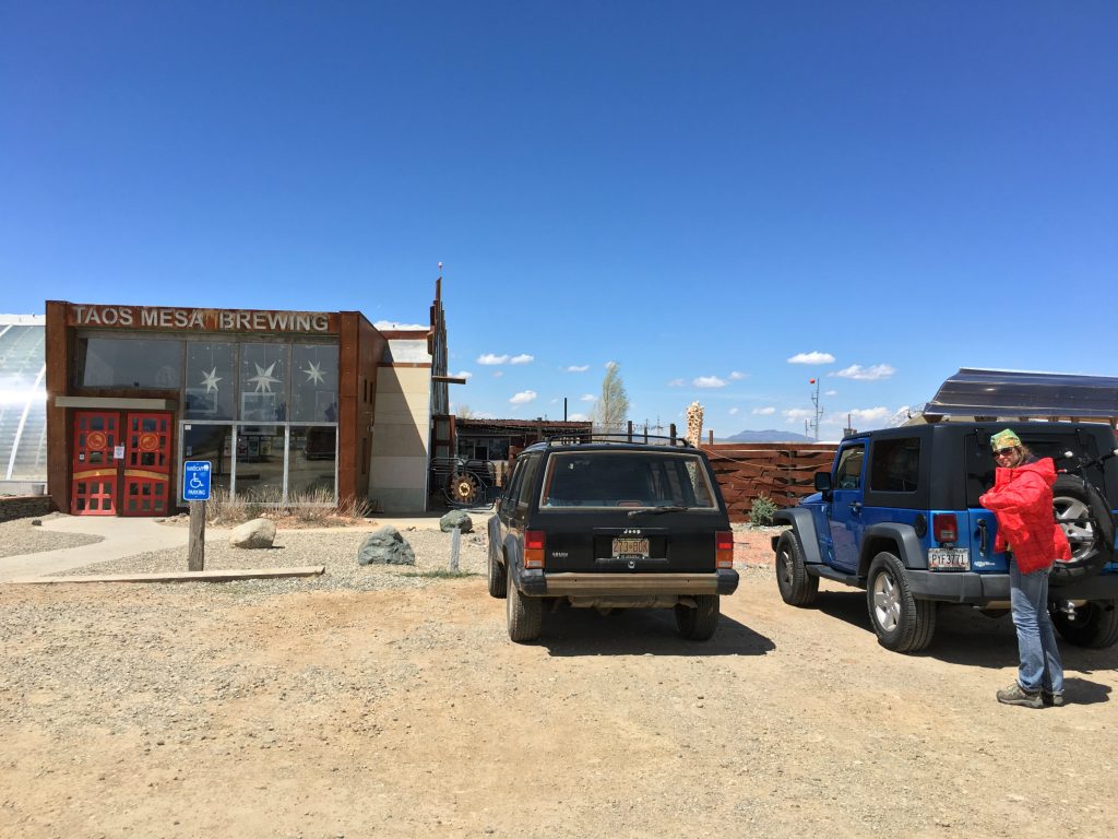
We stopped by after hiking at Rio Grande Del Norte and having a picnic lunch on BLM land near the parking lot. The brewery had stages both inside and outside and clearly hosts a lot of events and concerts. However, the taste of the beer paled in comparison to the views of the mountains. The beers were mediocre at best, with standard flavors and nothing truly interesting. But those views though! Taos Mesa Brewing 2

Pecan Grill & Brewery, Las Cruces

This was a rare find that we stumbled across after taking a wrong turn following a hike in the Organ Mountains. I was actually on the hunt for a PetCo because Monkey was (gasp!) nearly out of food. I had seen the Pecan Grill and Brewery come up in a Yelp list a few days before, so we stopped in to try it to make the wrong turn worthwhile.

I was hesitant at first because it seemed like it would have more of a restaurant vibe, which often means that the beer takes a back seat in quality. However, this place pleasantly surprised me more than pretty much anywhere else on this trip. They had happy hour specials that they honored the price on, cheap appetizer specials that were quite tasty, and a laid-back environment where I got a little writing done. Our server did a killer job too.

Pecan Grill Las Cruces

High Desert Brewing, Las Cruces

Another Las Cruces brewery we visited was High Desert, which was our destination after hunting for peridot gemstones at Kilbourne Hole. Some of these New Mexico breweries serve food, while others are drinks-only. We try to save money by making our own food in the camper, but making beer from the road isn’t really all the feasible. However, at this place, we splurged and split a couple appetizers to go along with the sampler.

It was an awesome environment, despite Monkey being super-restless after a long and bumpy car ride. The patio was cozy and closed in, which provided some shelter from the crazy high winds that I’ll always remember about Las Cruces.

High Desert Brewing Las Cruces

Don Quixote Distillery & Winery, Jaconita

But of course, there are many other things to drink besides beer…namely wine and spirits. This was a stop on the way back from Chimayo, which is a Catholic pilgrimage site in the middle of nowhere.

Don Quixote Distillery & Winery 1
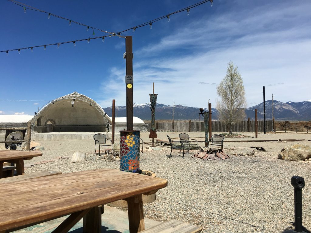
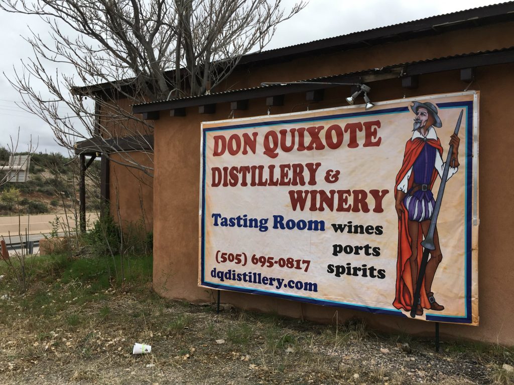
We arrived to Don Quixote a few minutes before it opened and downed cans of soup and beans in the car while we waited. The bartender/sole staff worker was the most unfriendly host I’ve encountered in a tasting room. We were the only ones there, but she talked on her phone the entire time and seemed genuinely annoyed by having to serve us (paid) samples. Don Quixote Distillery & Winery 2
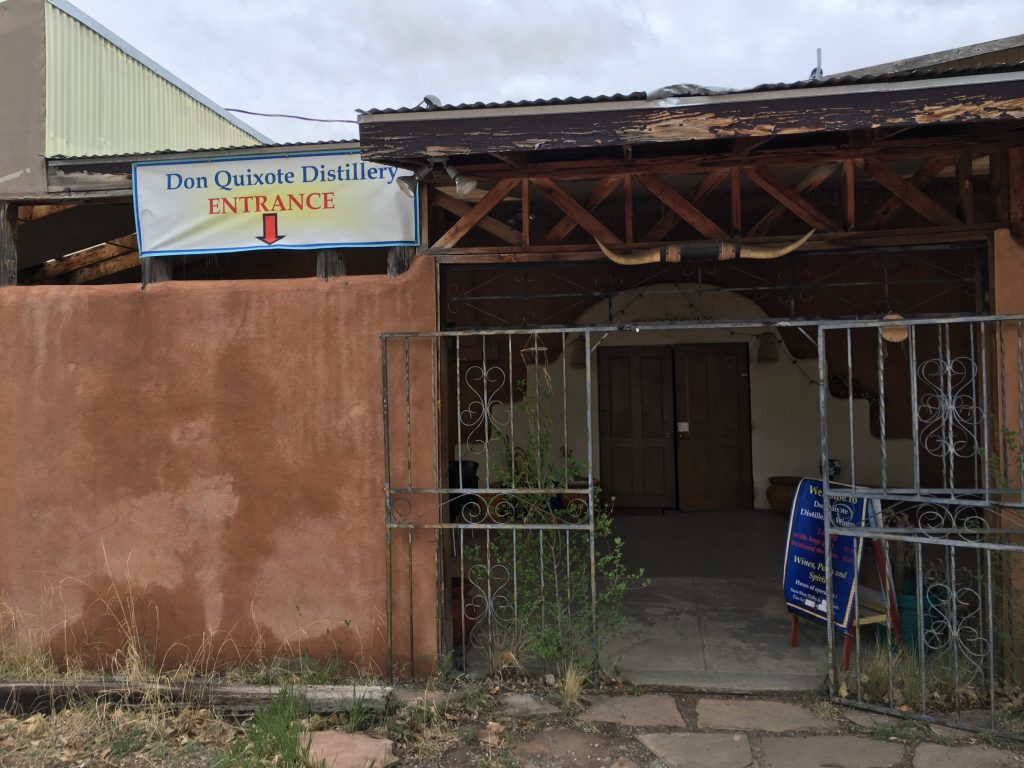
I remember really liking the lavender and juniper gin, which was a surprise because I’ve never been a gin drinker. The flavors were intensely good though. I also remember liking the rose-infused wine. However, I didn’t buy anything except the tasting, mostly because of the service.

Breweries and Dogs

Although I may have started off writing this a bit disenchanted with the ever-expanding craft brewery scene, I still believe there are new experiences to discover at each one. Lately, my brewery experiences can be best defined as dog experiences too.

We’ve been slowly but surely training our newly adopted lab/pit, Monkey, to become the ultimate brewery companion. Breweries and dogs seem to go hand-in-hand, and I’ve always wanted a chill and friendly pup by my side while I sip my brews on a patio.

Before visiting any given brewery, I’ve gotten really good at one particular phone call that goes something like this:

Brewery Person: Hi, XYZ Brewing Company, how can I help you?

Me: Hi, do you have a patio that allows dogs?

(response #1) – Yep, sure do.

(response #2) – Nope, sorry, only service dogs.

(response #3) – You wanna do WHAT?!

Santa Fe Brewing Company 5
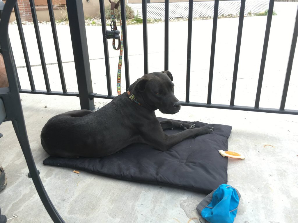
On dog-friendly patios, Monkey is getting better at the fine art of hanging out, usually equipped with a comfy pad, bone, and travel water bowl.

But of course, sometimes she likes to do this and sit like people, which is a bit awkward.
Red Door Brewery ABQ 2Then other times, she does this and sleeps all cute-like and curled up under the table. And I forgive her for all wrongdoings.Second Street Brewery Santa Fe 2
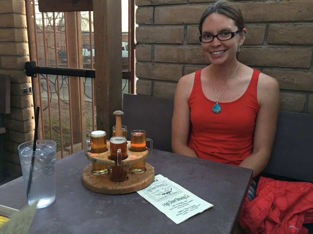
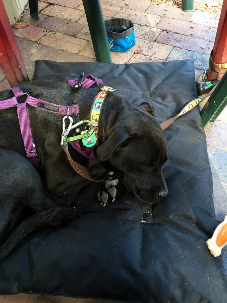
Perhaps one of these days I’ll manage to secure a writing gig that pays me to write about and review breweries. Then, without a doubt, I’d be all over this scene as if I’d never lost a beat since 2012. I’ve already started to break into the wine scene with a steady gig at The Grapevine Magazine, so perhaps craft beer writing could be in my future as well.

But until then, I’ll just jot down a sentence or two at the end of the day, snap a picture if I think of it, and not stress out over missed writing opportunities. After all, quality beer is best enjoyed with a chill state of mind, right?

3 Unforgettable Hiking Trips near Las Cruces: Southwest Road Trip Series

While spending a month in New Mexico, my husband, new pup, and I set up camp in three different “home bases” to explore the surrounding areas: Albuquerque, Santa Fe, and Las Cruces. I didn’t know much about Las Cruces before I spent a week here, but it ended up being one of the memorable parts of the entire trip. This was largely because of the unique hiking spots we got to explore that were nothing short of fascinating.

One thing that I’ll always associate with Las Cruces is the crazy high wind. Pretty much every day we were here, there were sustained 30 mph winds with 50 mph gusts that were relentless. Other things I’ll always remember about this place include finding my birthstone in the wild, hiking through a sandstorm, and learning how resilient my pup, Monkey, really is.

So for the next contribution to this Southwest Road Trip Series, these were my three most unforgettable hiking trips in the Las Cruces area.


1. Kilbourne Hole – Mining for Peridot Gemstones

The first hike that we went on in the Las Cruces area didn’t end up involving much actual hiking at all. Instead, it was a treasure hunt!

Kilbourne Hole is a place that you won’t find in average New Mexico guidebooks, and we only learned about it while reading about gemstones native to this region. I was skeptical about finding gemstones out in the wild, untouched by human existence in this day and age. But treasure hunts like this don’t happen every day, so we had to give it a try.

It took about an hour and a half to reach Kilbourne Hole from our campground in Las Cruces via intense off-road-style dirt paths that brought the Jeep’s speed down to about 20 mph. Pretty close to the Mexico border, this place really is in the middle of nowhere, and the 45-minutes of rocky dirt trail to get here was an adventure in itself.

IMG_4793Kilbourne Hole is a maar (i.e. a pit/depression caused by a volcanic explosion) in Doña Ana County and a remnant of a volcanic explosion that dates back an estimated 100,000 years. Today it’s a National Natural Landmark on BLM land and known for the unique minerals that surfaced after the eruption. The crater measures just 1.7 miles long by over a mile across, but it’s hundreds of feet deep.

IMG_4794
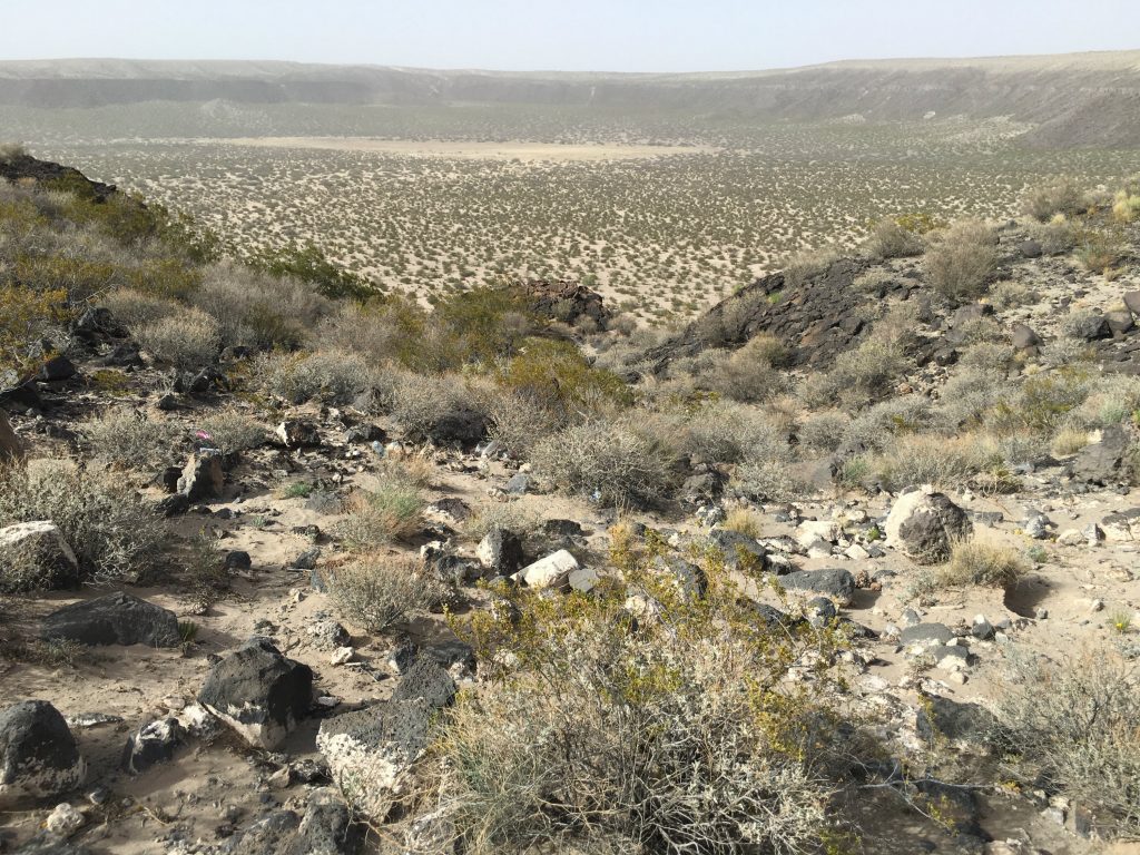
Although I was skeptical about actually finding rocks worth anything, only a few minutes passed before we started seeing green and yellow gems glimmering in the sunlight. This area is open to the public and there are no regulations about removing any rocks from the site as long as you can maneuver the crazy roads to take them back to wherever you came from. IMG_2471
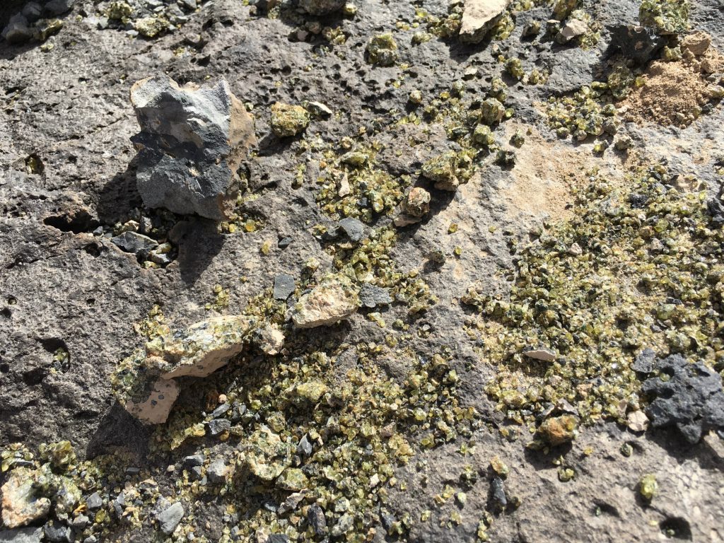
Along the road to get here and at the crater site, I never saw a single other person or car. The only signs of life out here were a few stray cows and a desert flower or two.

After parking the car, we descended into the deep gorge pit and braced ourselves for the crazy wind blowing in all directions. This area can only be described as desolate. In fact, the landscape makes you feel like you’re in a cartoon: the same scene over and over again to mock you and make you question reality. IMG_4812
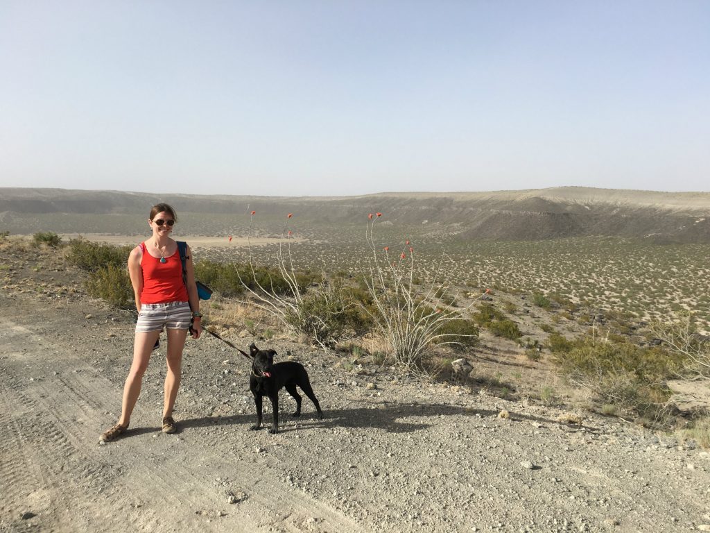
But what was really fun about this adventure for me is that we actually found my August birthstone here, peridot! Some of the stones were scattered loosely, likely someone else’s scraps from a previous collection. But others were hidden deep inside unassuming dark rocks strewn about and required a good smash to reveal the shiny stuff inside. IMG_2973
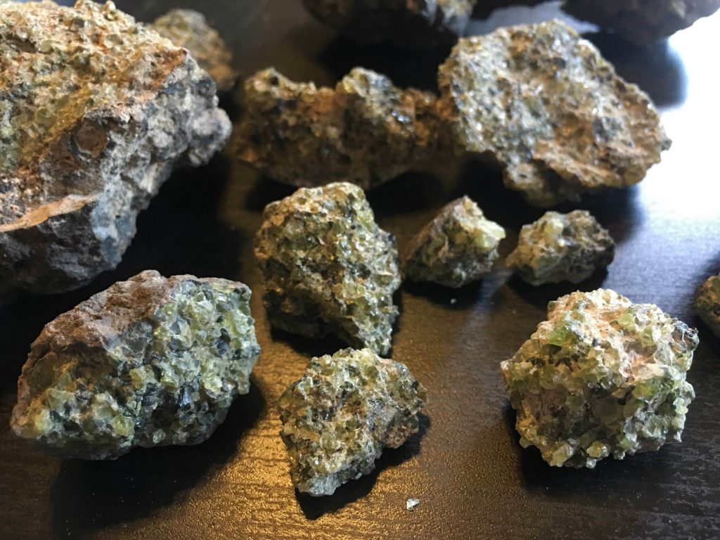
We brought a couple handfuls of peridot-encrusted rocks back home with us and have begun to separate the gems from the rock parts. It’s tedious, but how fun would it be to create a piece of jewelry someday with my birthstone gem that I “mined” for along the U.S.-Mexico border! IMG_2975

Science nerds out there can read more about the crustal and mantle (peridotite/olivine-bearing) xenoliths on the New Mexico Bureau of Geology and Mineral Resources landmark page. There’s also a 7.57-mile hike that you can do around the volcanic maar sink hole that takes about 3.5 hours and takes you to different parts of the crater that has other types of rock to check out.


2. White Sands National Monument – A Surreal Sandstorm

When I was 15 years old and had my learner’s permit from driver’s ed, my parents and I went on a trip to the Grand Canyon. To my delight, they let me get some of my driving hours in on straight and boring roads in the Arizona desert. Little did I know that my parents set me up to drive in my very first sandstorm with plenty of those little white crosses lined along the highway to serve as reminders of the sandstorms that have come before.

The day we hiked White Sands National Monument maybe didn’t constitute a full-blown sandstorm like that one, but the powerful winds sure did make for an interesting day in the desert.

Oddly, we had to pass through border patrol just to reach the national park, which the park staff blamed on anti-drug trafficking efforts. However, the roads were paved, which was a nice change after the insanely bumpy ride to Kilbourne Hole. The visitor center and gift shop had lots of fun souvenirs if you need to stock up on friends & family gifts, so they’re worth a quick stop on your way in.

IMG_4828
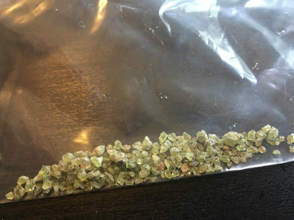
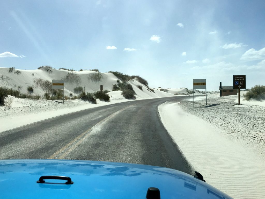
Hiking the white sands of New Mexico really is unlike hiking anywhere else. It’s vast, desolate, windswept, and mysterious. And since the dunes are formed by gypsum, the sand is surprisingly cool-to-the-touch, even on scorching hot days.
IMG_2493
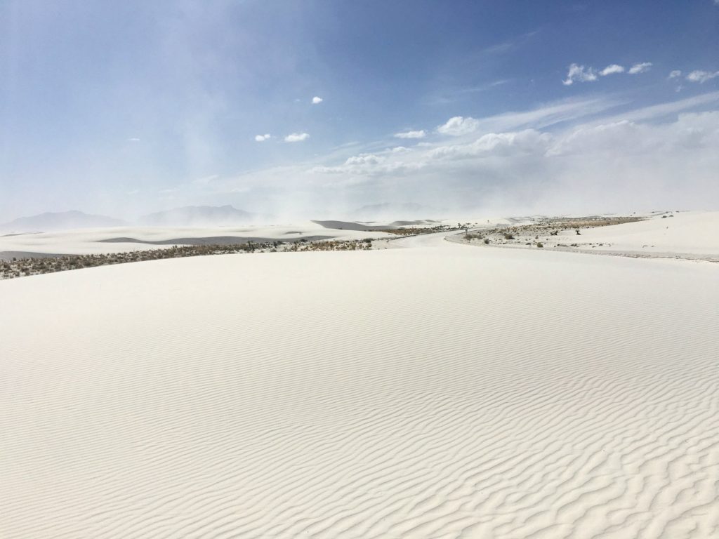
These dunes in the Tularosa Basin were explored by Native Americans, exploited by Spanish explorers in pursuit of resources, and used by the U.S. military for missile testing. They’ve really been through a lot but are in amazingly preserved condition. IMG_2509
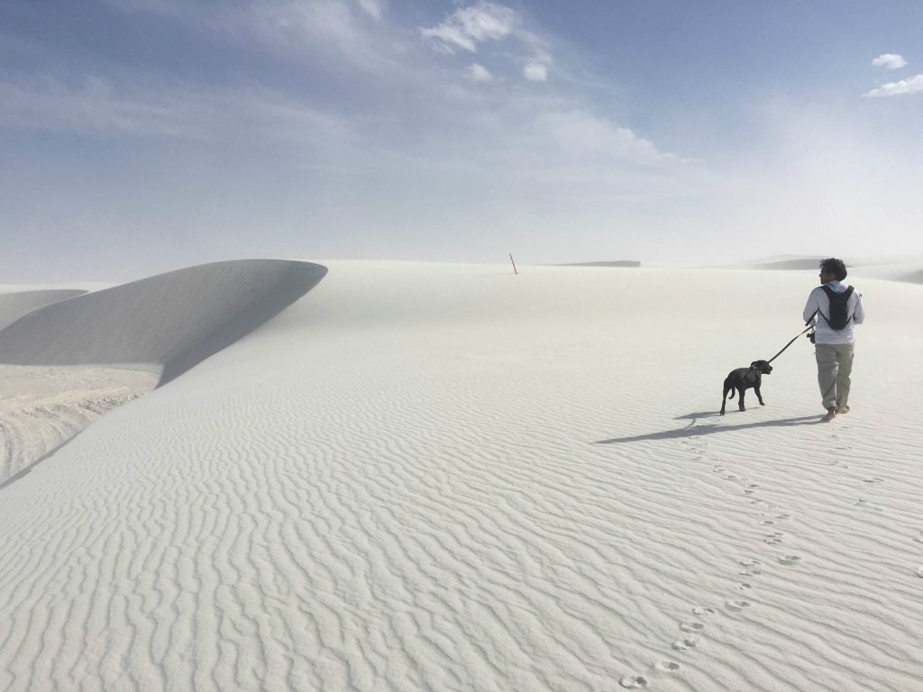
As we set on out the Alkali Flat Trail, we only encountered one other couple that was moving markedly slower than we were across the dunes. This trail is just under five miles, but surprisingly strenuous with the steep dune climbs and high winds.

It’s best climbed barefoot, and lots of water is an obvious must. I heard that you can actually rent out sandboards and sleds to glide down the dunes, which would have been a blast but we didn’t have time to try it after the hike and before the sun set. IMG_4924
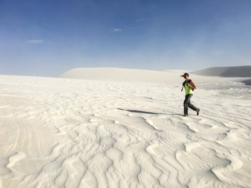
There’s no shade or water along this trail, or anywhere out in the dunes, but thankfully there are helpful little orange and white posts to let you know you’re on the right path. Reduced visibility and getting lost are total possibilities out here, especially in the high-winds of the spring season.IMG_4918
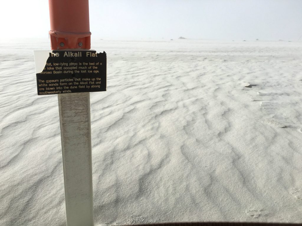
About halfway through the hike, you’ll reach the flat section that has a really creepy vibe to it. The Alkali Flat is the dry lake-bed of Lake Otero, which filled the bottom of the Tularosa Basin during the last ice age and covered a massive1,600 square miles. IMG_4969
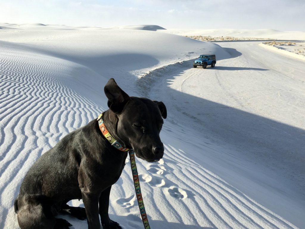
Although she was just as covered in sand from head to toe as we were, Monkey was a really trooper and truly seemed to really enjoy the soft, cool texture for the most part. When overly excited, she “twirls” and “dances,” which escalates to the highest degree on sandy beaches and even dunes like these.IMG_4957


3. Organ Mountains – Baylor Pass Trail

Several years ago when I first started freelance writing full-time, I wrote some advocacy articles for the petition site, Force Change. I learned about the Organ Mountains in southern New Mexico while doing some trip research and wrote a petition to Preserve Beautiful Desert Mountain Range as a National Monument back in 2013. A little over a year later, President Obama signed a presidential proclamation that the five mountain ranges above the Chihuahuan Desert would finally have National Monument status, and therefore federal protection and managed preservation.

Well, I finally got to visit these mountains for myself and venture out on a hike that started with this ominous warning sign. One afternoon after working a half-day back at the campground in Las Cruces, we set out on the Baylor Pass Trail, which is about six miles long.

P1060708The Organ Mountains are full of Native American, New Mexican, and American history that includes Billy the Kid’s Outlaw Rock, Geronimo’s Cave, pictographs & petroglyphs, Apollo Space Mission training sites, and WWII aerial targets. Their towering peaks are even more ominous that that warning sign and create an eerie presence in the sunset.
P1060711
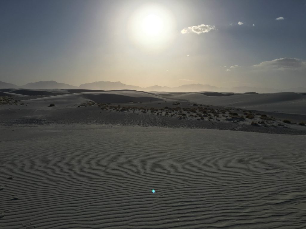
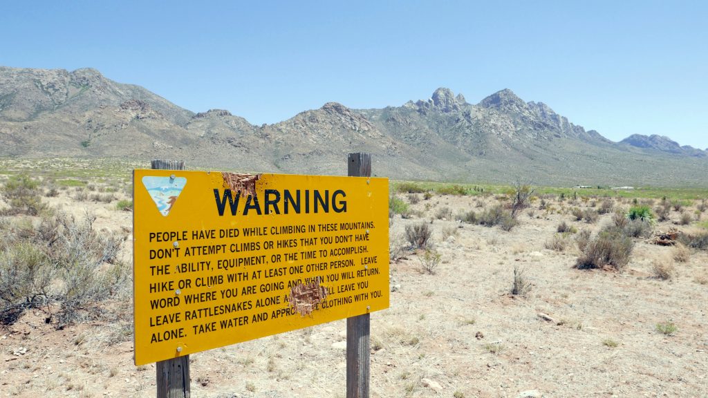
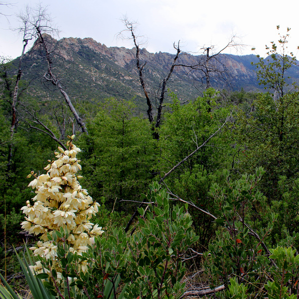
From the trailhead, it felt like a long hike just to get to the base of the mountains, and it was a steady, moderate climb from there. I saw quite a few wildflowers and mysterious yellow berries in the shrubs along this trail, which took my mind off the rising temperatures and bright sun beating down.
P1060725
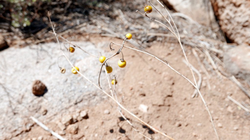
This is when Monkey really proved her resilience here because I’m pretty sure she got a spider bite and was a real champ about it. She’s a very quiet dog that rarely makes a sound at anything, but I heard a tiny yelp and saw her frantically pawing at herself and starting to roll around on the ground. Then I noticed a spider on her paw and brushed it off. I can’t be sure that the spider caused the ruckus, but there was no other explanation in sight.

Monkey’s hiking pace slowed dramatically, and she would periodically sit down mid-stride, which I’ve never seen her do before. She also seemed to be limping, which was especially concerning because we still had about 1.5 miles to get back to the car. I was starting to prepare myself to carry this 44-pound pup the rest of the way and start searching for nearby animal hospitals as soon as I had internet reception again.

But somehow, she just slowly got over whatever was bothering her and got back to her old self again by the end of the hike. I was really proud of my little Monkey for being so tough and keeping up with us on all these hikes. Her life has changed so dramatically since she was picked up as a stray and lived in county animal control cage, and I can only hope that she’s enjoying all of these new adventures as much as we are.

P1060757

Well, since this wraps up my posts about my three home bases in New Mexico, my next ones will be about getting off the beaten path, doing some biking, sampling brews at local breweries, and random musings on traveling with a dog. There’s plenty more New Mexico adventures to come, which I’d better wrap up soon because the next big trip is right around the corner!

***This article was also featured as a guest post on Southwest Discoveries. Check out Hiking in New Mexico – 3 unforgettable trips to take

Hiking in Tucson – 5 Awesome Adventures (A Guest Post from Mitch Stevens of Southwest Discoveries)

To stick with my recent theme of Southwest hiking trips, today I’d like to share a guest post from Mitch Stevens of Southwest Discoveries. Most of my trip to the Southwest was centered on New Mexico, but I can’t wait to get back out to the Southwest to explore more of Arizona too. This post is all about Hiking in Tuscon, with five awesome hikes to check out for yourself.


Hiking in Tucson is arguably some of the best hiking in the world. From lush Sonoran Desert vegetation to picturesque mountain ranges it’s easy to see what attracts hikers to this corner of the world. As you gaze upon towering saguaros and beautiful sky island mountain ranges in the distance, you will understand why hiking in Tucson should be on every adventurer’s travel bucket list.

I’m Mitch Stevens, founder and lead guide for Southwest Discoveries, a hiking and adventure company based in Tucson. Born and raised in New York City, I came to discover the great outdoors and fall in love with Arizona’s special places. My favorite hikes in Tucson include the following wondrous adventures, some of the most awesome treks in the southwest.

1. Mt. Wrightson – Hiking Tucson’s Loftiest Summit

Mt. Wrightson - snow pic

The spirit of the Boy Scouts lives on at Mt. Wrightson. A wooden memorial stands alongside the trail about halfway up to the summit. On November 15, 1958, three boys ages 12 to 16, were caught in a ferocious blizzard and died there. The normally mild weather of southern Arizona was interrupted by an arctic cold front, plunging temperatures below zero. The Boy Scout episode of 1958 caused the largest search and rescue operation in Arizona history, leading to the formation of search and rescue teams in southern Arizona and other locations.

But two summers ago when I led a group of hikers to the summit, the weather was benign. There was a slight chance of monsoon storms in the afternoon which never materialized. We started our hike on the moderate and well graded Old Baldy Trail, allowing us to achieve the summit in less than four hours. The trail originated at Madera Canyon, a world renowned birding spot. Hiking in the Santa Ritas enabled us to not only escape the summer heat but to take in exceptional mountain vistas.

Accompanying us was hiker extraordinaire Bill Bens; who had climbed the mountain over 130 times. He has walked these trails during full moon occurrences and after winter storms with the aid of crampons. The photos Bill shot on these excursions were stunning, resembling scenes more reminiscent of the Canadian Rockies than southern Arizona. He is just one of the many who has fallen under the spell of Mt. Wrightson.

About a mile from the top we reached Baldy Saddle, a great place to rest. Among meadows, spruce and ponderosa pine trees, we observed deep canyons, lofty ridges and sloping grasslands. The final ascent was steep and rocky but taking it slow and easy allowed us to reach the mountain’s glorious pinnacle, no worse for the wear.

The views from the peak were outstanding. They extended more than 60 miles into Mexico and encompassed much of southern Arizona. At Wrightson’s distinct rocky peak, elevation 9450, we peered off into the distance at other sky islands such as Baboquivari, Mt. Lemmon, the Rincons and dozens more.

There are two main trails leading to the summit, and they cross each other twice, making a figure 8. On our descent back to the trailhead, we veered off on the longer and equally scenic Super Trail. It was there that we spotted a mother bear and cub bounding off into the woods, a bonus to an already exceptional and wonderful hike.


2. Redfield Canyon – The Place Time Has Forgotten

Redfield Canyon

Imagine a secret place, a narrow red-walled chasm featuring tall cliffs pocked with eroded caves and strewn with boulders. A place where deep within its heart exists a stone cliff house built into a cliff; lying in splendid isolation. Rumor has it that when they excavated it in the 1930’s, a mummified skull of a Native American infant was unearthed. The daughter of the family who lived in the cliff house brought the skull to school for show and tell!

In this spectacular canyon, hidden cascades and deep pools may be discovered in the side canyons while occasionally bighorn sheep and mountain lions are spotted on the canyon walls. Pictographs, petroglyphs, ruins of the ancient ones and pioneer relics are scattered throughout the canyon and the Galiuro Mountains, where Redfield is located. The Galiuros are made up of a network of peaks and canyons and are a great example of the fault-block development of the Basin and Range Province, stretching from southern Arizona to Oregon.

On a fine autumn day, our group drove the rough but picturesque Jackson Cabin Road eleven miles to the head of Swamp Springs Canyon. We parked our vehicles, unloaded our gear and began our two-day backpack. The trip proved most enjoyable when done as a backpacking trip because of the rugged nature of the terrain. The roundtrip mileage clocked in at approximately fifteen miles.

We scrambled seven miles down Swamp Springs to the confluence of Redfield Canyon. The canyon included beautiful riparian vegetation such as sycamore, cottonwood, walnut and oak trees as well as flowing water. In the distance, saguaros cactus and other Sonoran Desert plants held sway, clinging to steep cliffs flanking the canyon. The contrast between lush woodland, water and stark desert was fascinating.

After camping at the cliff house, the next morning our group climbed a steep route leading out of Redfield Canyon and hiked the Sheep Wash Trail. Riveting views of tree-lined Redfield Canyon from above and far reaching vistas of the Galiuro Mountains were the highlights. The meandering Sheep Wash Trail eventually rejoined Redfield Canyon after seven miles and a side route guided us to Jackson Cabin. After spending time exploring the cabin and pioneer relics, we followed Jackson Cabin Road three miles back to Swamp Springs Canyon where our adventure began.


3. Monsoon Magic on the Red Ridge Loop
Red Ridge Loop

Simply put, the Red Ridge loop is one of the most beautiful summer hikes in Arizona. In the middle of a desert summer, a group of us embarked on this 14-mile jaunt in the cool pines atop Mt. Lemmon, just north of Tucson. We dropped over 3,000 feet to the floor of the Canada Del Oro drainage. In the near distance stood Rappel Rock, Samaniego Peak and Cathedral Rock. These landmarks appeared even more mysterious and intriguing than usual because of a fine layer of fog which enveloped the mountain.

The route wandered through a landscape of lush forest, as well as burned trees, a reminder of the fires that raged through this area ten years ago. The forest has made an impressive recovery and in many of the burned areas there was beautiful new growth, including wildflowers. Many people hike Mt. Lemmon each year and explore the front side of it on trails such as Wilderness of Rocks and Marshall Gulch but few actually explore the northern backside. Here, where few hikers tread, the Canada del Oro canyon was lush and full of life with water running roaring through it. The splendor was mesmerizing.

Massive old Ponderosa Pines, Douglas Firs, Cypress and grapevines cloaked the creek bottom. The scenery was reminiscent of a blend between the Colorado Rockies and the Smoky Mountains of Tennessee. A few storms rolled in but for the most part the rain was light and we stayed dry. However, nearby thunder was ominous. As we approached the Red Ridge trail junction the vegetation changed. We started to see more oak, juniper, huge sycamore trees and blooming yucca, an impressive succulent plant.

To the west rose tilted cliffs of granite known as Reef of Rocks. Tucked into a ravine in the rock face stood an impressive waterfall; an effect of over twelve inches of rain which had pounded Mt. Lemmon during the previous thirty days. Red Ridge is named for an iron bearing formation which gives off a rusty tint from the oxidation of iron during natural weathering. The final three miles to the Red Ridge trailhead is strenuous. In fact, the grade is steep and unrelenting at times. But if you pace yourself, before long you’ll be back in the cool pines and aspens on your way to the top of Mt. Lemmon.

A word of caution, this is not a hike for couch potatoes; it is long and strenuous. Drink plenty of water before and during this hike. Don’t forget the electrolytes and include lots of snacks. You’ll need it!


4. Rincon Peak – Of Dad, the Mountain and Life
rincon peak 2 (1 of 1)

With dad’s ashes, two days’ worth of water, food and gear, my pack weighing well over forty pounds, I trudged up the mountain, saving my energy for the big push near the end. My father asked me several years ago to scatter his remains on a beautiful mountaintop. He passed away three weeks prior to this trip and to honor him; I chose one of the best hiking trails near Tucson and most spectacular sky islands in Arizona, Rincon Peak.

The steepness of the trail and terrain was unrelenting but the views were outstanding. We started out in desert scrub and hiked through a riparian forest featuring huge oaks, cypress and sycamore trees. But there was no water to be found. It had been a very dry year and all of the springs and creeks had dried up. Despite the arid conditions, we observed colorful wildflowers such as blooming cacti and radiant coral bean plants in full blossom.
We ascended through junipers and pinyon pine trees, typical of mid elevation altitudes in southern Arizona. As we climbed higher, massive Manzanita shrubs flourished, some of the most beautiful I’ve ever seen.

As we climbed, my mind drifted once again to my dad. Towards the end of his life when he was fading in and out, he gathered his family around him and with tears in his eyes; he admitted that although my dad was difficult to deal with at times, he never meant it. To a man who hardly expressed emotion, this was profound. It was his way of completing and saying he loved us.

We reached the summit of Rincon Peak. Atop this isolated peak in southeastern Arizona, I gazed upon a landscape which struck awe, resonated beauty, and took in one of the most biologically diverse corners of the world. The landscape encompassed subtropical oaks, soaring pine-clad cliffs, and undulating hills of grassland and forest.

One hundred miles north of here, the massive Colorado Plateau and Rocky Mountains jut into central Arizona with their snow-clad peaks, thick forests and deep canyons. The Mogollon Rim lies at the southern edge of the Colorado Plateau. In the opposite direction, 150 miles to the south, the Sierra Madre Occidental of Mexico, another great mountain system in North America, gives way just before reaching the Arizona New Mexico border. The ecosystem there is different from the sky islands, different from the Rockies, and adapted to warmer temperatures with strong connections to the tropical latitudes of the Western Hemisphere. The mountain ranges of the Sky Island Region exhibit the north south overlap of these two major mountain systems which span the temperate and subtropical latitudes.

From atop Rincon Peak, I released my dad’s ashes into the wind. His remains have melded with the elements of the ages, the rain, the earth, the wind, the water. Perhaps after good monsoon storms his ashes flowed through rushing waters down the mountain and eventually merged with the San Pedro or Santa Cruz, the Gila, the Colorado and into the sea. Storms will again rain on the land and the cycle will repeat once more.


5. Palisades Canyon – One of the Most Exciting Tucson Hikes

Mike on R4

Mike on R4

If you are looking for one of the best Tucson Hikes you can experience, you cannot go wrong with Palisades Canyon. Trekking it comprises one of the most exciting adventures in the southwest. This epic canyoneering trek originates on Mt. Lemmon and plummets 12 miles to Sabino Canyon. The trail starts out in a pine forest and culminates in the Sonoran Desert.

Palisades Creek and its tributaries tumble over polished stone into numerous pools and slots. It courses through hard Precambrian granites and gneiss which compose the heart of the range. The Santa Catalina Mountains, like a few other sky islands, were created by tectonic uplift deep within western North America’s crust. It is considered a metamorphic core complex, formed over fifty million years ago
by granite that has risen to the surface from great depths.

As if soaring cliffs, craggy peaks and stunning scenery isn’t enough, there are waterfalls, one of nature’s grandest spectacles. At Palisades in late summer, cascades are found in absurd abundance in all sizes and varieties. Sometimes, depending upon the angle and reflection of the sun, vibrant rainbows are created. Imagine rappelling into a rainbow!

The price of admission is high in terms of physical exertion, but the rappels are some of the best around. Palisades features seven spectacular waterfall rappels and some of the slickest rock in the state. Keeping one’s footing is of paramount importance; it is often easier to slide down the falls on your side with your feet dangling in midair. The hike itself is over 13 miles long with a total elevation loss of over 4,000 feet and a 1,500-foot ascent at the end. Therefore, this trek is recommended only for experienced technical canyoneers in good physical condition.

Those less than experienced in the rigors of technical trekking should tackle less challenging canyons and Tucson hikes before attempting Palisades. Canyoneering is the fastest growing alpine sport in the United States and for good reason. An intrepid backcountry enthusiast can access and experience amazing and remote places only seen by a few. Palisades Canyon is one of those beautiful and rarified places.

To safely descend this canyon, you’ll need a 200-foot rope and a 200 foot pull cord as well as harness, helmet, carabiners, quick links and about 140 feet of webbing. Wear boots with good traction and wetsuits come in handy in all but the hottest weather. Groups of five or less is recommended because of the time commitment involved, fourteen hours and a hike out in the dark. But if you are up to the challenge, the full descent of Palisades Canyon is a sublime journey indeed and, as we said, one of the best Tucson Hikes you can experience.


This is Alyssa again, and I must admit that these hikes sound pretty freaking sweet. A big thanks to Mitch for sharing his local hiking expertise and inspiration!

Next up on my to-do list is a post about hiking around Las Cruces, New Mexico. Two of my most memorable hikes at White Sands National Monument and the Organ Mountains were in this area, and slowly but surely, I’m excited to tell the stories of these trails and other random adventures along the way.

Seeing Santa Fe on Foot: Southwest Road Trip Series

My next post in this “Southwest Road Trip Series” is all about Santa Fe, a two-week destination that I enjoyed so much that I’ve considered moving there. There aren’t too many places that I’ve visited and thought I could see myself living for a while (Portland is another one of them).

So to get to know the city and surrounding area a bit better, we decided to spend a couple weeks at a campground in Santa Fe. Much of this time was spent on foot, hiking in the nearby parks and strolling around town with Monkey, adventure dog extraordinaire.

IMG_4577

Santa Fe weather was all over the place…this was taken one morning when we woke up to SNOW!

One awesome part about our home base, Ranchos de Santa Fe Campground, was that there was a half-mile wooded trail right behind the tent sites, yet still on the campground’s property. This was a great place to walk or jog Monkey first thing in the morning and as work breaks throughout the day before heading out for whatever activities we had planned.

IMG_2166

Dale Ball Trails

The big trail system in Santa Fe is named after Dale Ball, the lead guy who designed and constructed the trails, and our first hiking outing in the area was here. The Dale Ball Trails are a 22-mile network of trails managed by the Santa Fe Conservation Trust at the base of the Sangre de Cristo Mountains. The trails here are also connected to the Atalaya Trails and Dorothy Stewart Trails.

We parked at St. John’s College and hoofed it on sidewalks to the trailhead.

P1060272
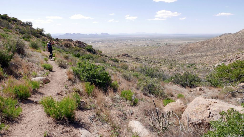
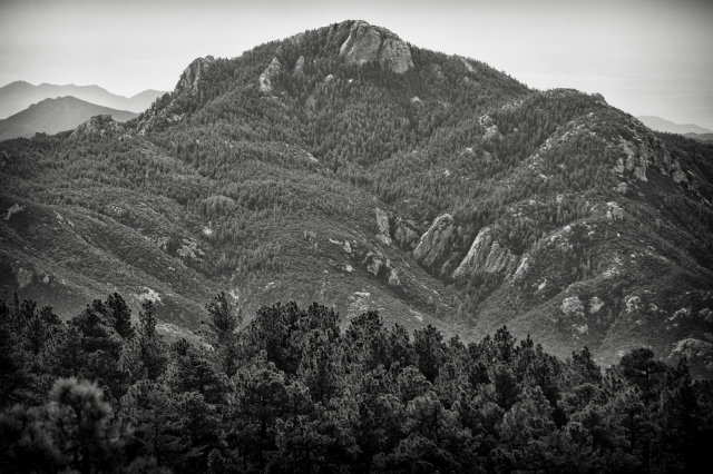
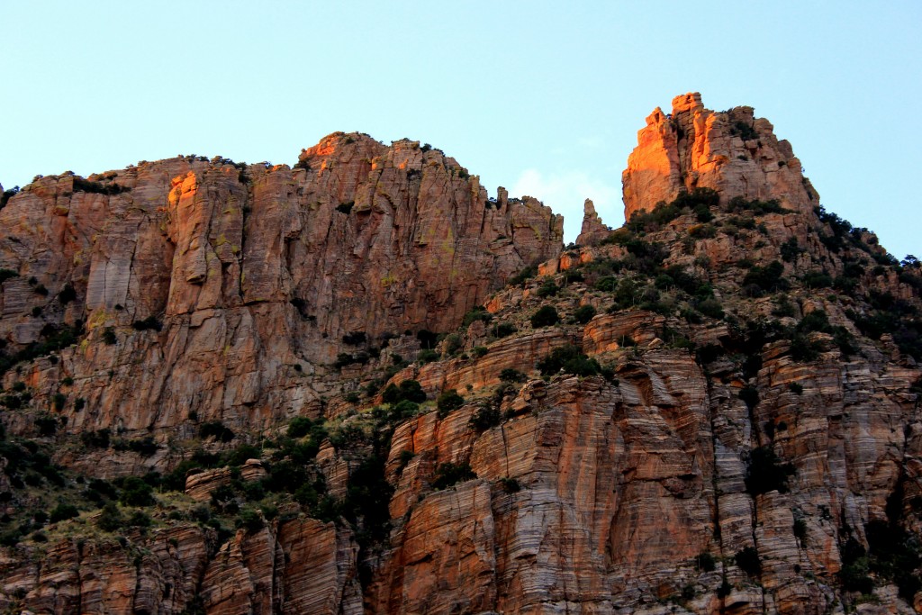
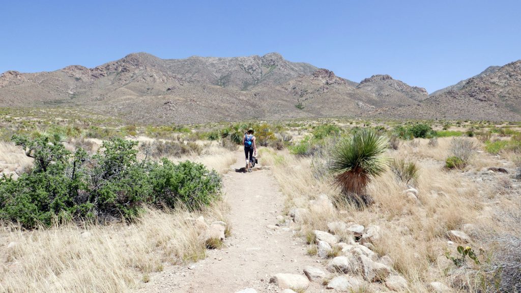
We chose the route that led to Castle Rock, because well, that seems majestic enough right? The route was pretty steep and actually one of the more strenuous ones we’ve done in a while.

Oh, but the views!P1060293
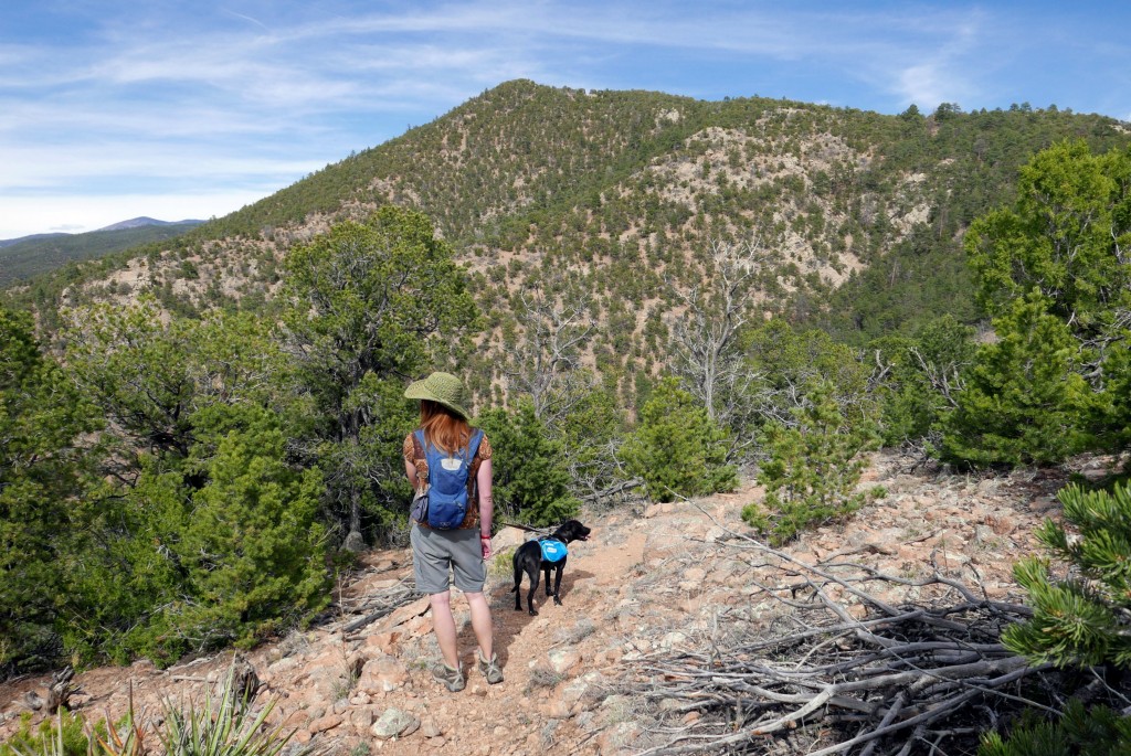
The approach to Castle Rock, which was an impressive exposed rock outcropping, involved scrambling up boulders and teaching Monkey the basics of rock climbing. She has a crazy amount of stamina, a severe lack of patience, and an obsession with all creatures from lizards to squirrels. But despite her little personality quirks, she proved to be a pretty solid rock climber.
P1060319

La Tierra Trails

A lesser-known hiking area lies outside the city, but apparently it’s a pretty popular spot with mountain bikers. La Tierra Trails extend over 25 miles and were formalized by Santa Fe less than a decade ago to develop a multi-use trail system northwest of the city.

We started this journey on La Cuchara Trailhead at the south, which was near a dog park we intended to visit but never actually made it to.

IMG_4588
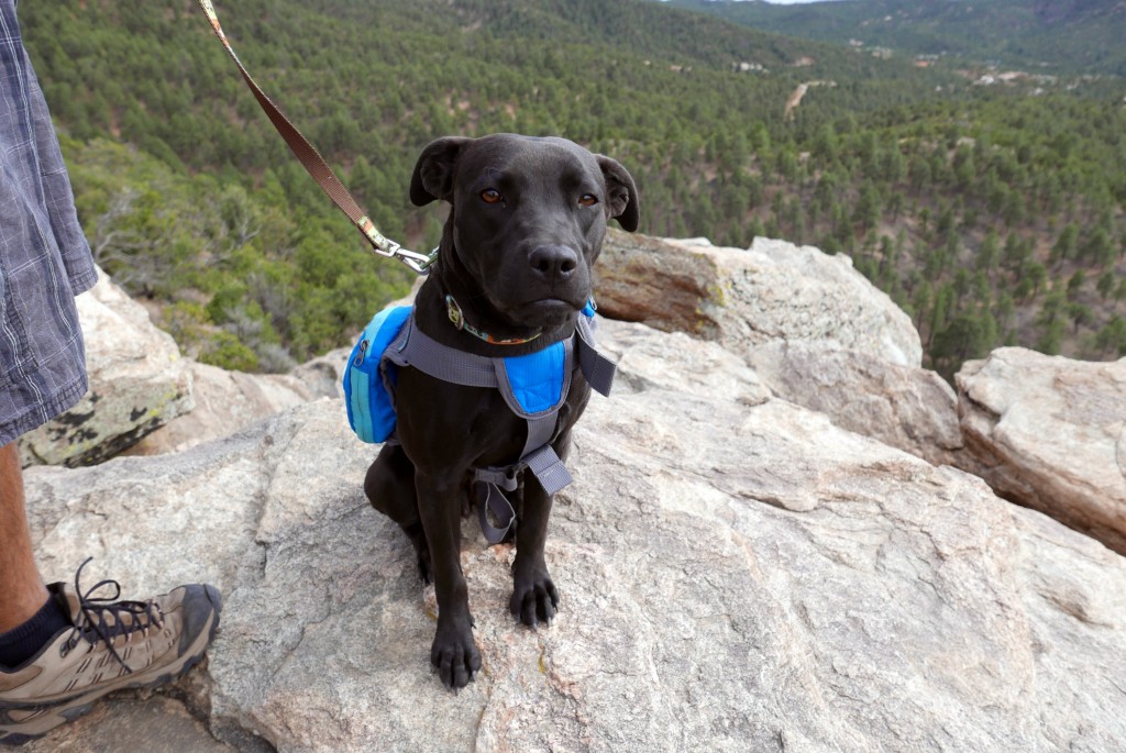
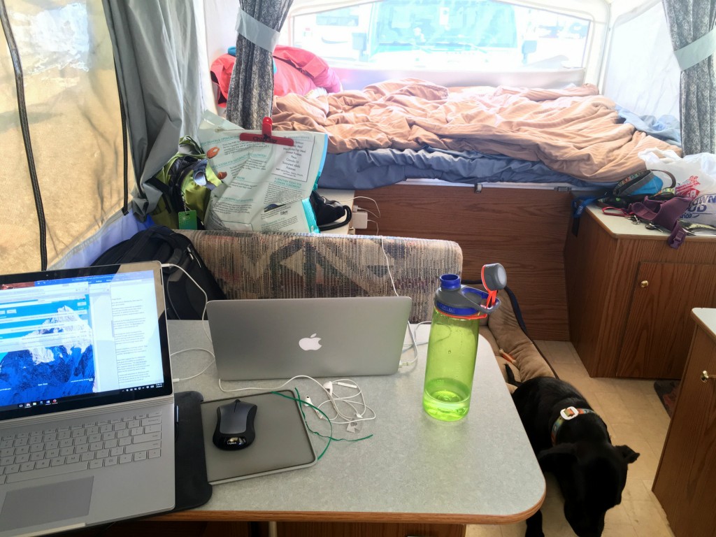
We nearly made it two miles and then had a work emergency and had to turn back to retrieve laptops from the campground and settle things. These types of emergencies don’t happen often, but when they do, unfortunately hiking has to take a backseat to the day jobs.IMG_4592
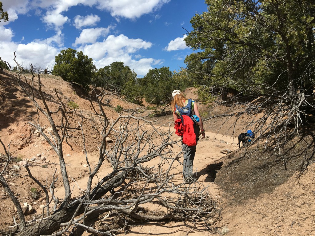
This was a pretty rugged hiking area with downed dead trees and few trail markings. The trails were sandy, and my feet sunk in a bit with every step to make that 1.85 miles feel a bit more challenging than it really was.

We were all frustrated with having to turn around so soon in this remote and peaceful area, but fortunately a trip to Santa Fe Brewing Company picked our spirits back up when the work emergency had been resolved.
IMG_2318

Santa Fe Plaza

However, each one of our week-long (two weeks in the case of Santa Fe) area explorations include some urban hiking as well. When we first got into town, I took myself out on a solo outing to check out the downtown plaza and do some jewelry shopping.

Solo time is totally a must when you’re traveling and camping one-on-one with someone (no matter how cool they are) in a very confined space. I spent my Santa Fe solo time checking out local community/donation yoga classes at Yoga Source and wandering around town. I had read about the Native American Vendors Program of the Palace of the Governors, which is a government program that encourages artists from the nearby pueblos to “set up shop” on the plaza sidewalk to sell their treasures. I ended up buying a ring for myself and a necklace for my best friend here from a guy from Santo Domingo (a pueblo we actually visited on the way to Santa Fe), and he cut me a decent deal for buying two pieces.

IMG_2075
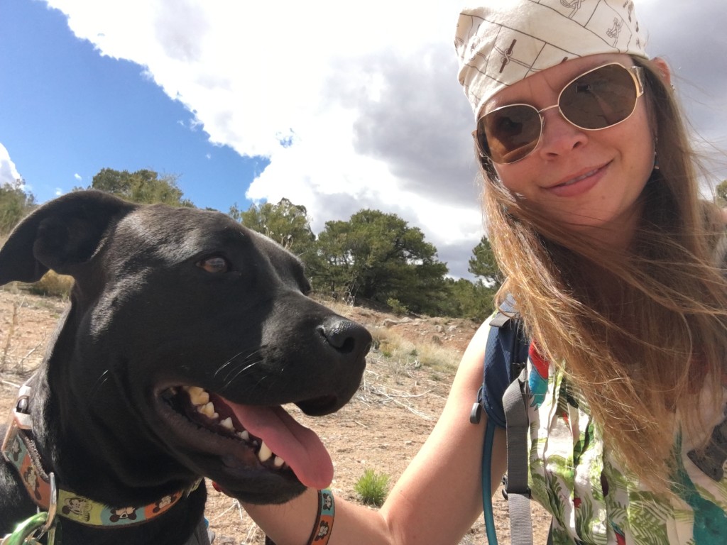
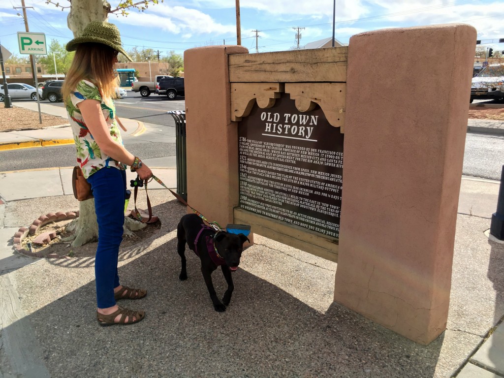
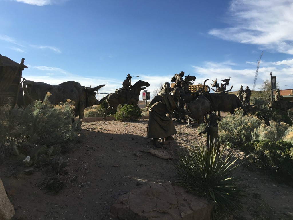
There are tons of shops around the plaza, most of them out of budget but nice to look at anyway. I love the architecture in Santa Fe, which was surprisingly consistent in the churches, shops, restaurants, and homes in the local neighborhoods.

The Santa Fe Plaza is the central part of the city and has been the heart of downtown for over 400 years. Native American and Spanish markets are the centerpiece, and there are a lot of concerts and community events scheduled here at certain times.P1060394
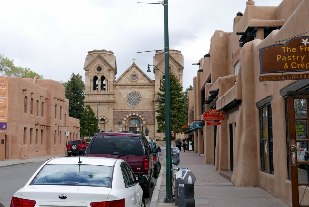
A lot of things appealed to me about the southwest: the laid-back atmosphere, the weather, the outdoorsy-ness, the artsy-ness, the lack of traffic, the abundance of good hair days. However, one thing left me a bit unsettled.

There were tragically few gnomes living in New Mexico…none in shops, none in front yards…nowhere.

This is my one and only gnome encounter from my month in New Mexico, which was at a Christmas shop of all places in Santa Fe’s downtown plaza. I’m convinced that it is not a Santa nor an elf, but a full-fledged gnome and an instant friend on a surprisingly cold southwestern day.
P1060407

Railyard District

Lots of cities have industrial areas that they’ve been trying to transform into the next trendy place to hang out. In Santa Fe, this is the Railyard District. The railroad has played a crucial role in Santa Fe’s history, and old-timey photographs of it were once pitched to East Coast-dwellers to entice them to come experience the Wild West.

IMG_4607
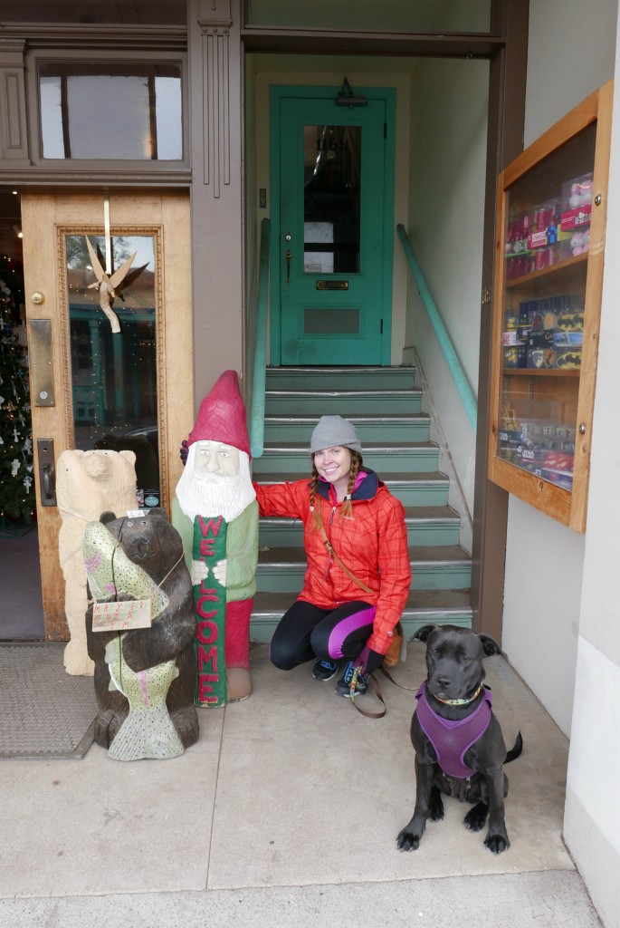
The railyard was declared a blighted area in the late 1980s and started undergoing serious redevelopment. Today this area is home to a popular farmer’s market, arts and cultural organizations, shops, art galleries, and restaurants.

We visited the Railyard as a hybrid hiking/biking excursion after finishing the day’s work back at the campground. We biked to the Railyard and then locked up our bikes to check out the area on foot and venture into a few shops and indulge in some fro yo.

IMG_4611

Museum Campus Trails

The weather was all over the place in Santa Fe, and some days were just too cold and windy to be able to enjoy a good hike. But that’s okay because I also enjoy a good museum from time to time. The only issue was what to do with the dog because nine times out of ten, dogs and museums don’t mix.

That tenth time was the dog-friendly International UFO Museum in Roswell, New Mexico…more to come on that later!

So to solve our dog woes, my husband and I took turns going into a museum of our choice while the other walked around with Monkey. There’s a big museum complex on the outskirts of Santa Fe, so it’s easy to walk from one to the other. I decided to check out the International Museum of Folk Art, and the husband chose the Spanish Colonial Art Museum.

IMG_2083
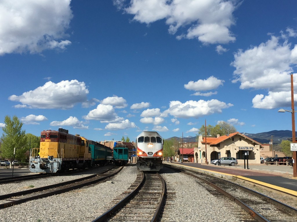
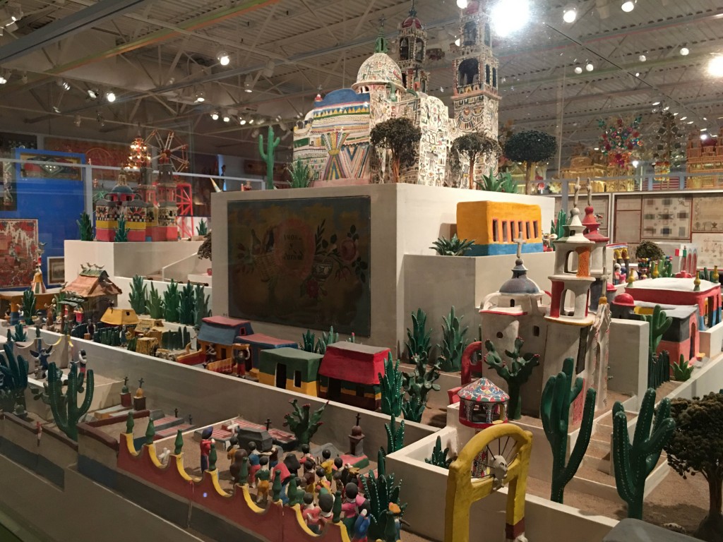
I definitely enjoyed the displays of miniatures and flamenco culture. Museums are a great place to soak up some solo time, especially if you like looking at certain things more than others or like browsing at your own pace.IMG_2097
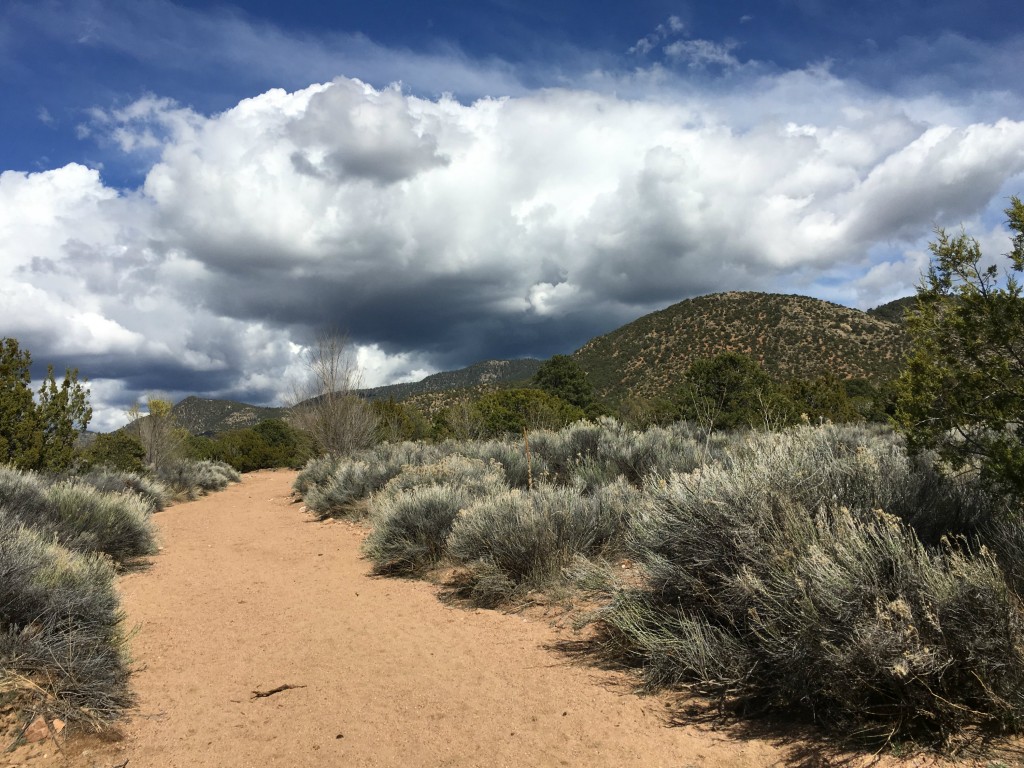
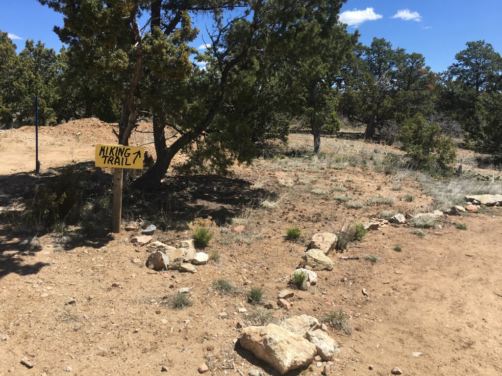
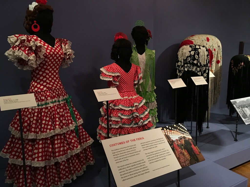
But something unexpected at the museum campus was an extensive set of hiking trails! What started as a crappy day actually turned out to be a pretty nice one. So when my museum turn was over, I took Monkey out behind the museums to do some hiking.IMG_2120
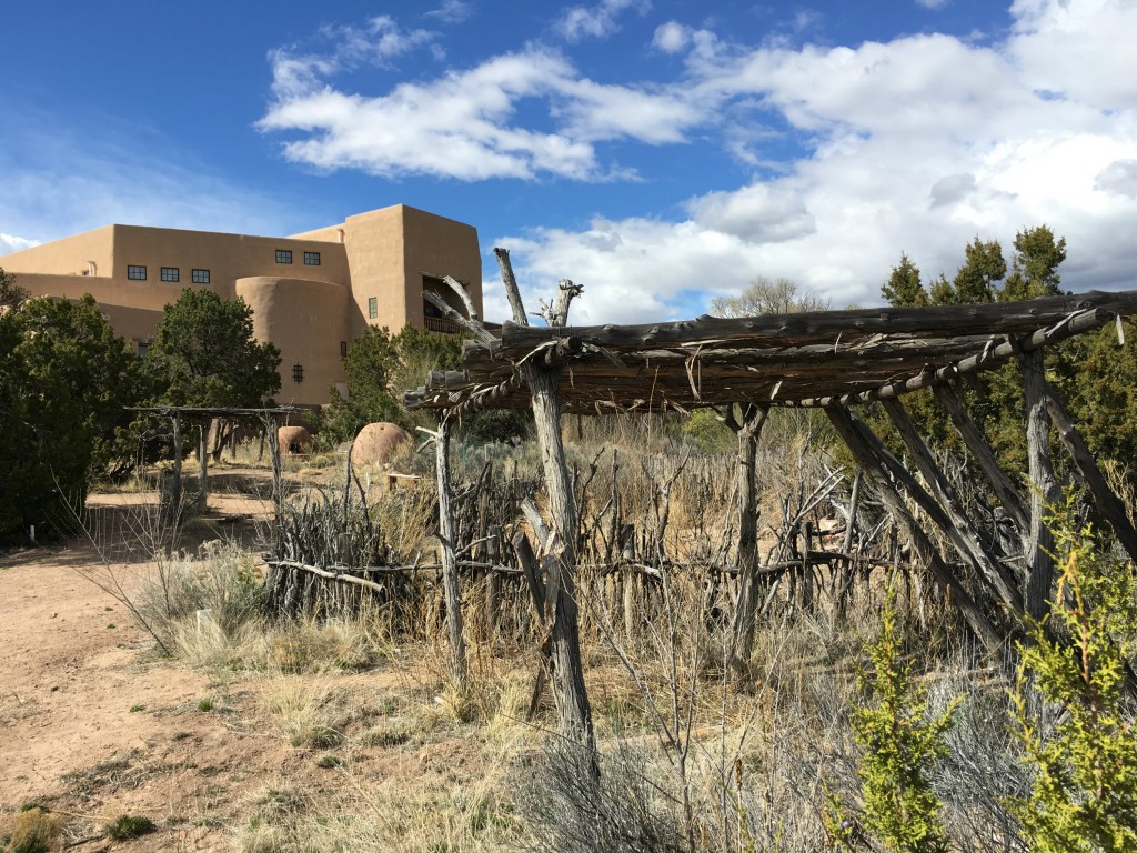
The trails were pretty flat, but winding and not marked. I found it surprisingly easy to get lost (as my directionally challenged self usually does), but eventually found my way back to the Jeep before the storm clouds rolled back in.IMG_2115

Not far from Santa Fe, we also got off-the-beaten path to check out Chimayo, Ojo Caliente, and the Turquoise Trail. Details on those day trips coming soon, slowly but surely!

So is Santa Fe still in the running for a possible future residence?

Maybe. The big thing holding me back thus far is price. Santa Fe is not a cheap city to live in, or even visit for that matter. Rent is high, taxes are high, and restaurants and shops are pretty pricey too. We scoped out a bunch of Craigslist postings for houses and apartments for rent and drove around Santa Fe neighborhoods to see what they were all about. Even if you’re not super-serious about moving to a destination, this is great way to get an inside look into what a city really looks and feels like away from the tourist circuit.

But only time shall tell where the next long-term destination will be, or if they’ll even be anything permanent for a while. Life on the road is just too way much fun 🙂

Hiking around Albuquerque: Southwest Road Trip Series

So today marks day #29 of my Southwestern road trip and I’m just now getting around to my first blog post. Womp womp.

I’d almost forgotten how time-consuming it is to hold down a full-time job while exploring towns and natural sites in new places. But I must say that working in a pop-up camper is MUCH easier than seeking out pavilions, arcade rooms, and laundry rooms while tent camping.

IMG_1893

But to keep track of it all, we’ve been taking tons of photos and I’ve been keeping up with my trusty travel journal at least every couple days. Just this morning, my husband literally just sent me two dozen photo album links of our trip so far, so I thought it was high time to start writing about some of the awesome adventures we’ve been having so far!

This first road trip post is all about hiking around Albuquerque. After starting in Atlanta and briefly passing through Alabama, Mississippi, Oklahoma, and Texas, Albuquerque was the first destination on our list. Hiking is a big part of our travel style, so I’m aiming to highlight the best hikes we did in each of our destinations.

IMG_1891

Why Albuquerque?

Well as the largest city in New Mexico, it seemed like a logical place to start a month-long exploration of the state. Besides, we’re big Breaking Bad fans and were excited to visit as many film sites as possible around town.

IMG_4236

Sandia Mountains

While staying in Albuquerque, one of the first hikes we did was in the Sandia Mountains. We set out on the South Crest Trail and looped around the Faulty Trail and Upper Faulty Trail. This hike kind of reminded me of hiking in Georgia with its dirt/rock terrain and lush greenery. However, this hike was definitely hillier than most Georgia State Park trails, but they didn’t have much in the way of wildflowers.

IMG_4188

We hiked about five miles on this route since we still weren’t exactly sure what Monkey’s hiking capacity is. At this time, she hadn’t even been with us for two months, but already I’d noticed that she does quite a bit better hiking on trails than walking around in cities. Her excitement level is more chill without all those distractions, which is totally understandable. By the way, I’m also working on a post about what to do when your dog is more social than you are, because that’s definitely the scenario here!

IMG_1878

Read more: 

Old Town Albuquerque

Of course, we also did a fair amount of “urban hiking” as well to check out Old Town Albuquerque and the downtown area. This is a cute artsy area with lots of shops and nice for an afternoon stroll.

IMG_4165

This is where I first got in my head that I wanted to buy myself a silver and turquoise cuff bracelet as a souvenir. Shortly after making this decision, I discovered that the ones I liked were in the $1,000 range and totally out of budget.

Throughout this trip, I proceeded to browse shops for my dream bracelet. But in the end, I decided to give up and settle for a $19.99 knock-off. Whatever, it’s still cute and I got some other awesome turquoise jewelry too that I’m planning to chat about exclusively in an upcoming post!

IMG_4177

But moving on from my jewelry woes, there was also a pretty interesting sculpture garden that we checked out near Old Town ABQ as well. It was outside the city’s art and history museum on the other side of a pretty large park.

IMG_1847

Read more: 

Petroglyph National Monument

But my favorite place to hike in the area was Petroglyph National Monument. I few years ago, I wrote a post about petroglyphs and pictographs after checking some out on hikes in Montana and Wyoming. And I’m still a bit fascinated about ancient rock carvings and all that.

P1060202

Related: Pictographs v. Petroglyphs v. Graffiti

The trails of choice were Rinconada Canyon and Piedras Marcadas, which were both dog-friendly. On the first of these routes, we hiked about a mile to reach the petroglyphs and then they slowly started to reveal themselves. The carvings were bit far away from the trail but still totally visible and easy to point out. Round trip, Rinconada Canyon involved about 2.2 miles of hiking.

P1060163

Then we drove about six miles up the road to Piedras Marcadas, which was oddly located right in the middle of an urban subdivision. These people’s backyards literally back right up to the petroglyph trail, which was kind of cool and kind of ridiculous at the same time.

Between the two trails though, this one was definitely the better one to scope out petroglyphs. There are lots more of them, and you can walk right up to the rocks with carvings.

P1060202

Surprisingly, there really wasn’t much graffiti out here either, which was refreshing. Piedras Marcadas was a little over two miles round-trip as well and offered lovely views of the town down below and nearby mountains.

P1060205

Read more: 

A Dirt Road Near Cochiti Lake

One pretty random hike that we ventured out in in the Albuquerque area was along a dirt road near Cochiti Lake. This was actually a backup hike after finding out the hard way that Tent Rocks National Monument doesn’t allow dogs.

This is in an area full of Native American pueblos. We tried to stop by one, Santa Domingo Pueblo, but it was early morning on a Sunday and nothing was open and we felt kind of awkward just lurking around.

Anyway, the national park dude at Tent Rocks recommended that we just drive down the road and pull over wherever to hike with our dog without hassle and for free. So that’s what we did.

IMG_2031

We parked and hiked down a paved road until we hit a barricaded dirt road and turned down on it. There was only one other couple around and quite a bit ahead of us down the trail, so we actually let Monkey off-leash for a bit. As a recovering stray, she doesn’t go too far away from us and is slowly earning our trust.

IMG_4385

We hiked this route until we got to a dried-up river, which seems to be a pretty common occurrence in New Mexico given the climate. The weather was absolutely perfect – sunny and 70s. From here, we moved on from Albuquerque and drove to our next destination: Santa Fe, which we quickly discovered had plenty of awesome hiking spots of its own!

Arizona Day Trips – 5 Awesome Hikes in the Southwest (A Guest Post from Mitch Stevens of Southwest Discoveries)

It’s been way too long since I’ve had a chance to update this blog about my recent adventures, but I’m happy to report that a BIG ONE is beginning TOMORROW!

If all goes as planned, I will have rounded up the husband, the dog (we recently adopted one – more to come on that soon!), and a bunch of gear by mid-morning. I’m pointing Chief the Jeep and the currently nameless pop-up camper towards New Mexico and embarking on an extended working/camping/exploring road trip to the Southwest for a wonderfully indefinite amount of time!

So I thought there was no better time than the present to share a guest post from the founder of an Tuscon, Arizona-based adventure travel company I recently connected with by the name of Mitch Stevens. Mitch is the founder and lead guide of Southwest Discoveries, and he was kind enough to share some Arizona hiking expertise with me and my readers. Whether on this upcoming trip or a future one, I hope to check out some of these awesome-sounding Southwest hikes very soon.

——————————————————————————————————————–

Arizona Day Trips – 5 Awesome Hikes in the Southwest 
By Mitch Stevens of Southwest Discoveries

It’s a well known fact that Arizona is beautiful, often breathtakingly so. In this post, we will introduce five of the most awesome, wondrous and secluded hikes in the southwest. From the fascinating Sonoran Desert in southern Arizona to the red rock country near Sedona and the Grand Canyon, Arizona features a staggering diversity of landscapes, perfect for Arizona Day Trips and adventures. But with so many amazing places to trek, just where to you draw the line? Allow us the opportunity to present to you five of the most awesome, wondrous and secluded hikes in the southwest that are perfect destinations for your next hiking adventure.

The first of our five Day trips in Arizona offering big, uninterrupted space, plenty of cactus and southwestern flora to experience and the unspoiled splendor of one of Earth’s major ecosystems.

1. Mt. Ajo – Organ Pipe Cactus National Monument

Ajo Sunset (1 of 1)

As a trip leader and interpretive guide, Beth Krueger knows the desert. She once spent four days camped at Organ Pipe Cactus National Monument, surveying birds and other wildlife. While most hikers avoid summers in this part of the world, this is Beth’s favorite season. At this time of year, she can savor the fruit of the organ pipe cactus, purported to be the best tasting in the world.

Beth and I collaborated on a late winter outing at the park’s nearly pristine desert wilderness, celebrating the life and landscape of the Sonoran Desert. Our group hiked to the summit of Mt. Ajo, an incredibly beautiful trek which enabled us to experience the Sonoran Desert at it’s finest.

We marveled at magnificent organ pipe and saguaro cacti as well as a rich assortment of extraordinary plants. The preserve is a showcase for plants and creatures who have adapted to the extreme temperatures, intense sunlight, and little rainfall that characterize this southwest region. Located between Arizona’s Ajo Mountains and the Mexico border, Organ Pipe is the only place in the United States where the organ pipe cactus appears, rare in the United States but common in Mexico

A hiker can explore many sections of this international biosphere preserve where big views, uninterrupted space, lots of the namesake cactus and one of the Earth’s major ecosystems survives in almost unspoiled splendor. The monument lies next to Cabeza Prieta National Wildlife Refuge, which is connected to the Barry Goldwater Air Force Range. Together, these lands represent a large, unbroken desert habitat, home to species such as the endangered Sonoran pronghorn, Quitobaquito pupfish and desert bighorn sheep.

Our group hiked one and a half miles through dense stands of giant columnar cactus to the Bull Pasture overlook. There are exceptional views in every direction. The immediate surroundings are filled with smaller peaks, canyons, and other rocks formations; and in the distance are more mountains. If winter rains are generous, this vicinity of the park erupts with dense stands of Mexican Gold Poppies and other gorgeous wildflowers.

After we left Bull Pasture, the official trail ended and the unofficial cairned route began. A series of switchbacks quickly took us up several hundred feet, and the views just kept getting better. Before long, boulders and rock formations that were part of the backdrop at the beginning were now right in front of us. After a few short, steep switchbacks with some loose footing, the route meandered alongside amazing rock outcrops, including windows, arches and a series of huge cone-like stone formations.

At this point, the awesomeness factor jumped to a whole new level. After another mile of hiking on a ridgeline with stunning views, a short but fun boulder hop landed us atop Mount Ajo, the tallest mountain in Organ Pipe Cactus National Monument.(http://www.nps.gov/orpi/index.htm) We scrambled a short distance on the summit and more grand views emerged.  There was a large and colorful rock slab that looked like a spaceship, covered in lime green lichen. This made for a great resting spot.

On the return hike, we completed a loop hike by taking the Estes Canyon Trail to the trail head.  Estes Canyon is spectacular for birding and has many beautiful organ pipe and saguaros. It’s a great place to observe the unique botany and ecology of this fascinating region. For a brief cyber journey of this southwestern wonderland, turn up your speakers and enjoy Organ Pipe Magic. https://youtu.be/tnMc680-TXE


2. Wet Beaver Creek – Paradise Found

Wet Beaver Creek - swimming

Arizona’s Wet Beaver Creek Wilderness is paradise found. Located on the western escarpment of the Mogollon Rim, the perennially flowing Wet Beaver Creek drains an area of 250 square miles and descends more than 5,000 feet in its 30 mile tumble to the Verde River. What makes this stream particularly appealing for hikers is that it’s a backcountry swimmer’s dream; no fewer than twenty five plunge pools (25 to 75 yards across) must be negotiated. Although a day hike at Wet Beaver Creek is very enjoyable, the entire wilderness hike can encompass a 2 or 3 day backpacking trek, an unforgettable adventure.

Wet Beaver Creek, from start to finish, crosses the divide between the Colorado Plateau to the north and the Basin and Range country to the south. If completing the entire journey, a hiker will trek from verdant ponderosa pine forest at the rim to Sonoran Desert and descend through five geological formations: Basalt, Kaibab, Toroweap, Coconino and Supai.

On a beautiful early fall day, a group of us started our day hike on the Bell Trail in the popular lower end of Wet Beaver Creek. The walk started out mellow and flat but after a mile, the scenery become increasingly colorful. Red Supai sandstone rock formations comprised the rim of the canyon and the walls steepened. We reached the famous Crack, an amazing swimming hole cut out of the Supai formation.

Continuing upstream, true adventure began. The rugged character of this riparian wilderness revealed itself as we splashed, waded and swam across huge plunge pools. The forest canopy thickened and red rock outcrops soared overhead. We swam through a huge pool which was especially charming; a balanced rock towered above us.

At our lunch spot and turn-around point, we scrambled to a remote prehistoric Indian Ruin. Wet Beaver Creek lies within the ancestral lands of the Sinagua culture and archaeologists are still investigating evidence of their prehistoric occupation at Wet Beaver Creek. The Sinagua were hunters and gatherers, utilized extensive irrigation systems and were believed to be the first to trek and swim the length of Wet Beaver Creek. Throughout the Verde Valley, Sinagua rock art and extensive ruins are abundant. Nearby Montezuma Castle National Monument and Montezuma Well are outstanding examples.

An exploration of Wet Beaver Creek is an astonishingly beautiful trek and well worth the time and effort. To view highlights of this epic adventure, turn up your speakers and enjoy this three minute video. Happy trails!
https://youtu.be/ksxI7eIpIYk


3. Finger Rock – Tucson’s Best Trek

Finger Rock - alpenglow

Superlative landscapes, beautiful sunsets, grand views and an exhilarating short climb to a lofty stone pinnacle are the drawing cards of Tucson’s Finger Rock Trail. Late fall through spring are the best times to pull off this trek.

We started early in the cool dawn air and hiked to Linda Vista Saddle, a steep and invigorating workout. In three miles we ascended over 3,000 feet and arrived at one of the few level spots along the trail. If we continued two more miles on the Finger Rock trail, we would have topped out at Kimble Peak, a worthy destination in its own right.

However, our goal today was to scale Finger Rock itself. We left the established trail and headed off to the northwest, down a gully then up a sketchy route, climbing another 1,000 feet. An hour and a half of scrambling and bushwhacking later, we were at the foot of Finger Rock, a slender pillar of lichen encrusted granitic gneiss which juts up 250 feet in spectacular fashion.

Guiding us on this perfect autumn day was Don Smith, an accomplished rock climber, caver, canyoneer, backpacker and avid adventurer. Don has been known to take lengthy sabbaticals and journey to fantastic locales such as the Yukon, Alaska and Belize. He takes folks to some remarkable places, including Tucson’s Finger Rock!
Don went first, set the anchor and belayed the rest of the group. We completed the first pitch then reached the midpoint of the climb. Don clambered up the rock, achieved the near high point of the Finger and secured the rope at strategically placed bolts. The rest of our crew, one by one, scrambled up to a high perch offering marvelous panoramas of numerous rock formations, the lofty crest of the Santa Catalina Mountains and the Tucson valley and beyond.

From there, it is a short scramble to the actual high point of Finger Rock, a precarious roost which can only accommodate one or two people. After spending about an hour enjoying the incredible spectacle, we rappelled 100 feet to the bottom of Finger Rock.

Three and a half hours later, after witnessing an awesome sunset, we all safely returned to the Finger Rock trailhead, rejuvenated after another splendid day of adventure in the mountains.

For an exciting glimpse of this astonishing trek, click on https://youtu.be/8plEYNCcxHw­. Turn up your speakers and enjoy!


4. Rogers Canyon – Spirits of the Past in the Superstition Wilderness

Arizona day trips - group at Rogers ruins

Most folks have hopes and dreams, some more grandiose than others. But few people are fortunate enough to realize all of their dreams. Elisha Reavis wanted to live off the land in a beautiful place far away from the hordes of humanity. He lived out his dream in a high mountain valley in Arizona’s Superstition Mountains where he farmed, grazed and tendered an orchard. Ponderosa pines graced his ranch and a beautiful clear spring-fed creek watered the fruit trees he planted. He died in 1896; his grave-site is located in a place few people will ever see. Thanks to Randy Weber, a Tucson hiker, historian and naturalist, we were one of the few.

500 years before Reavis departed, the Salado peoples were eking out a living in Rogers Canyon. So we headed left at the Rogers Canyon trail junction to observe the fascinating cliff dwellings. Gradually, the character and look of the landscape transformed from high desert grassland to riparian. Huge old sycamore trees, juniper, oak and mountain laurel appeared. As we ventured deeper into the thick of Rogers Canyon, spectacular volcanic rock formations made their appearance. Various shapes chiseled by the elements resembled a teapot, Queen Victoria’s crown and a huge boulder perched precariously high up on the canyon wall.

Finally, we arrived at the Salado cliff dwellings. These well preserved ruins, located in a huge cave above the canyon floor, were the highlight of our day. At one time, as many as 100 people lived here and there were more than 65 rooms when it was constructed over 600 years ago. Most of the ruins have all but vanished but there is still a lot to see. The view from the ruins, looking out across the canyon was fantastic, a sight to behold. The ruins are fragile and irreplaceable; the forest service asks that hikers tread lightly and respect this magnificent place.

The long and bumpy drive from Rogers Trough trailhead is almost as striking as the hike itself. To the west views of saguaro studded Byous Butte, especially at sunset, are glorious. About six miles down the road on the right, we observed a picturesque stone arch. Numerous ridges and peaks of the Superstitions as well as other sky islands in the distance were prevalent throughout the journey back to civilization.


5. Adventuring at Nankoweap

Nankoweap - Fred and the canyon

For hikers wanting to experience raw adventure and avoid crowds, the Nankoweap trail at the Grand Canyon is one of the most enjoyable and epic treks in the southwest. Spectacular geology and out of this world views are the calling cards of this magnificent place. Nankoweap is located at the North Rim of the Grand Canyon.

The trail was originally constructed by Major John Wesley Powell, the one armed civil war veteran and explorer in 1882. It was created so that Charles Doolittle Walcott, a geologist in the Powell party, could easily be able to access the canyon and study its rock layers. Powell is best known for his epic explorations down the Green and Colorado Rivers and is credited with leading the first group of men down the Colorado River in 1871, through present day Grand Canyon.

Julie Dobson, who runs a travel adventure website called Escaping the Midwest, (http://escapingthemidwest.com/2016/01/22/the-words-of-john-wesley-powell/), recently posted a few of Powell’s most famous quotes about the Grand Canyon. Powell wrote, “the elements that unite to make the Grand Canyon the most sublime spectacle in nature are multifarious and exceedlingly diverse.”

In 2015 I had the pleasure of guiding a group of adventurers down the Nankoweap Trail. The first three miles were a delightful romp through a high elevation forest of ponderosa pine, juniper and aspen. Then suddenly, the trail took on an entirely different character. The route plunged off the rim of the Grand Canyon and a long ridge-top traverse ensued. After hiking two more miles, all the while gazing at amazing far reaching views, we arrived at Marion Point. Coming into contact with the geology in this part of the Grand Canyon was incredible, rock layers reached far back into our planet’s past from 300 million to 750 million years ago.

Wonderful and unbelievable panoramas unfolded. The visible green ribbon along Nankoweap Creek was 2,500 feet below us. The forks of Nankoweap Creek extended far back toward the plateau, each separated by colorful rocky ridges and lofty buttes. The most striking of these was Mt. Hayden, a distinct and slender 400 foot Coconino sandstone spire at an elevation of over 8,000 feet. Marion Point can also be the turn around location for hikers interested in a spectacular but rigorous ten mile roundtrip day hike.

But our group’s plan was to trek further into the heart of the Grand Canyon (backpacking experience and appropriate gear are highly recommended). Our long ridge-top traverse continued. After we reached Tilted Mesa in just over two miles, the route led steeply down to Nankoweap Creek and the Colorado River. Near the river, high cliffs of Redwall Limestone and beautiful exposures of Muav Limestone and Bright Angel Shale were the dominant features. Our first view of the emerald green Colorado River in the distance was mesmerizing. Not only did we finally see the river but we heard the roar of Nankoweap Rapids, amplified by red and tan walls at Marble Canyon.

Our group camped at the Colorado, which proved to be an excellent base for exploring further afield. We trekked seven miles upstream along bubbling Nankoweap Creek and discovered intriguing places such as Mystery Falls, a set of cliff top Anasazi granaries, and a fascinating cave featuring a stream running through it.

Should the Grand Canyon be included on your bucket list? Most certainly. And the spectacular and uncrowded Nankoweap trail is one of the best ways to experience the real Grand Canyon, the raw and unspoiled grandeur of this most magnificent gorge, one of the seven natural wonders of the world.

Who’s Behind All These Gnome Homes in Parks?

As a writer and hardcore gnome enthusiast, I keep up with gnome news on a daily basis. (Just create a Google alert for “gnomes”!)

One trend that I keep seeing is “gnome homes” popping up all over the country in public parks. As we all know, gnomes and nature go hand-in-hand, so it makes perfect sense that they’d be setting up habitats in our most beautiful and scenic parks. With the assistance of creative and devoted humans, gnomes are moving into parks and sparking the imaginations of kids and adults of all ages.

Tomahawk Creek Trail – Overland Park. Kansas

Gnome homes started appearing along this trail in 2013, and their creator was recently identified as a single mother named Robyn Frampton. An Overland Park filmmaker created a documentary about her project called “The Gnomist.” It’s a story of paying it forward (one gnome home at a time) getting through a painful divorce, and connecting with nature and other people.

1

Little Buffalo State Park – Newport, Pennsylvania

Sadly, this is a story of gnome homes that haven’t been well-received. A local retired couple built 39 gnome homes to encourage kids and adults to interact with the park. For fear of harming the natural environment, park management has evicted the gnomes. However, the couple insists the trail has no damage, and the park has seen tremendous increases in visitors since the gnomes appeared. You can sign a petition to keep the gnomes keep their homes and the community enjoying the magic they bring.

Glen Park – San Francisco, California

Gnomes have also taken up residence in this park along the Creeks to Peaks Trail with a sign reading “Leave for all to enjoy.” Visitors are encouraged to check out the gnome home while walking through the park and leave their own mementos behind in the community’s knotty tree stump.

Lamignomes…The Next Big Gnome Movement?

My new website is definitely still a work in progress, but I’ll give you a sneak peek into my next gnome venture: Lamignomes (i.e. laminated gnomes). Armed with custom gnome printouts, popsicle sticks, a sharpie marker, and a laminating machine, I have been creating gnomes with “talk bubbles” who have lots to say about the places I travel to. Stay tuned for an update on the Lamignomes movement in a future post!

2

Have you spotted a gnome habitat growing in a park near you? Share your story (and photos!) with us, and maybe we can visit them someday too!

Active & Outdoorsy Adventures in Puerto Rico

For the first three decades of my life, Thanksgiving consisted of turkey, pumpkin pie, and sitting around staring at people I’m related to. This Thanksgiving, however, was a little bit different.

Flights to Puerto Rico were super affordable over the holiday, so we decided to switch things up and spend five or so days on the island. The week was packed with active and outdoorsy adventures, and these were some of my favorites!

DISCLAIMER: This is just a quick overview because my attention span and patience are running low today, but for more details on how to replicate these adventures, I’d recommend checking out the site, Puerto Rico Day Trips, which proved to be very useful when planning my trip.

Hike the El Yunque Trail to the Summit

El Yunque is a rain forest in the northeastern corner of Puerto Rico and home to hundreds of species of trees and flowers. Take the steep, winding back-roads to drive here from Fajardo for a unique glimpse at village life.

P1050873

The guy working the front desk at the park warned us that the trek to the summit would take four hours, but we did it in three. We weren’t really hustling that much either. The hike to the summit is a moderately-strenuous 5-mile hike that ends at an observation tower riddled with graffiti.

IMG_3408

It was super foggy at the summit on the day we hiked here, but it honestly just added to the mystery and intrigue of the whole place. The better views were down a bit further on the mountain.

Hike La Mina Trail to the Famous Waterfall

Also while in El Yunque, make sure not to miss the famous waterfall that you see on all the postcards. Otherwise, who will ever believe you went to Puerto Rico?! Even the cruise ships take excursions over here to see it.

Take a Dip in the Waterfall along La Mina Trail

The ultimate reward for a strenuous day of hiking is taking a dip in the waterfall along the La Mina trail. Sunbathing is popular here, so bring your swimsuit and a towel if you feel like getting in. We opted to continue hiking in the rain instead.

Bike around San Juan

The city has been making efforts to become more bike-friendly, and there is a great bike lane between Condado and Old San Juan. The hostel I stayed at, Mango Mansion, rents bikes for $20 per day. Local rental shops charge around $30-$45 per day.

P1050317

Honestly, he bikes were pretty crappy and hard to ride, but we made do and arrived back in one piece.

Bike around San Juan

Just keep in mind that bike lanes here aren’t continuous, so you’ll need to be comfortable riding on streets, bridges, and the occasional sidewalk to get around too.

IMG_3338

Bike to the forts…there are two of them and you’re admission fee at one gets you into the other one too. The streets in Old San Juan are pretty steep and cobblestone-style, so you might want to lock up the bike and set out on foot for a while. The whole area is pretty walkable, although my feet were definitely killing me at the end of this day.

P1050452

Explore Caves at Parque de las Cavernas Del Rio Camuy

This is a beautiful park that offers guided cave tours following a trolley ride to see a huge sinkhole, stalactites, and ancient rock formations.

P1050555

The trolley seemed a little bit silly; we could have totally hiked down to the cave. However, such hiking is not allowed so we reluctantly hopped aboard and squeezed in next to a bunch of other tourists.

See the Caves at Parque de las Cavernas Del Rio Camuy

Regardless, the Parque de las Cavernas Del Rio Camuy tour was pretty worthwhile just to learn some stuff about what you’re looking at. It lasts about 1.5 hours and is bilingual in both English and Spanish.

At the very end of the tour, our guide mentioned that we might be allowed to hike around the area if we found the director and got special approval. By that time, it was a little too late to work into our schedule. But something to keep in mind to ask if you visit and want to ditch the tour crowds for a while.

P1050661

Hike at Bosque Estatal de Guanica

This is a dry forest in southwest Puerto Rico, and the Fort Trail extends about 6 miles round-trip to give you a taste of the island’s diverse terrain. The Guanica State Forest wasn’t a big tourist destination when we visited, but it’s pretty quick and easy to get here from Ponce.

P1050747

The trail is honestly pretty boring, with not much to see along the way and really no other hikers either. But it provides a contrast from the El Yunque rainforest, and it was just nice to be outdoors in the 80-degree weather.

Fort Capron is a small watch tower that offers lovely views of the rolling hills, sea, and village down below.

P1050761

This is also a nice area to sit and enjoy a little peace and solitude.

IMG_3362

This was the ideal picnic spot that we found to relax for a while between two separate hikes in the dry forest area. I could literally just stare at crashing waves for hours.

Have a Picnic along the CoastDon’t be intimidated by little local shops in villages along the way. Something that surprised me while visiting Puerto Rico is that food and drinks are far from cheap.

It’s basically American prices paid for with American money. At this little local shop, I picked up a sandwich for $5 and a bottle of rum for about $7, and juice mixer for a couple bucks…perfect for picnicking!

IMG_0809

Watch for Wildlife in Unexpected Places

Iguanas are commonly seen around the fort areas and are a favorite photography subject for tourists.

Keep and eye out for iguanas

But apparently, Puerto Ricans have viewed the infestation of iguanas as a nuisance species that chews native plants and burrows under roads. I still think they’re kind of cute, photogenic, and slightly terrifying.

Kayak to Monkey Island

This was one of the main reasons we chose Puerto Rico for our Thanksgiving destination, and unfortunately, it’s the one and only outdoorsy activity that didn’t work out. Rain, high winds, and treacherous water conditions prompted our guides to cancel the trip on us. But I’m including it here to encourage you to give it a try when you visit Puerto Rico.

*INSERT NON-EXISTENT AWESOME MONKEY KAYAKING PHOTO HERE*

Read some of the TripAdvisor reviews from lucky bastards who actually got to do this since I can’t provide a first-hand report. The monkeys here have been used for research, which is totally sad and wrong, but they seem to be here to stay so you may as well stop by to say hello. Depending on the weather conditions, there are also snorkeling opportunities on this tour, but I’m pretty sure monkeys aren’t into snorkeling with you.

To book your tour, visit the Barefoot Travelers Rooms site and contact Keishya Salko at [email protected] or 787-850-0508 to schedule. She’ll send you directions, a list of what to bring, and tips of other fun things to do like the Guavate Pig Roast.

And by staying active in all these ways, you can have all the mojitos your heart desires! Right? Right? At least that’s that I keep telling myself.

P1050296

To learn about some more awesome things to see and do in Puerto Rico, check out my post, Incredible Ways to Spend Your Vacation in Puerto Rico (List-Style Highlights Published on Trips to Discover!).