Adventure Travel Shop Guest Post: Hiking Ireland’s Wicklow Mountains

This summer’s European honeymoon adventure that I’ve been (slowly, but surely) writing about concluded with trip to Ireland. By this point in the journey, I was feeling pretty “citied out,” and seriously craving some peace, quiet, and green space.

Wicklow 1

I had started feeling uninspired, indifferent and fatigued…all emotions I never expected to experience on this trip. Clearly, this was the time to trade in crowds and lines for trees and trails. So we hopped on the first bus out of Dublin one morning for Wicklow Mountains National Park, which covers part of a mountain range that extends over most of County Wicklow on the east coast of Ireland.

Wicklow 2

Giovanna at Adventure Travel Shop was kind enough to publish a guest post I wrote to share with her readers about our much-needed time in the mountains and travel tips for pulling off a similar excursion for yourself. Check out my latest guest post, some scenic photos from the day, and Giovanna’s site here: Hiking Ireland’s Wicklow Mountains via Adventure Travel Shop!

Wicklow 3

Everything You Need to Know About Hiking With Your Dog

As an avid hiker, writer, and dog sitter, it only seemed perfect that I write an article for DogVacay about hiking with your dog.

P1000566

I’ve learned a TON about how to prep for dog hiking trips and care on the trail while working a side gig with this company over the past year. Hiking is such a wonderful way to spend time with dogs…whether your own or someone else’s that you need to tire out to get some sleep!

P1000456

Check out my publishedpost on the DogVacay blog. Pictured here are a few of my favorite hardcore hiker pups Abby, Aro, Lily, and Emma!

http://dogvacay.com/blog/hiking-with-your-dog/

*Photos and words by Alyssa Ochs, a DogVacay Host in Atlanta, GA.

Hiking to the Tallest Waterfall in the Southeast (with a Dog): Amicalola Falls, Georgia

One of the best things that I’ve discovered about living in Georgia is that there are lots of decent hiking trails within an hour’s drive.

Before my living situation brought me to the southeast instead of the northwest, I put a high priority on living in a hiking-friendly area. Although the mountains aren’t quite as tall or the parks as vast down here, Georgia continues to surprise me in pleasant ways.

Did you know that there’s a 729-foot waterfall just 90 minutes outside downtown Atlanta?

Well there is! And I recently had the pleasure of checking it out with my fiancée and a random English Setter named Lily.

Amicalola Falls State Park is located in north central Georgia, smack dab in the middle of the Chattahoochee National Forest. Newcomers be forewarned: this is one of the most popular state parks so arrive early in the morning to beat the annoying line of cars waiting to get in the parking lot by noon. Parking costs $5 unless you have a state park pass.

The drive to get here is quite nice – it’s hilly, windy, and redneck-y. As soon as you see the gentle rolling mountains in the distance, you’ll soon forget about the perils of Atlanta traffic. Wear layers and bring a jacket because the temperature drops at least 10 degrees by the time you arrive from the city.

IMG_7889There are several different trails to choose from when you arrive at the park. Hardcore hikers (with hardcore dogs?) can venture out on the 8.5-mile route to Springer Mountain, which leads from the park to the end of the iconic Appalachian Trail.

From the visitor center, we started on the 0.6-mile Creek Trail (yellow), past the reflection pool at the base of the falls. From there, you’ll find the Appalachian Approach Trail (blue), which leads to the top of the falls. This trail is marked in blue on the map and follows the creek on a series of steep stairs.

I was dog sitting Miss Lily, a 5-year-old English Setter, through my part-time gig as a DogVacay host. She seemed like a pretty agile pup, so I figured a nice long hike would do us both some good.

IMG_7903“Amicalola” takes a few attempts to pronounce correctly and means “tumbling waters” in Cherokee. The whole park spans about 1,000 acres and is considered one of Georgia’s Seven Natural Wonders. A quick Google search informed me that these are the seven wonders…two down, five to go!

  • Amicalola Falls State Park
  • Okefenokee Swamp
  • Providence Canyon
  • Radium Springs
  • Stone Mountain
  • Tallulah Gorge
  • Warm Springs

IMG_7927This stunning waterfall reminded me of the best ones I saw while hiking through the Smokys…which I guess makes sense because they’re really not all that far from each other.

In addition to the waterfall, there’s a 56-room guest lodge, a 24-campsite campground, 14 cottages, and even a dining room with banquet facilities. This is one fancy-pants state park!

IMG_7934

It’s about a mile from the base of the stairs to the top of the falls, with few open areas to stop and take a break. I don’t think Lily had ever seen stairs quite like these, and considering that she has anxiety issues that warrant doggie meds, they were a bit nerve-racking for her.

But we went slow, stuck with it, and eventually reached the top! It was about 10 or 11 in the morning on a Saturday in late March, so although we were greeted by some fellow stair-climbers, the route wasn’t over-crowded.
IMG_7940Brave Lily was the only dog on those stairs that day and she did a great job sticking with it. If it would have just been my fiancée and me, we would have likely continued hiking after reaching the top to check out some of the other trails. But this was enough for our day with Lily, and I’d packed a picnic lunch to relax and enjoy the scenery and the beautiful sunny day.

Much to Lily’s relief, we didn’t have to backtrack down those steep stairs to complete our journey back to the Jeep. We took the East Ridge Trail down, which was wooded, rocky, and had a moderate down-slope. Lunch at the top had re-energized us and the air was feeling warmer with each step.

IMG_7991Just before making this little trip up north, we picked up and installed a new (to us) soft top on my Jeep, “Chief Surfs with Manatees”. What better way to enjoy the fresh (pollen-filled) southern air than with the top down and my crazy hair blowing in all directions?!

This was the first day we put the new soft top to use, and lil’ Lily seemed to love the open air as much as I did.
IMG_8005If you’re looking to grab a beer on an outdoor patio after a day of hiking (my favorite kind of reward!), head to Dahlonega (another hard-to-pronounce name) and check out the Bourbon Street Grille for a well-deserved brew and a bananas foster dessert to share.

Dahlonega is a super-cutesy and historic town that’s the site of the first major gold rush in America. Step down, California!

There’s some tourist shops to check out in the downtown square, a growler fill shop, and apparently some wineries in the area that unfortunately, I only learned about later on.

IMG_7956

Hiking with a dog is a relatively new thing for me; however, I’m getting better at it every time. I’ve provided dog sitting and dog boarding services for about 20 dogs now, which I’m hoping will make things go smoother one day when I have a pup of my own.

These are a few dog hike considerations that I’ve learned so far, and the list continues to grow with each trail…

  • Understand your dog’s physical limitations
  • Scope out specific trails, trail distances, and terrain beforehand
  • Call the park to make sure it’s dog friendly
  • Leave early in the morning for a slimmer chance of crowded trails and hot temperatures
  • Have a reliable leash/harness setup
  • Bring water, a water bowl, food, and poop bags
  • Bring plastic bags, paper towels, and hand sanitizer for poop messes
  • Take breaks if your dog looks like she’s struggling or turn back early if you’re reasonably worried
  • Check the pup for ticks and fleas after the hike

My First Hike as a Georgian: Sweetwater Creek Trail

Over the past month, I’ve totally fallen off the blogging bandwagon. But don’t worry; I have plenty of excuses lined up to justify the absence of personal musings!

After six years of calling Chicago my home, I have relocated to Atlanta. I also got engaged (yes, the to-be-married kind), the holidays were squeezed in there somewhere, and I vaguely remember having a fever. Boo hoo and such.

But excuses aside, I’ve found the transition to southern living remarkably easy and have been out and about exploring what Atlanta and the surrounding nature areas have to offer. Which brings me to my first hike as a newly licensed Georgian – Sweetwater Creek State Park.

1

This is one of the closest state parks to metro Atlanta, so it was a logical pick for a first point of outdoor exploration. The park spans 2,549 acres, including a 215-acre lake, visitor center with gift shop, picnic shelters, fishing docks, and a bait shop. There are nine miles of trails here: the red, trail, yellow trail, and white trail.

SweetwaterCreek

There are three parking lots, but we settled on the third one for better access to the white trail. There’s a nice little visitor center and gift shop up front with a little museum about the wildlife inside and the old mill. We sprung for a Georgia State Parks annual pass, figuring that we’d be making quite a few visits to these parks to get our money’s worth and would make use of the campground discounts too. Gosh I can’t wait to go camping…I’ve sleeping in a warm, comfy bed for far too long. 
IMG_7858The white trail is the longest – a 5.2 mile loop that takes about 2.5 to 3 hours to hike. It’s rated “moderate to difficult,” but it was definitely tamer than that rating would suggest. Winding through stream coves on a wide dirt path, the white trail is the most remote and least crowded of the three.
IMG_7862Armed with a slightly-less-than hardcore manatee backpack (manatees!) and a picnic lunch, we hiked through the wooded area with lots of tall, skinny trees. My parents gave us a tree guide book for Christmas, but I haven’t really figured out how to transition it from being a coffee table book to a useful field companion. There has to be an app for that…
IMG_7864 The creek flowing across the rocks slabs was really beautiful, and I had to keep reminding myself that this really was January. There is definitely nothing about Chicago weather that I’ll miss!IMG_7870 After scarfing down the sandwiches and fruit I’d packed for lunch, we continued hiking to where the white trail met up with the red one. The red trail leads to the intriguing ruins of the five-story New Manchester mill, which was the most interesting feature of this hike. Discovering this mid-hike mill reminded me of the ruins of the Ney Springs Resort in Mt. Shasta, California.

Related: Resort Ruins and an Auto Graveyard: Rediscovering My Love for Hiking in Mt. Shasta

IMG_7874.CR2Another fun and notable feature of this state park were all the dogs! I’m slowly coming to realize how dog-friendly Georgia is. Although I don’t have a dog of my own yet, I run a dog-sitting side business through Dog Vacay. It’s a fun way to get to know different types of dogs and dog personalities while life if still a little too uncertain to commit to a full-time pooch of my own. Finding parks, patio bars, and even driving ranges to take the dogs-on-loan to makes the side gig even more fun. And in this particular park, I almost felt out of place NOT having a four-legged friend tagging along beside me.

IMG_7876 The red trail is the most congested trail in this park because it provides the easiest access to the historic old mill. As the stroller crowds trudged along en mass, I came to realize that we weren’t the only ones to have the brilliant idea of a mid-day hike in the mild sunshine. IMG_7878Now fenced off and lined with “no trespassing” signs, this mill was part of a mid-nineteenth century town called New Manchester. The Civil War destroyed this town, but remnants of this mill are still standing today. Apparently, park rangers lead guided hikes on certain days and times inside the fences and tell the history of this crumbling textile mill.
IMG_7882But even if you don’t catch one of those tour times, there are some signs posted around to catch you up with the Cliff’s Notes. With water rushing in all directions in the background, it really does make for some photo-worthy views.

1Actually just yesterday, I went on my second Georgia hike – to Panola Mountain State Park, also in close distance to Atlanta. And this time with a boxer that I’m dog-sitting for the weekend!

Aro

It feels great to get out and active in the middle of winter, and it feels even better to explore a new place that I call home. It’s a new phase of my life and I’m glad to be in an area where there are lots of trees and non-stressful spaces to reconnect with the environment around me. I expect these to be the first of many more hikes as a newly southern gal as I slow down my pace and start taking notice of the new, exciting, and beautiful things around me.

Spelunking at California’s Lava Beds National Monument

As I recently discovered, one of the best ways to break up a West Coast road trip is by taking a slight detour to the Lava Beds National Monument. Located in that mysterious Northeastern corner of California, this park makes up the largest total area covered by a volcano in the Cascade Mountain Range.Lava6

Mammoth Crater erupted 32,000 years ago and sent massive lava flows 10 miles downhill, creating some really impressive tubes, caves, and boulder fields. Medicine Lake Volcano last erupted 950 years ago, and shifting tectonic plates in the Pacific Ocean could actually make it active again someday.

This area is also steeped in brutal American history, thanks to textbook clashes between the Modoc Native American Tribe and Euro-American settlers. But you don’t have to know much about the Modoc War of 1872-1873 to enjoy this bizarre scenery.

lava 13

Surrounded by a high desert wilderness, this national park has over 700 caves, Native American rock art sites, historic battlefields, and campsites. Designated as a national landmark in 1925, Lava Beds has numerous lava tube caves, a couple dozen of which have marked entrances and developed trails you can venture down and explore.
Lava1

The best part? You can explore these caves on your own without forking over cash for a guided tour or having to put up with annoying tourists huffing and puffing next to you.

Not surprisingly, the best place to start is the visitor center because you can rent flashlights out here for free. They are heavy, bulky, and painfully dim, but they will set you back zero dollars. Basically, if you don’t have one of your own, they’re better than nothing down there.

Lava8

However, if you plan to spend a few hours at the park exploring the caves beyond just a few safe steps inside, splurge on an $8 plastic helmet at the visitor’s center. The cave ceilings get lower the farther you hike in and the ceiling rocks are dreadfully sharp. I had a head wound a couple years ago (the kind that requires 11 staples), so I wasn’t exactly into the mood to go through that all over again.

But before you lose yourself in the netherworld of spelunking, keep in mind that there are plenty of nice hikes above ground as well. Soak in the views of the cooled lava beds with gentle mountain peaks in the distance as you give yourself a mini history/geography lesson to stimulate some sort of brain activity.

Lava11

You can wander around to your heart’s content around the lava rocks around Black Crater and Battlefield. This is an awesome place to hike if you don’t want some “trail expert” telling you where you can and cannot go. Vegetation is very minimal, so it’s pretty hard to get lost too. On the day I went, the crowds were unbelievably slim and the whole place had a super eerie vibe.

Lava10

Definitely don’t miss out on hiking the Schonchin Butte, a 0.7 mile trail that feels about triple that because of the steep elevation. At the top, there’s a ranger station and the dude hanging out all alone inside was quite friendly. However, I truly wonder what he does all day up there.

Lava7

As you get back in your car and drive along the park roads towards the main section of caves, there are lots of places to pull off and check out. The most accessible caves are surrounded by metal fences and a ladder that leads down to their cool and creepy depths.

Lava5

To get a small taste of caving without much intensity, you can check out the Mushpot, an accessible cave with a high ceiling, paved surface, installed lighting, and lots of informational plaques to read.

Lava3

If you’re craving some more caving at this point, you can either hike or drive along the main road to explore a few others. I hiked down and around Labyrinth, Lava Brook, Sunshine, and Sentinel during my time at the park.

Lava4

But by far, one of the most awesome caves to check out is Skull Cave. Not only because it has a hardcore name, but also because the floor is covered in ice…even on a sunny 90-degree California day.

The trail down to Skull Cave isn’t very challenging, but it’s really unique. It’s a remnant of three large lava tubes situated on top of each other, and the rock ceilings are high enough so you don’t have to duck down at all. This odd setup traps the cold winter air and creates a year-around ice floor down a metal stairway on the lower level.

But why “Skull Cave?” Because two human skeletons and the bones of some pronghorn and bighorn sheep were once discovered inside…that’s why.

lava12

To pick out a few routes before you visit, check out this handy PDF of cave descriptions. All the caves are really chilly inside and regardless of the outside temperature, the caves range from about 30-55 degrees Fahrenheit.

Although visitors are free to roam around pretty much everywhere on their own, the caves are still fragile. So don’t touch stuff!

Lava9

There’s also been an issue with white-nose syndrome, a deadly fungal bat disease that’s been killing off bat populations down there. Check the National Parks Service site for current cave closures because of this.

After visiting other national parks on busy summer days, I really appreciated the low crowds and the freedom to wander around on my own at Lava Beds. Mammoth Caves in Kentucky, for example, doesn’t allow visitors to explore the caves unless they’re part of an organized tour group. Mammoth is still an awesome place though, especially if you sign up for the hardcore 6-hour “Wild Cave” tour.

Lava2

Lava Beds National Monument might seem a little out of the way for some travelers, but if you are in Northern California or are looking for a really unique road trip destination, I’d definitely recommend swinging by! Who knows, you might even find some of my gnome friends guarding the entrances…

Resort Ruins and an Auto Graveyard: Rediscovering My Love for Hiking in Mt. Shasta

When I first started writing this blog, I couldn’t wait to write a detailed account of every trail I hiked, every river I kayaked, and every brewery I sampled. But over time, my writing has struggled to keep up with my adventures.

Come to think of it, I guess that’s a good thing.

tree down

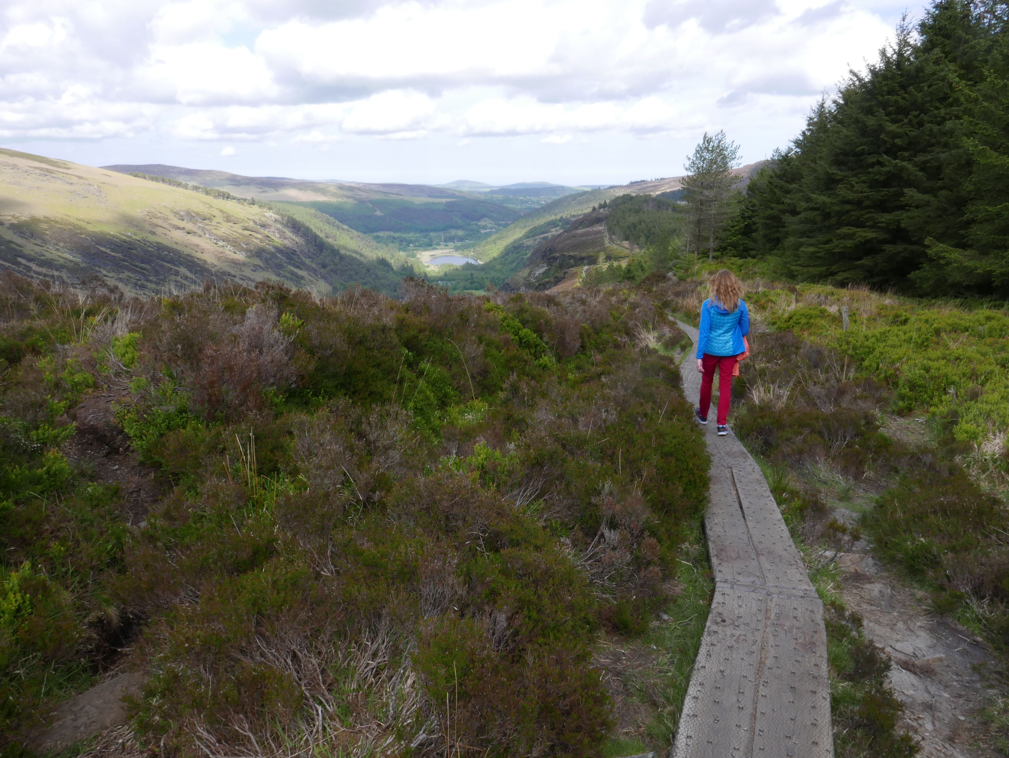
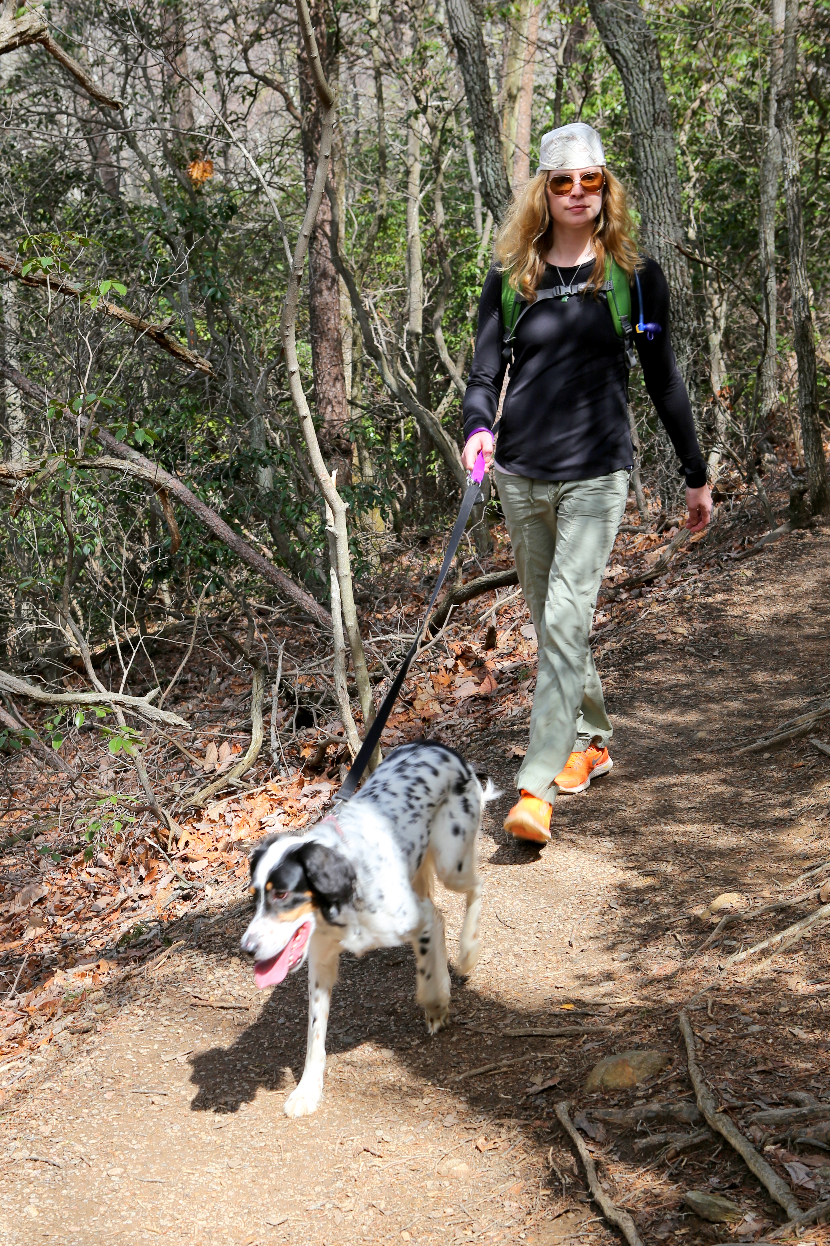
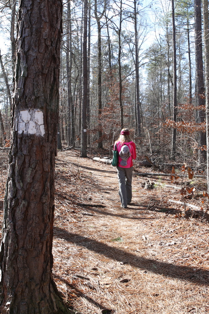
No baby trees were harmed in the dramatic making of this photo shoot.

These days, it’s been more difficult to see each and every outdoor experience as “blog worthy.” What honestly makes this adventure stand out from all the others? Will this place really stick with me when other memories fade away?

Best of luck out there all alone, Hyundai

Best of luck out there all alone, Hyundai

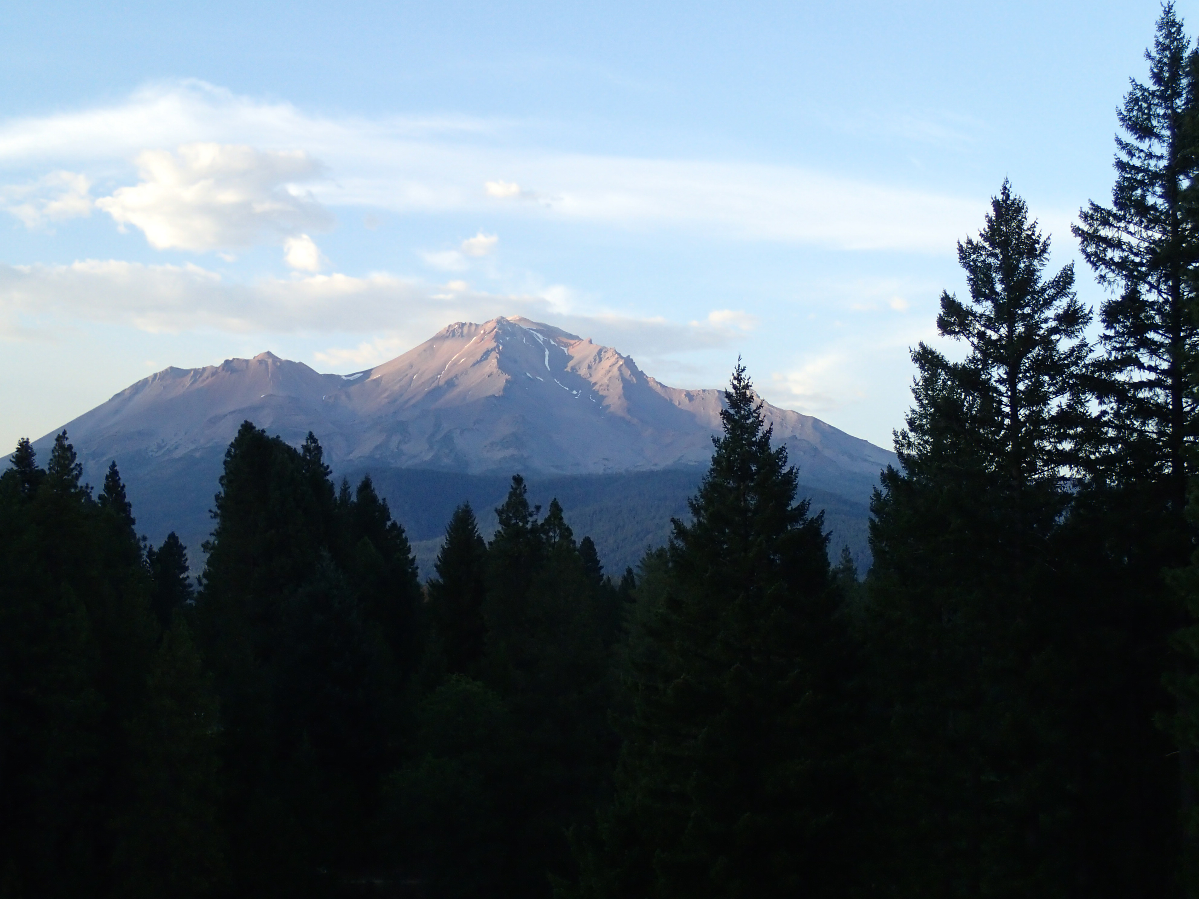
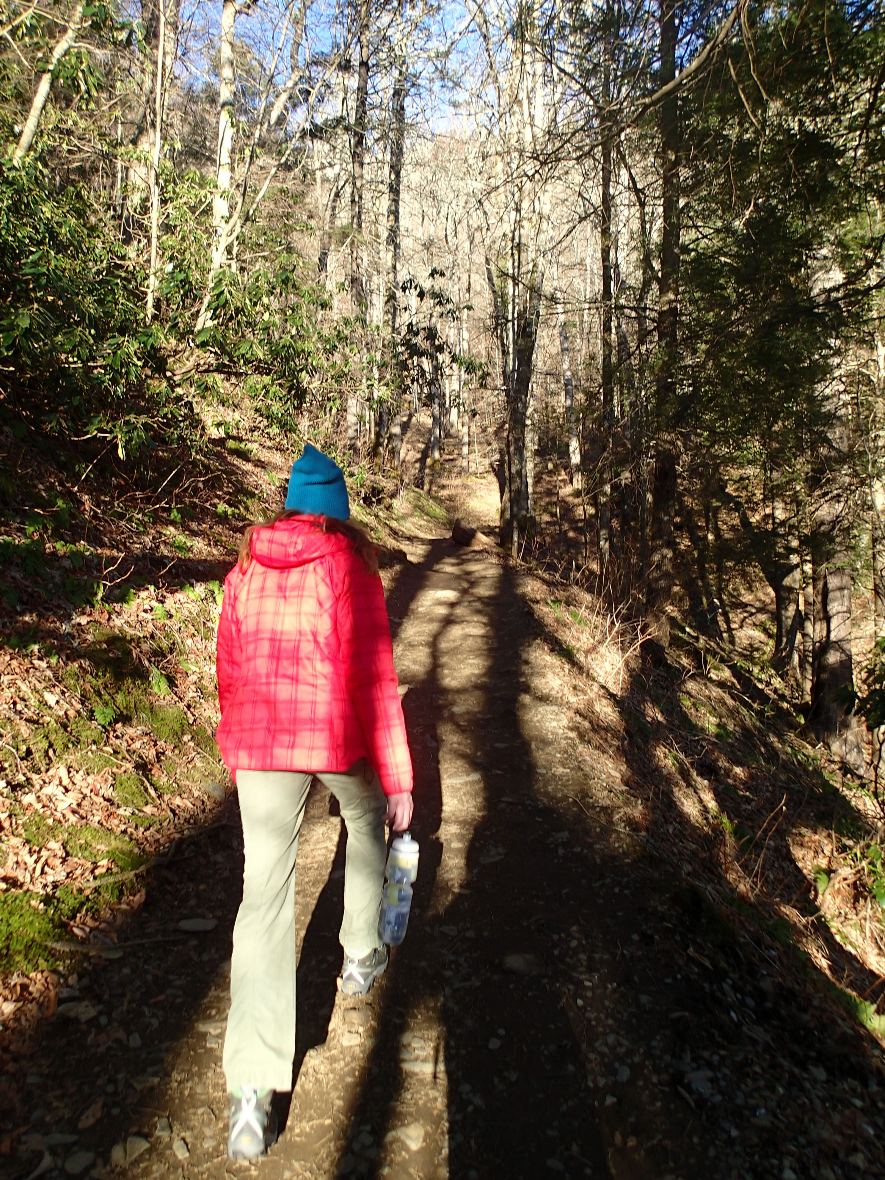
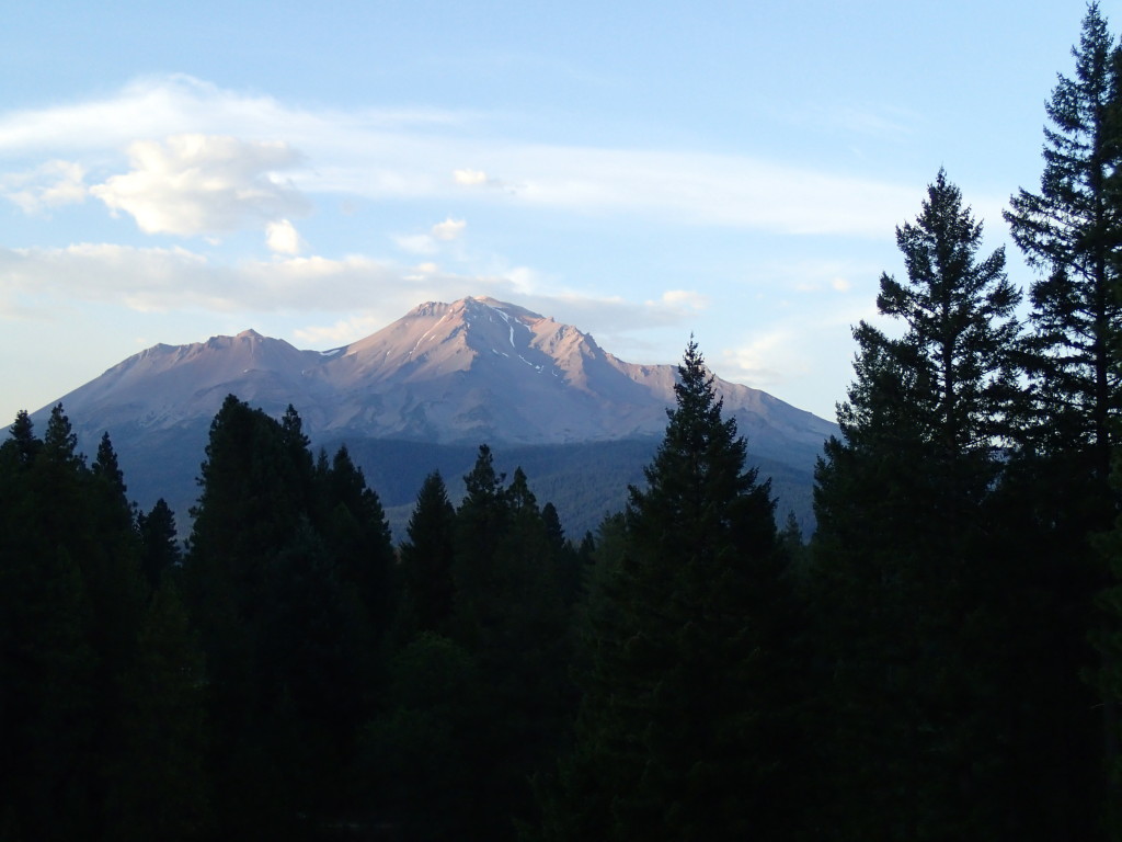
I recently went on two back-to-back hikes around Mt. Shasta, a small Northern California town that’s flanked by a towering mountain of the same name. After cranking out a few articles at a pretty sweet coffee shop in called Yaks, I drove to a remote parking area and swapped out the generic rental for a dusty pair of hiking boots.

Hikers were here, but where are they now?

Hikers were here, but where are they now?

Even from the first few steps, this trail sparked my interest. Abandoned fire pits and mysterious stone circles lie around every corner.

Evidence of mysterious rituals

Evidence of mysterious rituals

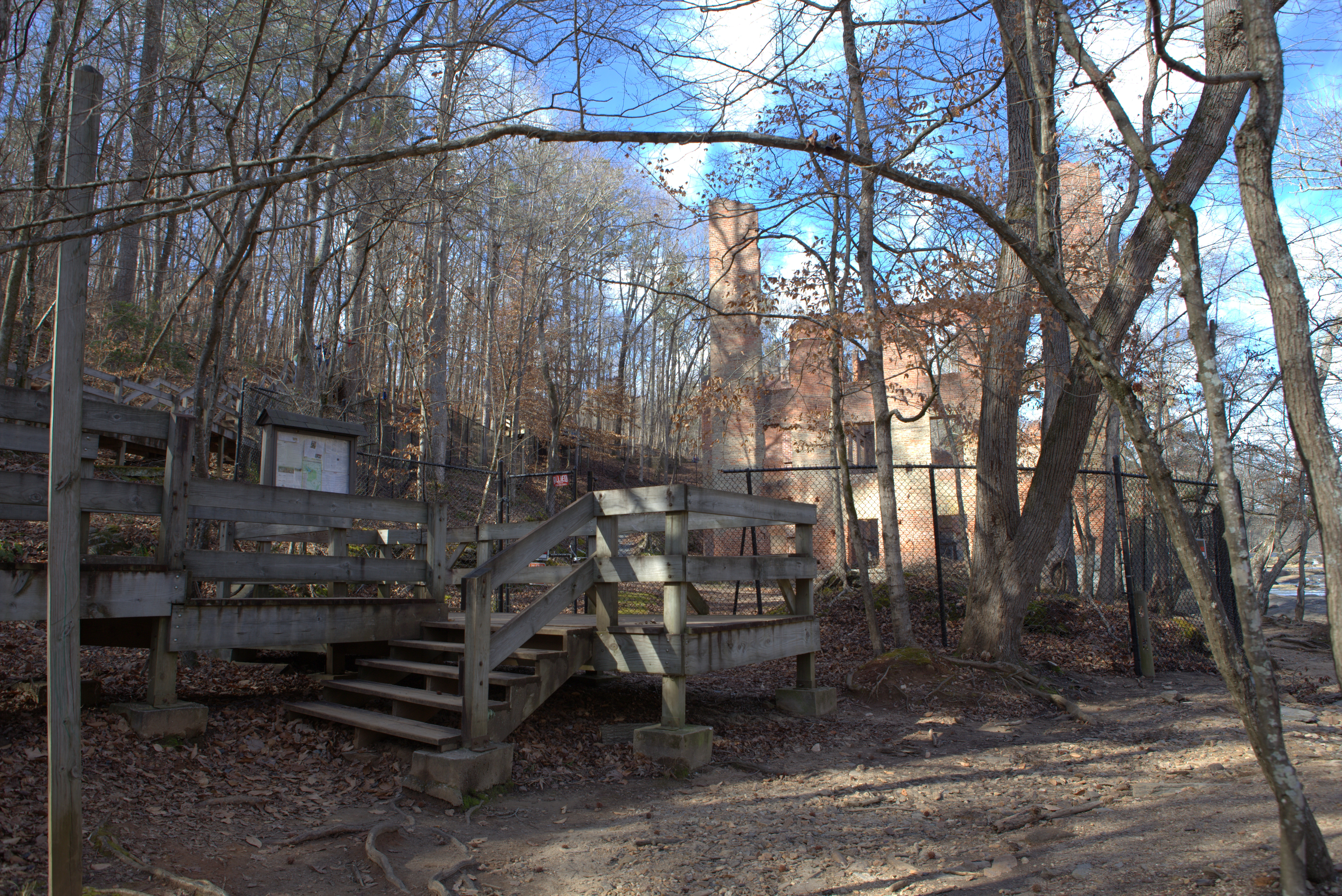
The Ruins of Ney Springs Resort

Anonymous hikers on the Internet promised me a waterfall and some 19th century ruins along the Ney Springs Canyon, and that sounded pretty good to me.

In the late 1800s, several resorts were built in the Mt. Shasta area, one of which being the Ney Springs Resorts. It wasn’t as popular as the Shasta Springs Resort north of Dunsmuir, but it was still a nice getaway spot in the mountains for vacationers back in the day. A guy named Joh Ney discovered that there were springs here, and the resort was eventually able to pipe fresh spring water into the buildings and accommodate 50 guests.

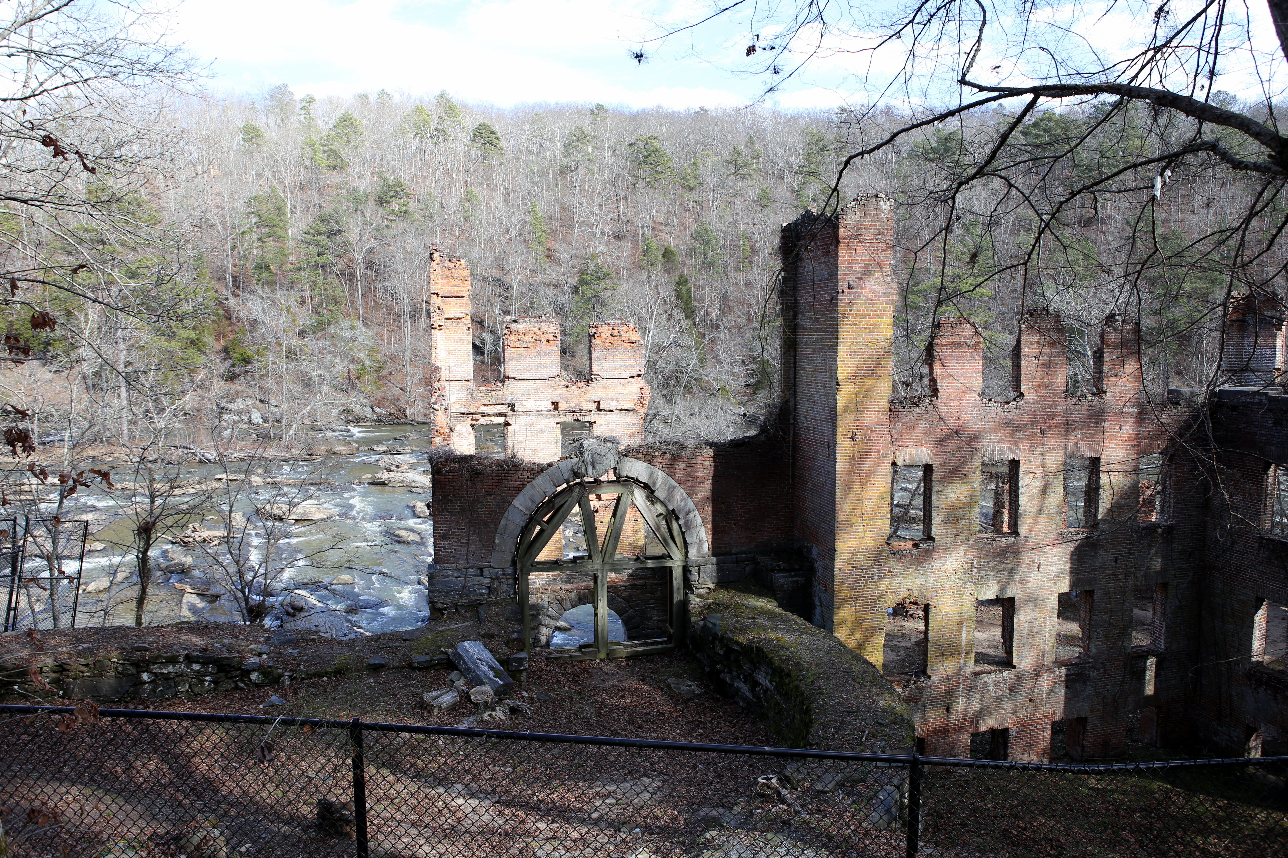
The trail is poorly marked and not surprisingly, I took a wrong turn or five. I kept wondering how visible the ruins actually were, and if I would miss them without even noticing. Finally, I spotted a cistern next to the creek and figured this must be part of the dilapidated structures I was looking for.

First sight of ruins...a cistern!

First sight of ruins…a cistern!

After checking out the cistern for a moment, I turned back towards the trail and instantly saw the next bout of ruins in the distance…the fountain! This find was even better than the last. I was surprised that the cursive letters of “Ney Springs” and “1889” were still so easy to decipher.

There was a really eerie vibe here and a sense that more ghosts than hikers may exist within these ruins. It doesn’t seem like there’s been much effort to uncover more of the resort ruins, so who knows what lies beneath the overgrowth?

The Ney Springs Fountain, 1889

The Ney Springs Fountain, 1889

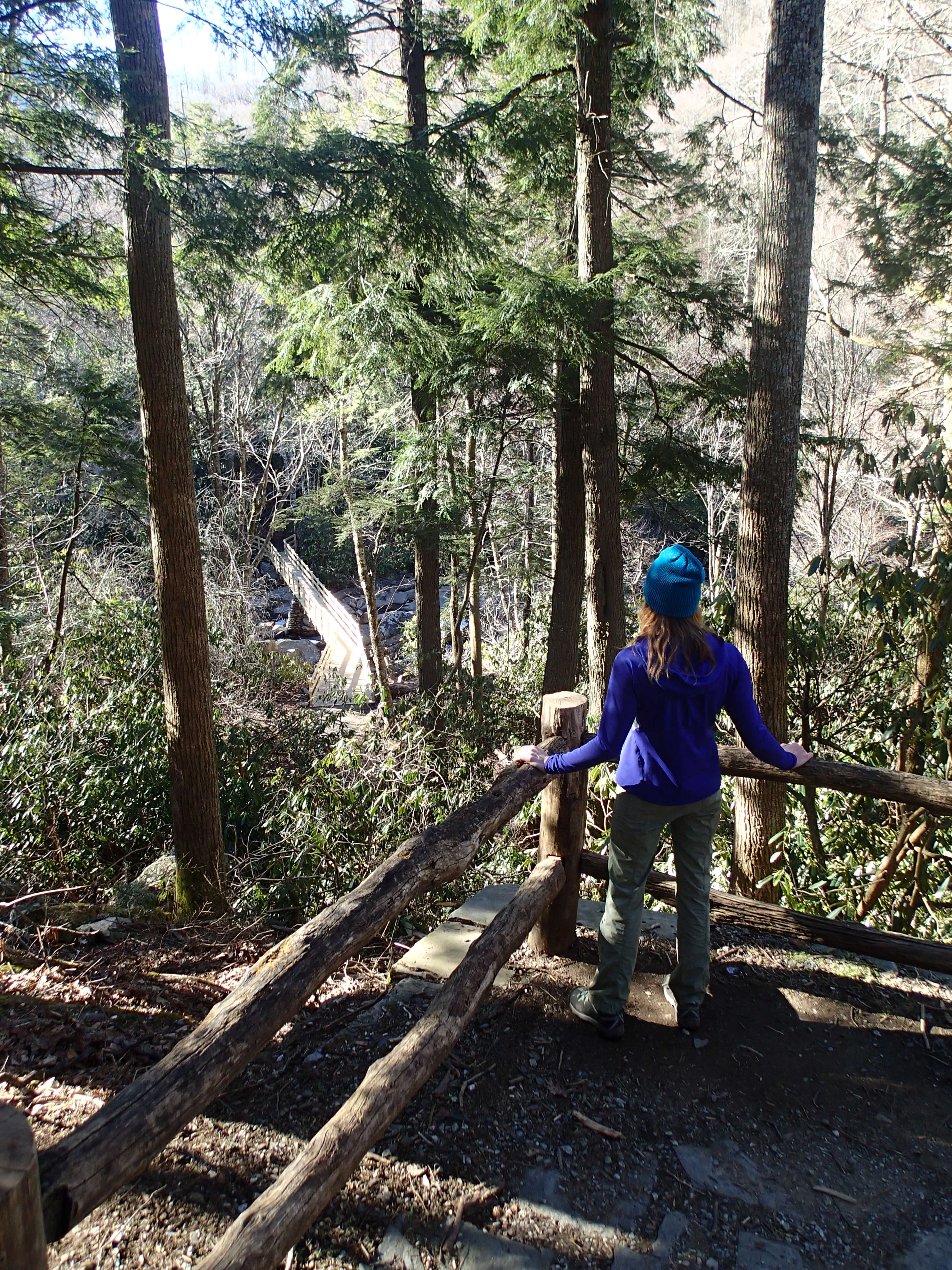
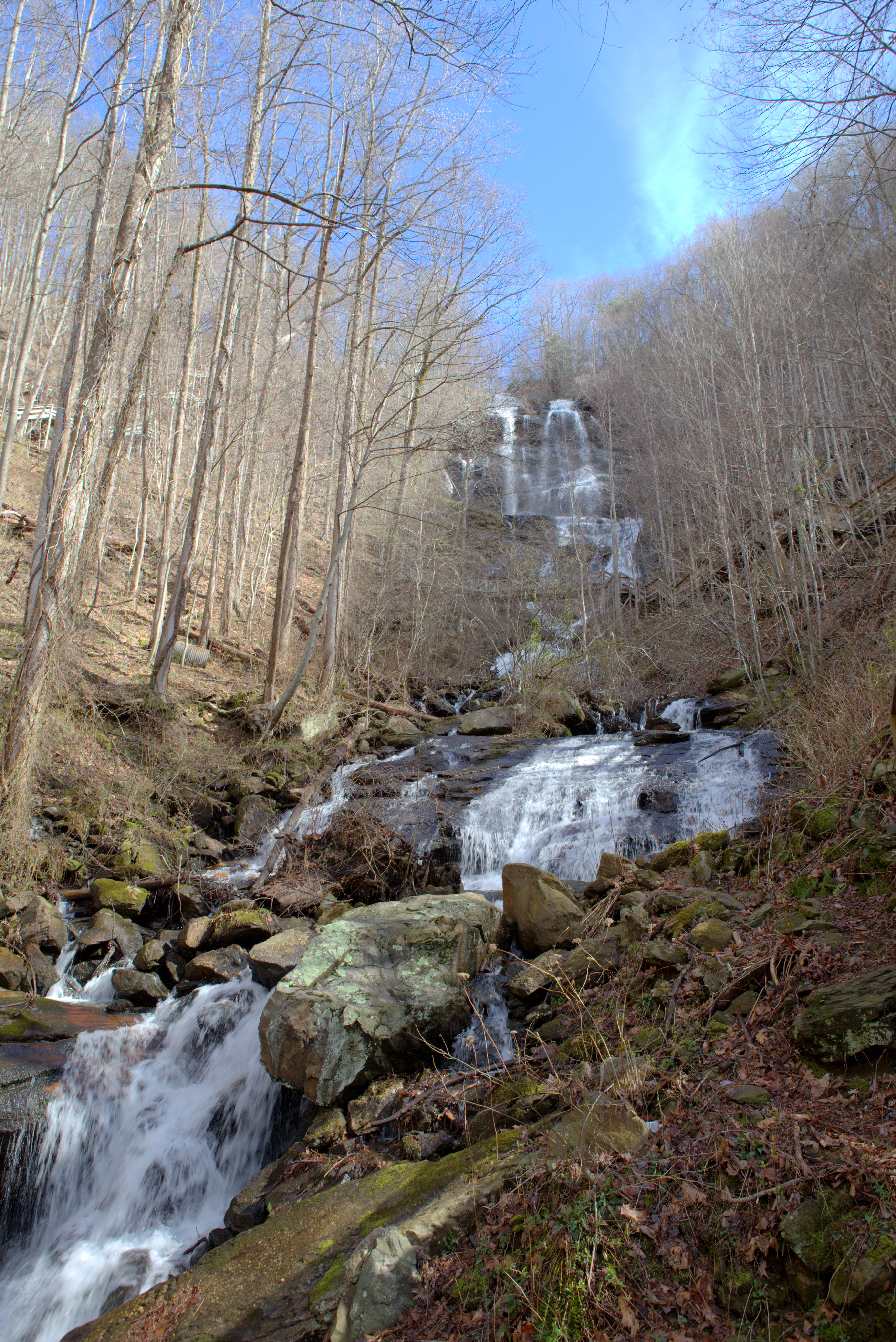
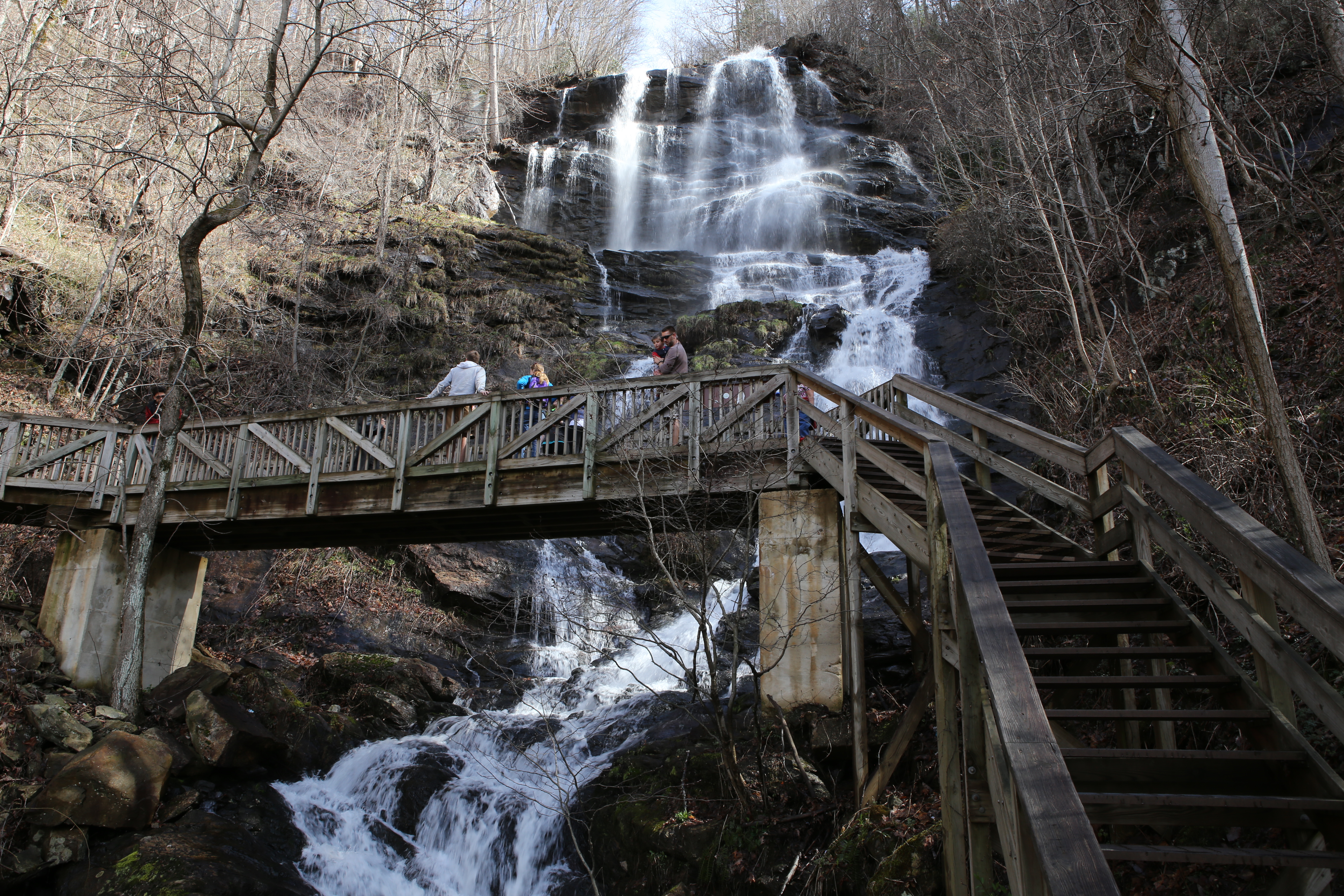
Still further inside the canyon lies Faery Falls, a 40-foot waterfall that seems to be the main draw for hikers today. The falls are about a quarter mile past the resort ruins, and there are several good spots up close to snap photos of the falls.

The Automobile and Appliance Graveyard

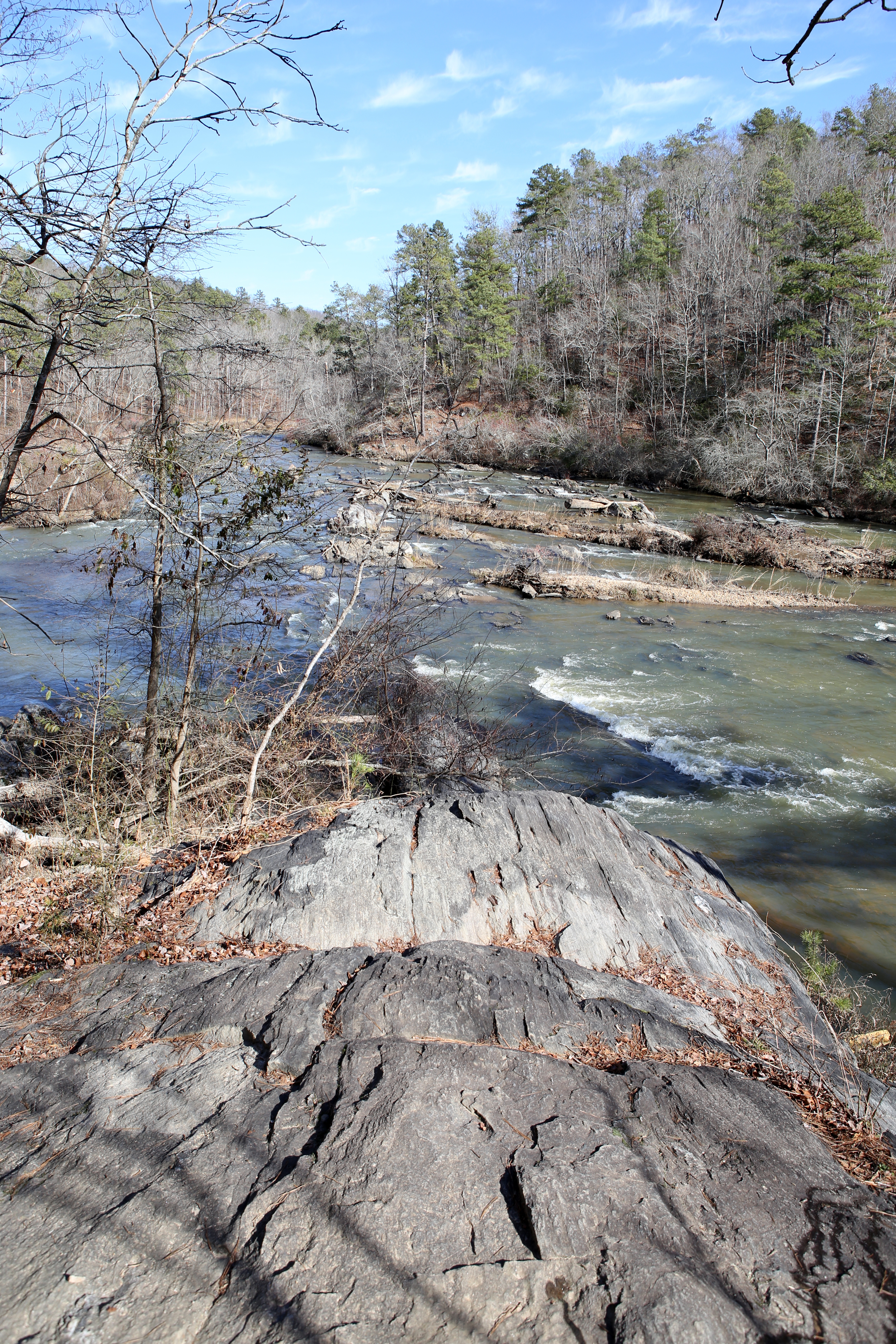
The Sacramento River flows to Box Canyon, where the Box Canyon Trail picks up and an automobile and appliance graveyard is tucked away in the woods. That’s right…this is the place where old cars and broken washing machines have gone to die.
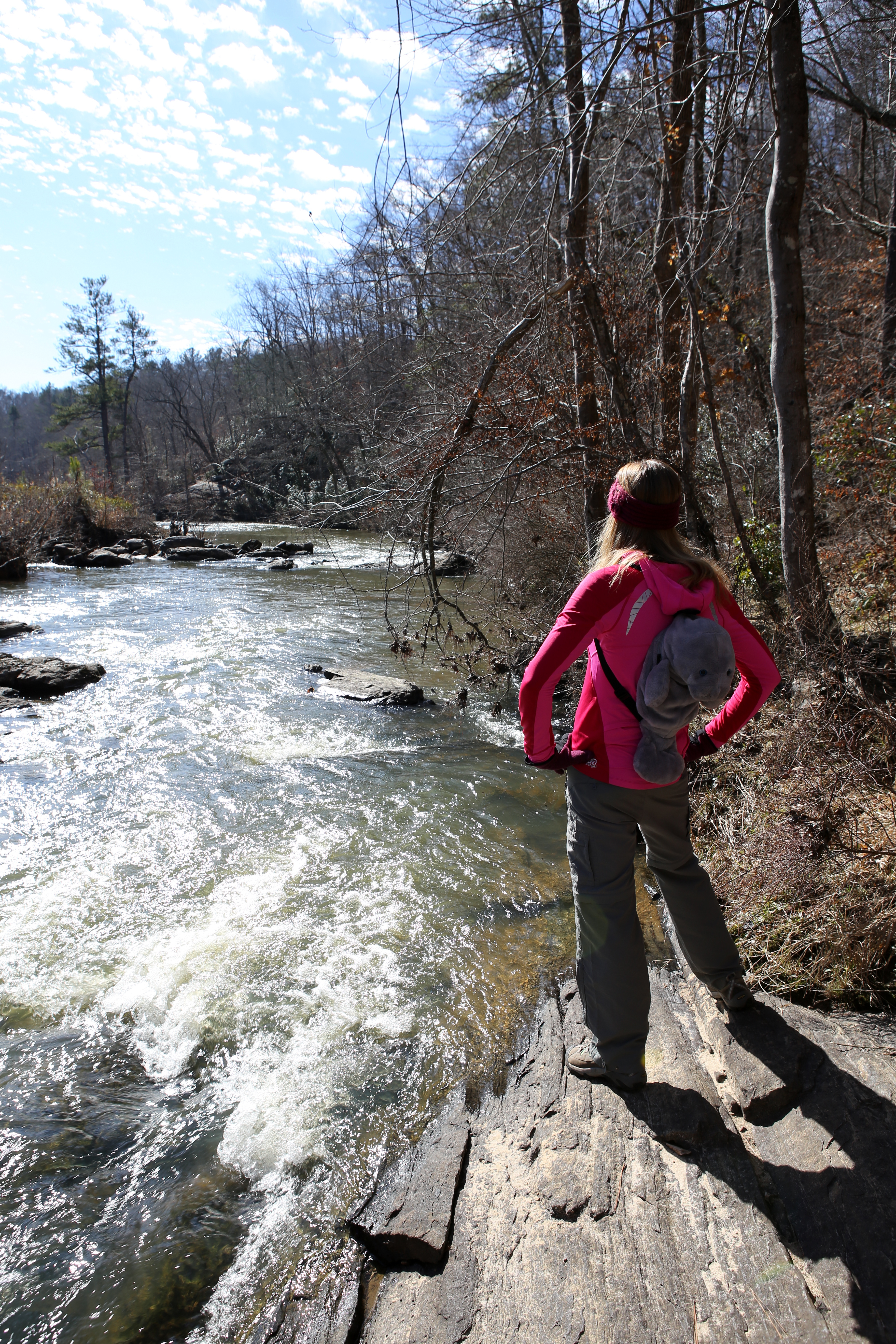
Day hike #2

Day hike #2

The mild trail began on the north side of the Box Canyon Dam, passing through pine, oak, and cedar trees. I couldn’t help but notice an intrusive golf course as I set the pace, but I stayed hopeful that far more interesting things were ahead.

Fortunately, I was right.

What is that I see among the trees?

What is that I see among the trees?

A faded hunk of metal peered out at me from behind a tree. I blinked a couple times to make sure the summer sun wasn’t starting to make me loopy. But hen another, and another.

Apparently, Mt. Shasta residents used to simply push their unwanted cars and appliances down the hill to dispose of them. Everything is completely toppled over, rusted through, and in a total state of decay. So much for recycling!

The aftermath of someone's once-beautiful car

The aftermath of someone’s once-beautiful car

But instead of feeling like I was walking through an old dump, I felt like I had stepped back into another time in history. It’s not every day that rusted car parts lie next to hundred-year-old trees, but it seemed to somehow make sense along this trail.

Although venturing off-trail is generally frowned upon in the hiking world, I couldn’t resist getting a closer look at some of this partially-preserved antique collection.

box3

Check out my new ride!

Just when I thought I’d seen all the rubble along the trail, another piece of machinery appeared and beckoned me to come take a look. Who did this washing machine belong to and how long had it been buried down here?

box4

Okay, who needs to do a load of laundry?

It’s baffling to me why people dumped their enormous (clearly non-biodegradable) trash here and why no one has ever bothered to clean it up. But I must say, this graveyard made for one of the most interesting hikes I’ve ever been on.

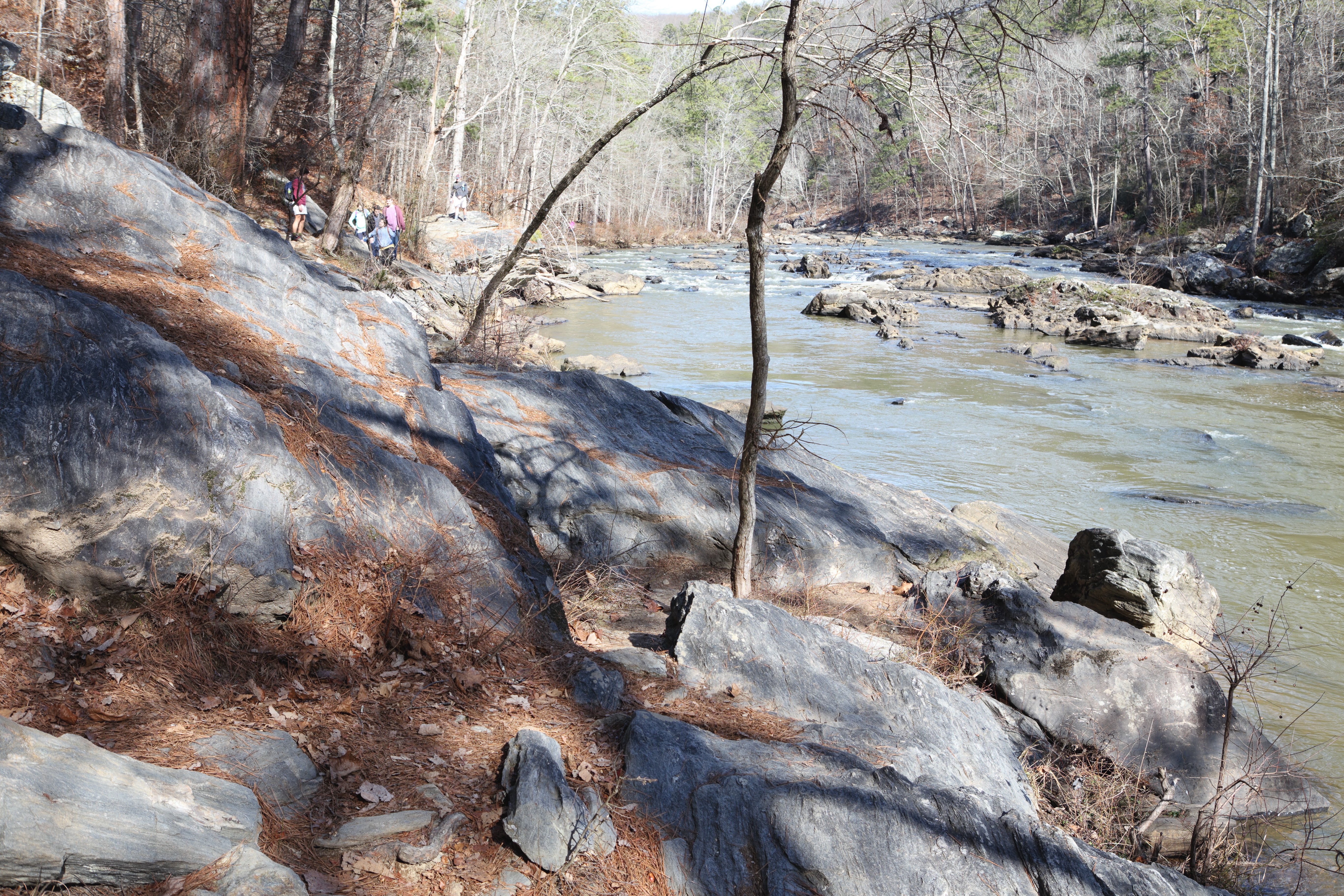
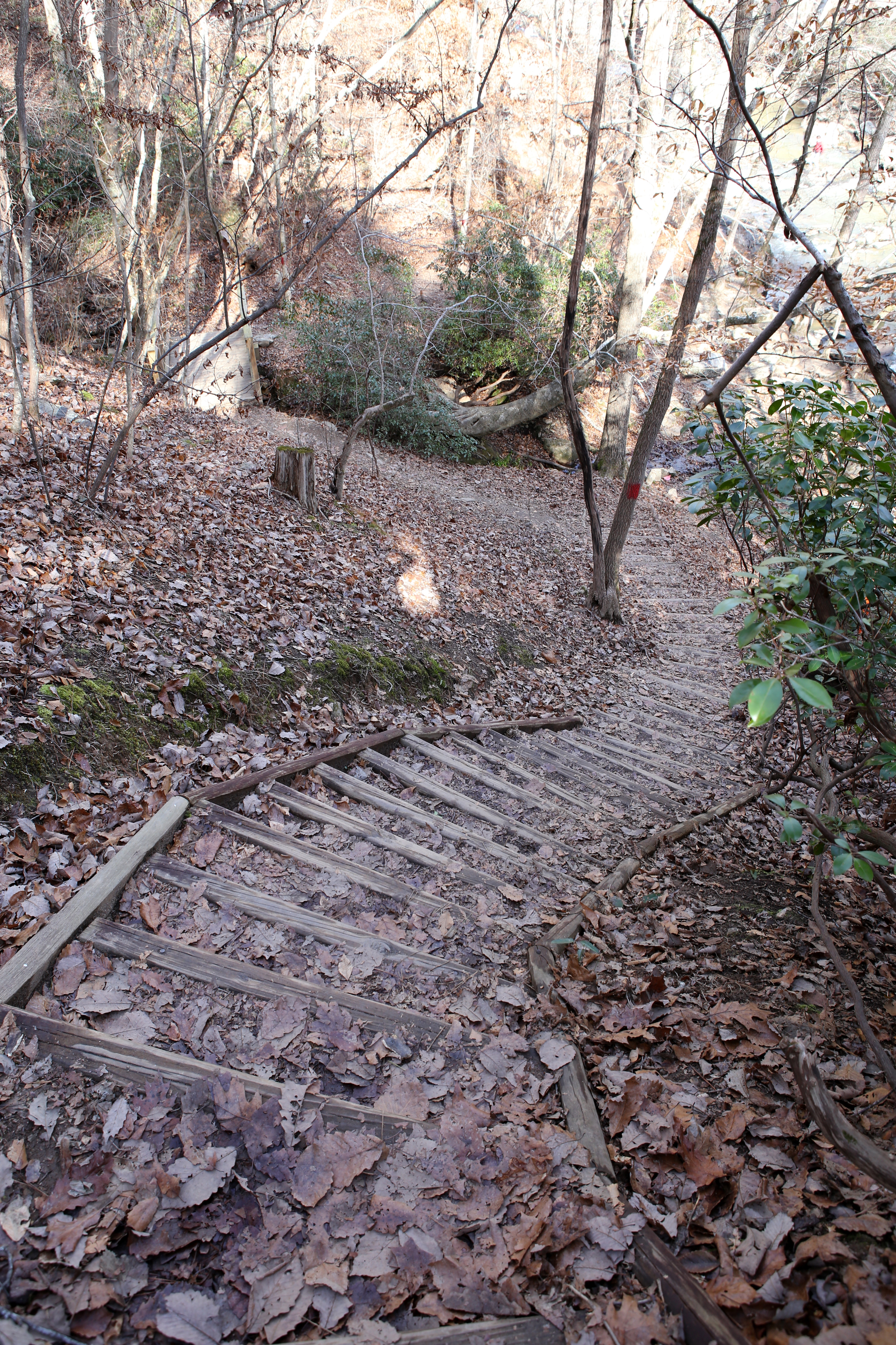
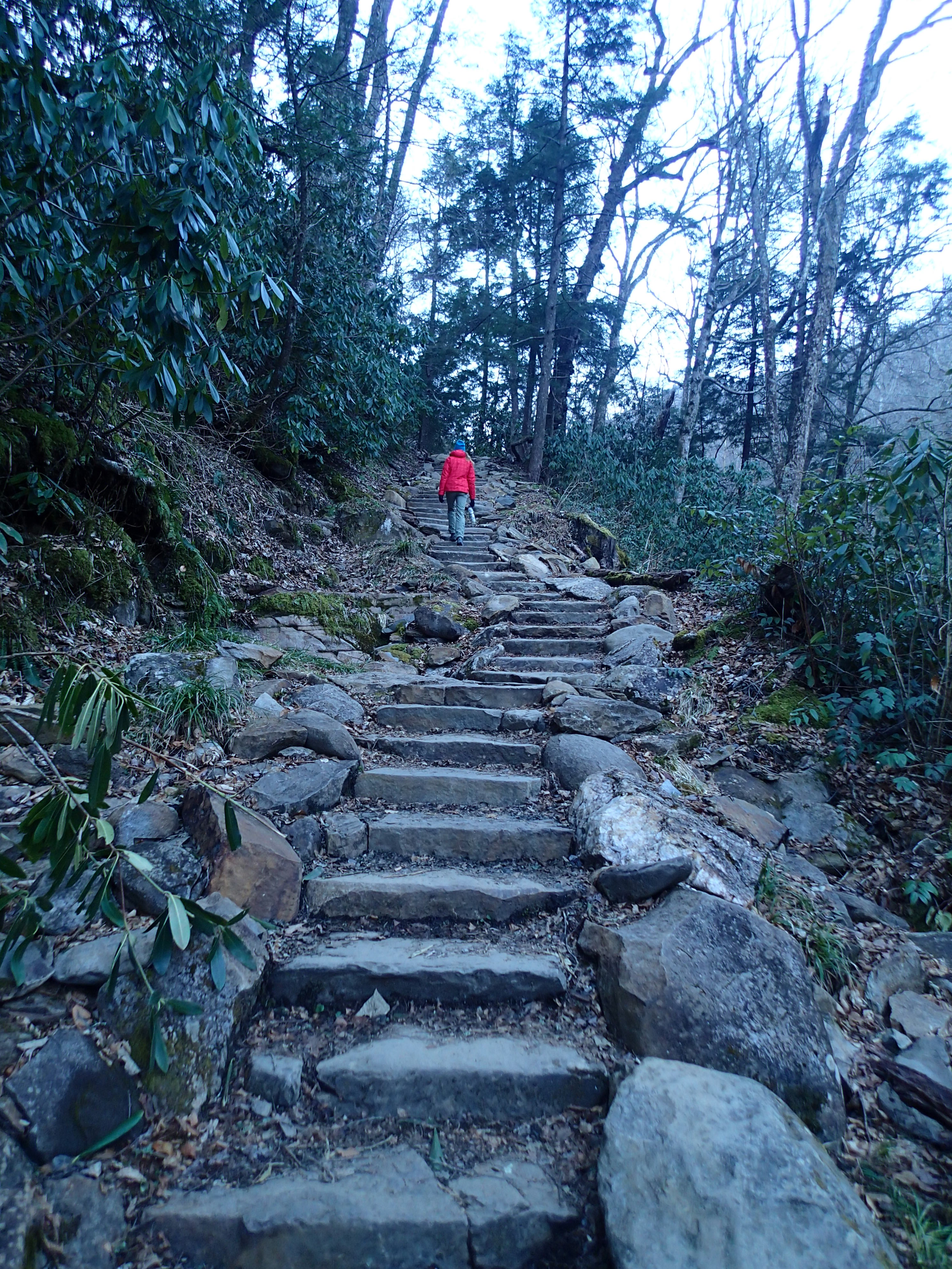
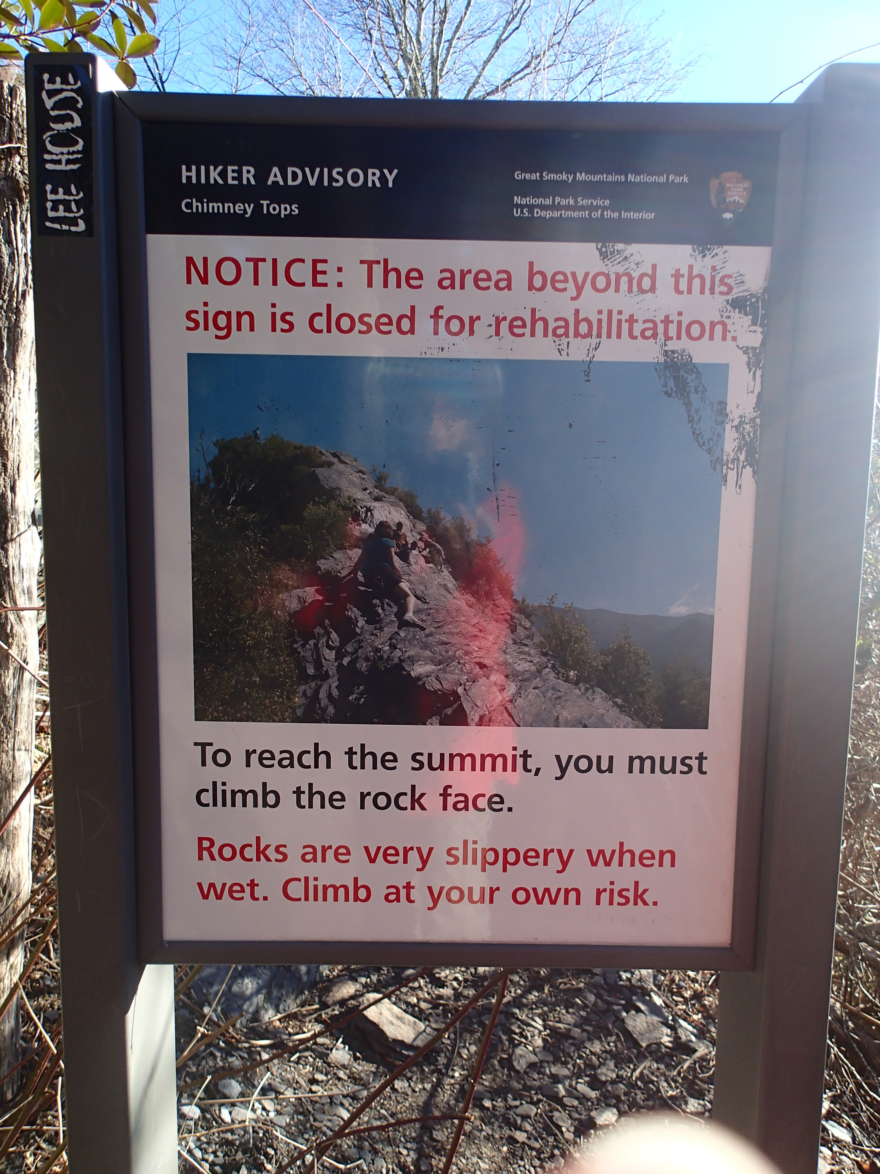
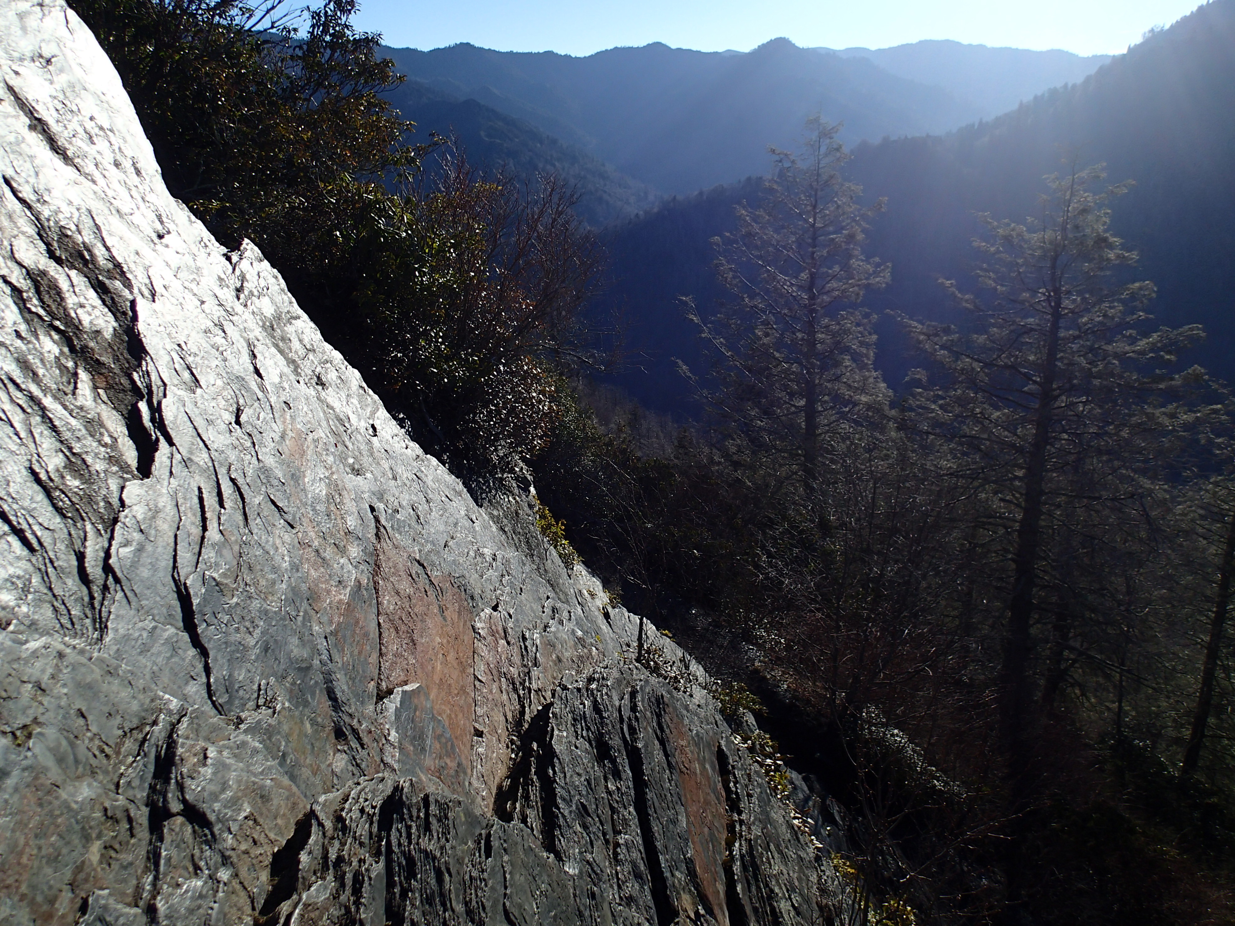
Stay on the Box Canyon Trail to actually venture into the canyon, which is steep and more challenging than it looks. I’m talking iron ladders mounted to cliffs, rock scrambles, and unsettling drop-offs.

Other Ney Springs Opportunities

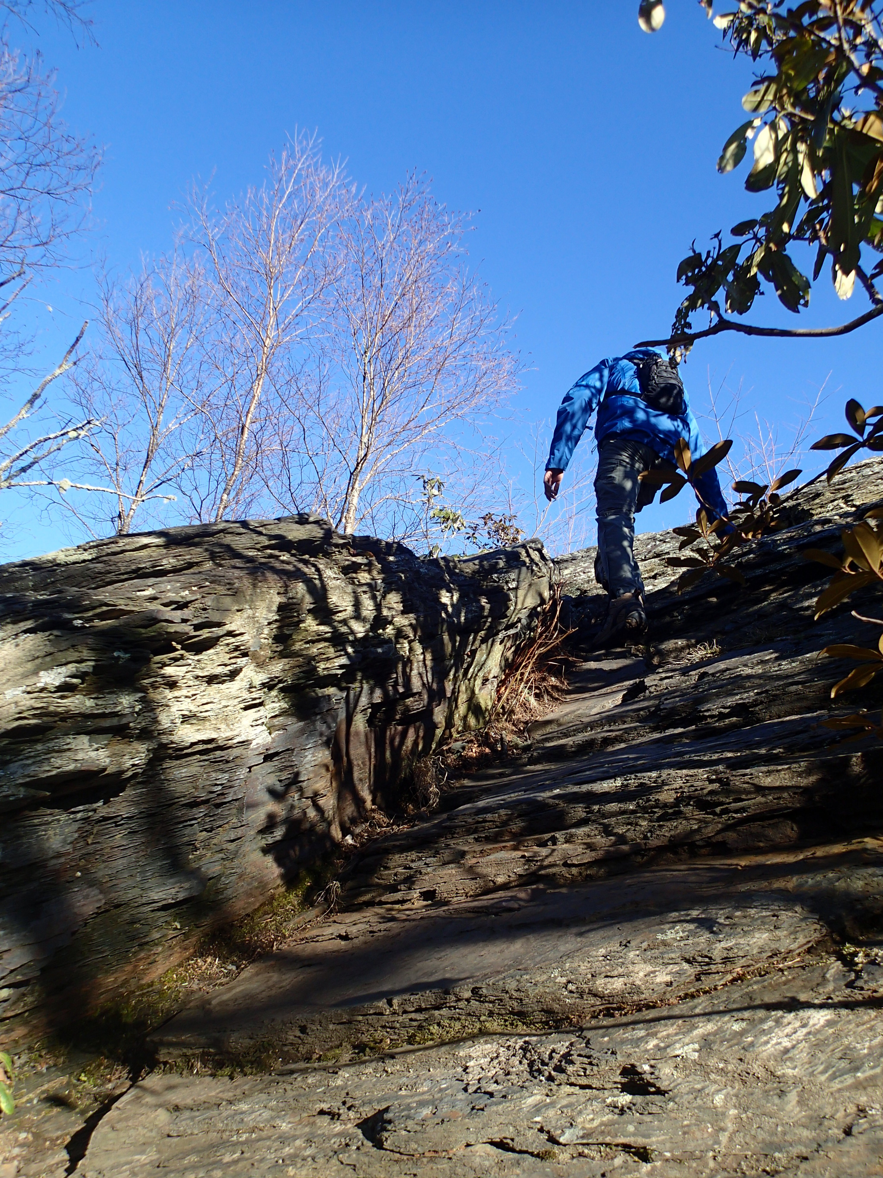
I didn’t know it at the time, nor did I bring my climbing gear with me, but Ney Springs is also a fairly established rock climbing spot. I spy some climbers perched on that crag!

climbers
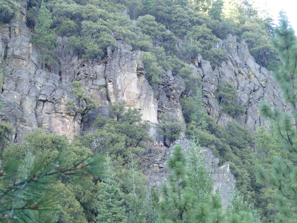
Apparently, the canyon’s north wall is the best place to climb, and the crags here are a top pick for winter climbing. The crags get a full day’s worth of sun, and the snow doesn’t build up much on the access routes. Maybe next time! If you’re heading that way, bookmark this Alpine Addict page for route info and beta.

mt. shastaHiking in Mt. Shasta meant more to me than stumbling across dusty ruins and unwanted garbage. These two hikes make me remember why I love to hike in the first place – that is, to explore the outdoors at my own pace and encounter unexpected things along the way.

Each trail has it’s own personality, and that personality infiltrates my own when I set off into the woods. I understand that not every trail will have stunning features like Ney Springs and Box Canyon, but I’m going to keep a closer eye out for the subtleties and never underestimate the surprises nature has to offer.
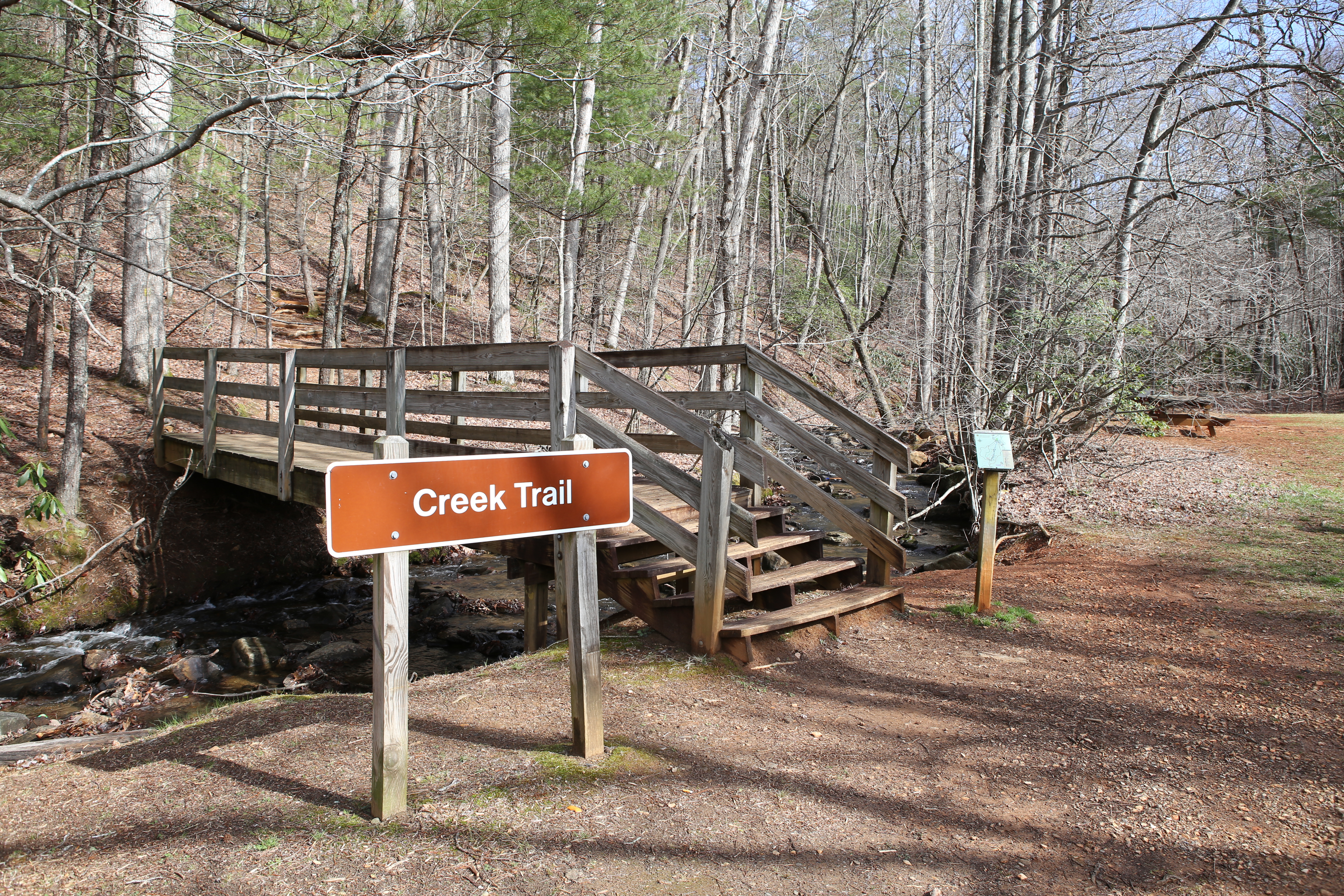
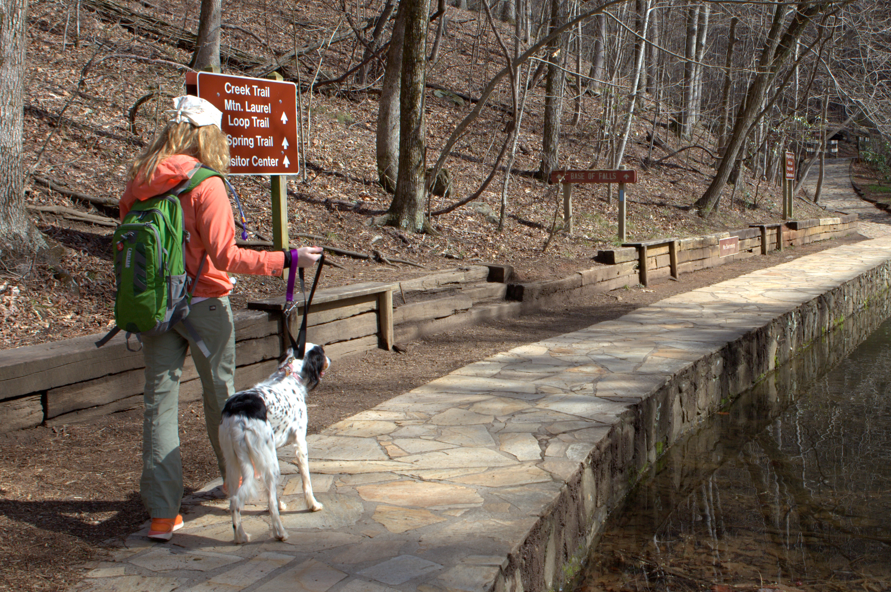
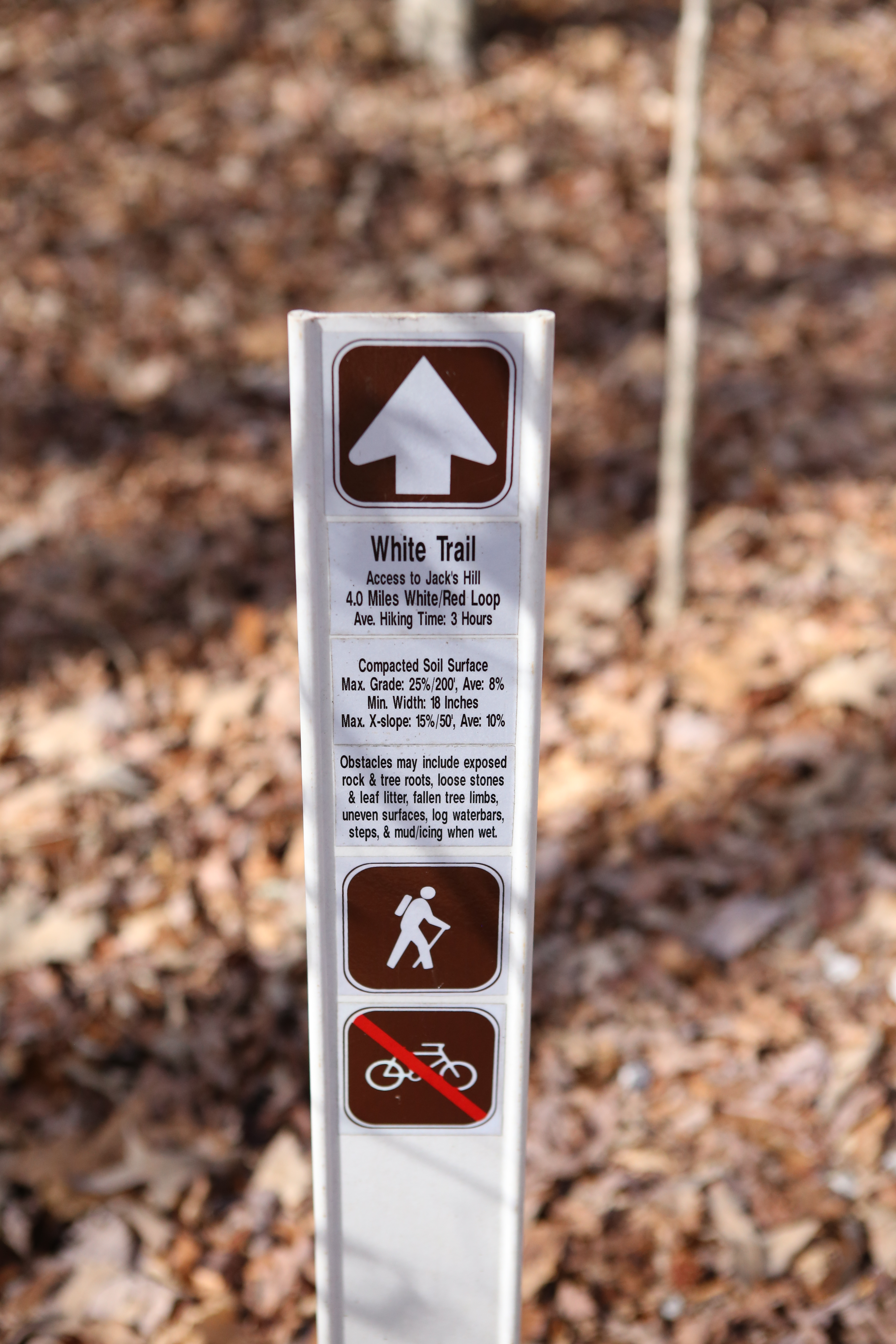
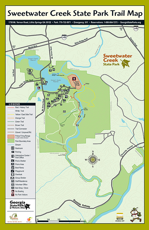
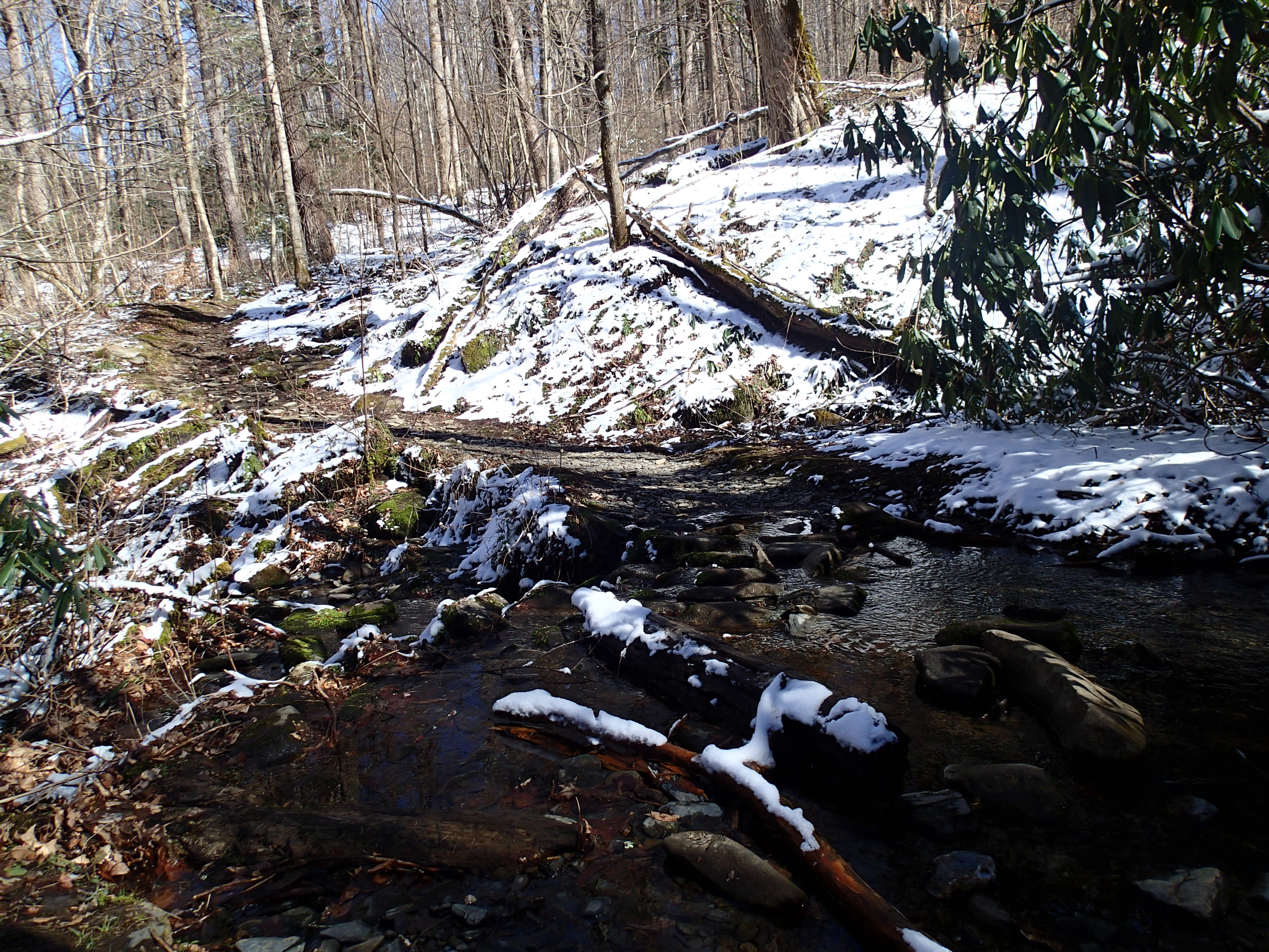
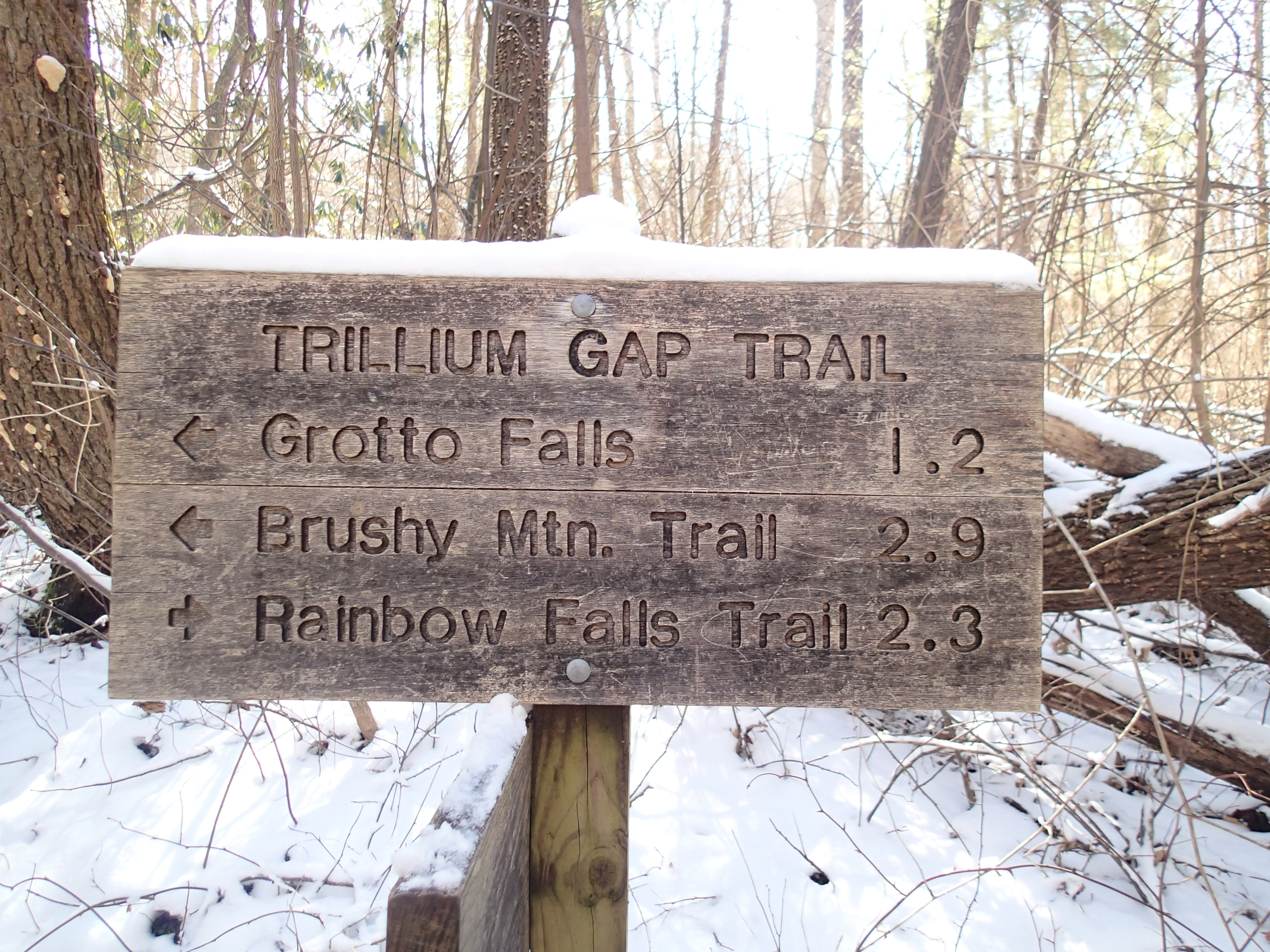
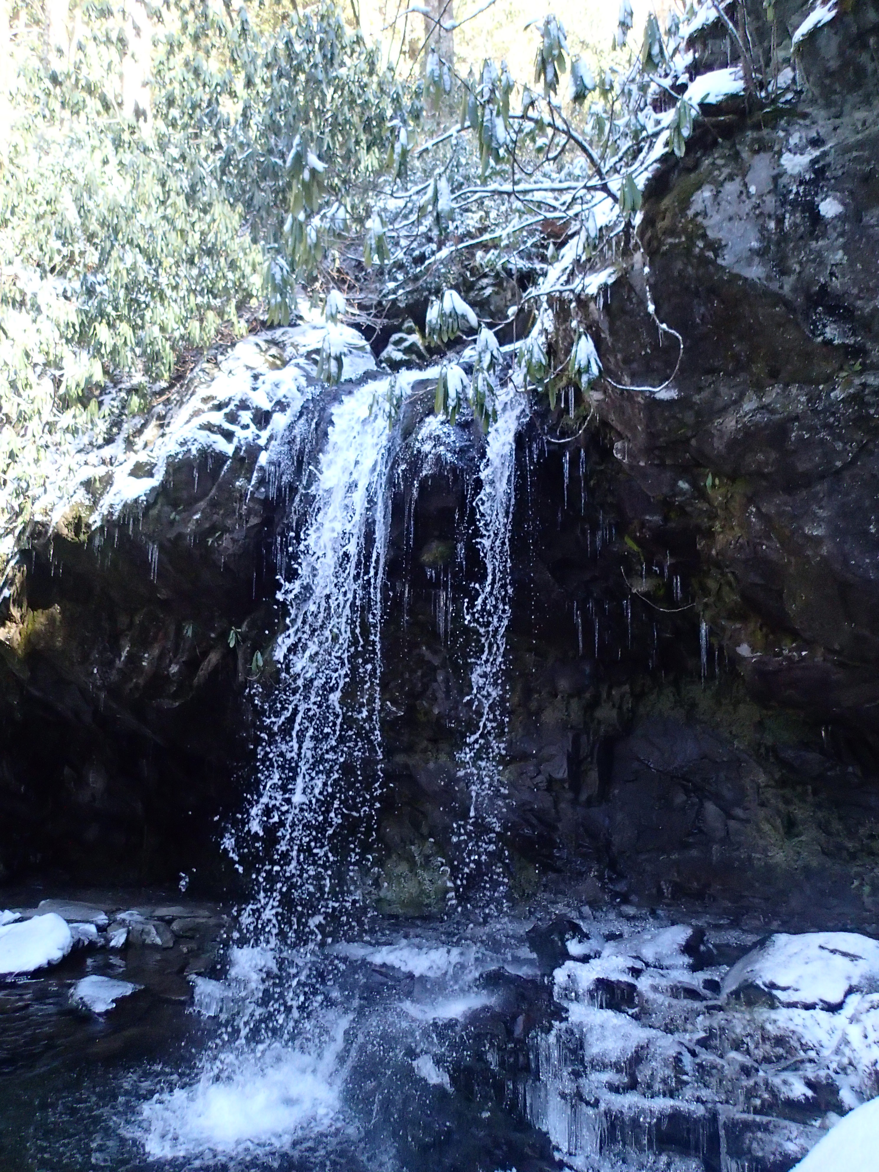
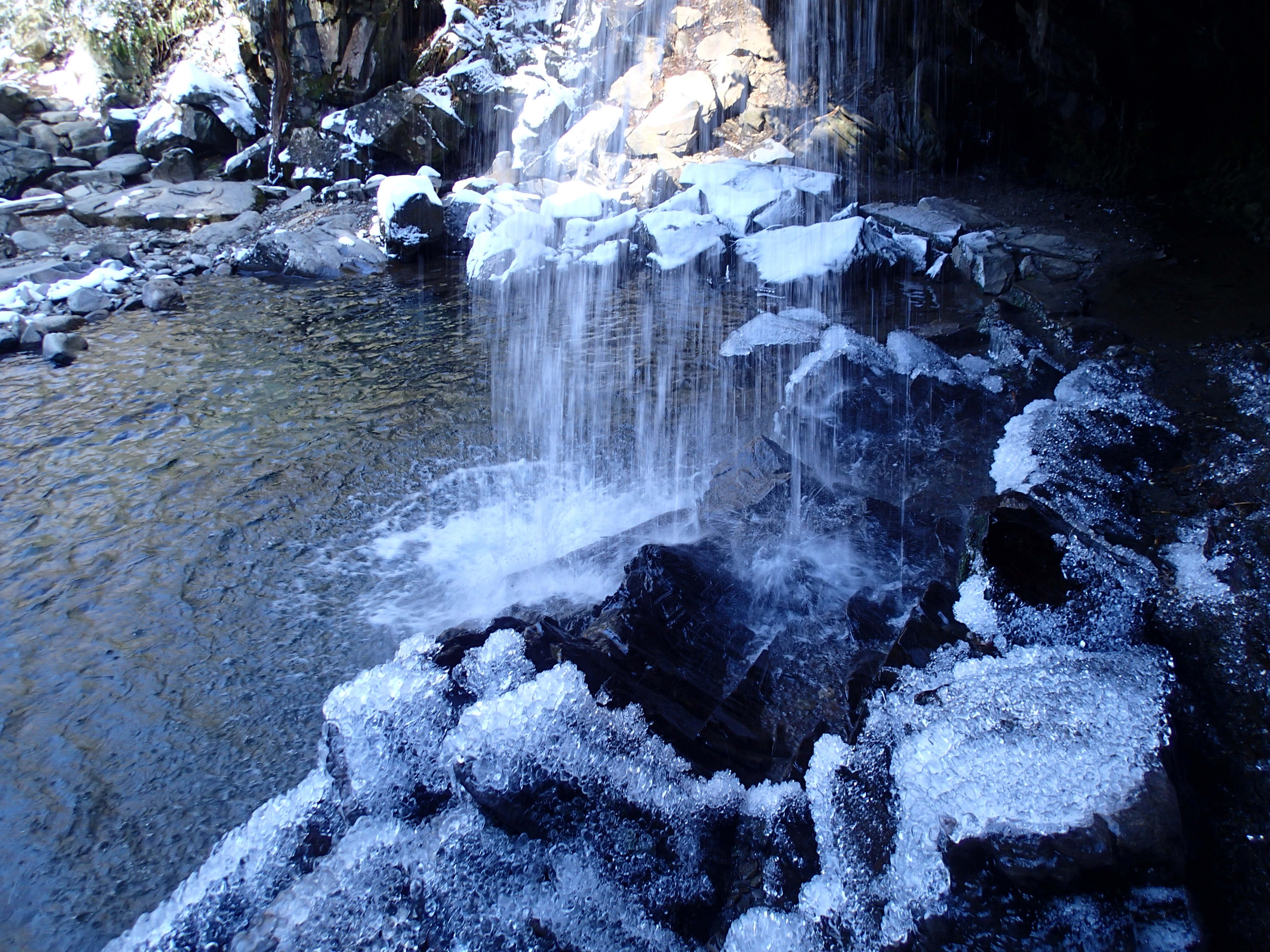
A Solo Smokies Hike Along Grotto Falls Trail

Travel companions are nice and all, but if you’re anything like me, you secretly crave alone time just as much when you’re on the road.

There’s something to be said for finding solitude in nature, to control your own route, and push your limits without someone else’s influence. During my recent trip to the Smoky Mountains, I decided to look into the trees instead of at the footsteps ahead of me. I set my own pace, stopped to take photos when I wanted to, and focused on listening to my jumbled thoughts.

Grotto 1

My solo route of choice was the Grotto Falls trail, and I drove from Pigeon Forge through Gatlinburg, and along windy, narrow uphill roads to reach it. I passed by the Rainbow Falls Trailhead, which was disgustingly crowded, and came to an abrupt halt at a road closure blocking my way.

The road to the Grotto Falls trail had been barricaded off, most likely because the National Park Service hadn’t yet opened all of the trails for spring. But since it was the middle of March, I was surprised to be greeted by orange cones and metal gates instead of an idyllic path.

It was time to improvise.Grotto 2

I parked my Jeep along the side of the road and made my way back towards the crowded trailhead I passed a bit earlier. After a half mile of roadside walking, I reached a different trailhead with a sign: “Grotto Falls 3.5 miles.”

Now I’m no sissy to a seven-mile round trip hike, but in the spirit of solo safety, I’d left word back at the RV that I’d be back (from a significantly shorter hike) within an hour or two. The mountains aren’t exactly known for their stellar cellphone reception, but I managed to squeeze a text through the void and provide a tip off that I’d be a little later than expected.

Grotto 3

And what an excellent decision that was!

Some sections of the trail were easy and flat, while others were coated in a fresh layer of mud from the previous evening’s snowfall. The light dusting of snow on the tree branches provided the perfect backdrop for a stereotypically introspective afternoon.
Grotto 4

Since there were really no steep cliffs along this route, my hike was more about endurance and less nerve-racking than I expected. There were a few fallen trees along the trail and a few streams blocking the path, but nothing that I couldn’t hop over with an ounce of grace.

I visually compartmentalized each category of thoughts into “folders,” filing one away when I’d sifted through it just enough to move on to the next one. While mental flickerings of my work stress, my relationship, and my enduring restlessness came and went, one thought persisted:

Wow, it’s taking me a lot longer to hike this than I ever expected!

Grotto 5

Keep trudging along…just 1.2 miles to go. Oh, and then the whole return trip.

As a kid, I remember watching stupid cartoons where a character was stranded in the desert and began to hallucinate, envisioning a mirage of water in the far distance. Well on this hike, a mirage of my own emerged…the elusive sounds of a waterfall.

I knew that my journey would be half done when I reached Grotto Falls, and I could have sworn to hear the falls miles in advance of their actual location. As I turned a corner with a glimmer of hope in my eye, I would come to find that the sound of rushing water could only be attributed to a tiny stream not even worth mention on a map.

Then the temperature began to drop. Noticeably drop.

Grotto 7A sound, much louder than any sound I’d encountered thus far on the hike, filled my ears to the brim. Finally, one turn I took led me to a totally mediocre waterfall.

“That’s it? That’s what I hiked four miles for?!”

But as I continued on, the small waterfall led to a much larger waterfall, and my bitching promptly subsided.

Grotto 6

Although the rocks leading up to the falls were frozen and slippery, the falls flowed fast. There are quite a few waterfall hikes in the Smokies, but very few that you can actually walk behind. This is one of them. The rocks were glistening with ice crystals and the mist would have only been refreshing if it was 40-degrees warmer outside.

Since this is an out-and-back hike, rather than a loop, you have two options to get back to your car. You can either backtrack exactly what you just did, or you can walk along the road about two miles to the barricaded gate. Since I knew there’d be no traffic along the road, I chose that route for a change in scenery.

grotto returnSome might call this downhill route “cheating,” but it did offer some amazing mountain views. And I’m okay with that. After 7+ miles and 3+ hours, I made it back to my Jeep with a heightened sense of confidence and way better attitude about the rest of this Tennessee road trip.

Solo Hiking Tips from a Pseudo-Expert

  • Decide on a specific trail and let someone know what it is
  • Read some online trail journals to learn about what previous hikers encountered on your route
  • Take a GPS or two-way radio because cellphones are worthless on hikes
  • Keep a record of how many miles you’ve hiked in the past (and on what type of terrain) and be realistic about how hardcore you are
  • Memorize some maps to get an overview of the area in case you make a wrong turn
  • Don’t underestimate your need for basic stuff like granola bars, water, a first-aid kit, and extra layers
  • Pay attention to what time of day it is and plan to be back before sunset
  • Take a million pictures because you’re the only one seeing thisGrotto 8

Hiking the Chimney Tops Trail: #1 of 3 Smoky Mountain Adventures

There are at least a hundred hiking trails in the Smoky Mountains, so how’s a girl supposed to settle on just one for an introductory hike?

Eeny meeny miny moe, randomly point on a map, and hit the road!

Chimney1

The Chimney Tops Trail climbs 1,400 feet in two miles, making it a relatively steep trail in anyone’s book. The round-trip trail length is four miles, making it perfect for a moderate morning hike. You’ll find the trail-head for the trip almost seven miles south of the Sugarlands Visitor Center on the Newfound Gap Road (latitude 35.63538, longitude -83.46979). There’s a “parking lot” alongside the road that you could easily mistake for a vista point pullout. This is less than a 30 minute drive if you’re camping in Pigeon Forge, like I did.

Chimney2

Chimney Tops is a mountain in the central Smokys with an elevation of 4,724 feet. It’s one of the rare occurrences of a bare rock summit in the mountain range.

Chimney3

Another reason to hit this trail early in the morning is that it is incredibly popular and gets disgustingly crowded…even during the off-season. The first 0.9 miles of the trail is super easy, so you can get a good pace going.

Chimney10

During this stretch, you’ll hike along Road Prong Creek and across several picturesque bridges and up some conveniently placed steps. Expect to step in a good bit of mud, even if you can’t recall the last time it rained.

Chimney4

You’ll know you’re halfway to the summit when you reach Beech Flats, and everything gets a little more challenging from here. Stay on the trail that veers right to reach the summit, which is a bouldering problem if I ever saw one.

Chimney5

To get the absolute best view, you’ll need to scramble to the top without the help of a cable to hold on to or any technical gear. Hikers get injured here all the time, so if you’ll feeling shaky, stay off the pinnacles and enjoy the comparably awesome view of the Sugarland Mountain in the west and Sugarlands Valley in the north.

Chimney6

I, for one, had yet to develop my mountain legs and told myself I was satisfied with the view after climbing up about one-third of the pinnacle structure. It is nerve-racking up there, but if you gaze straight forward to either side, the characteristically hazy views should restore some inner balance.

Chimney7

From start to finish, Chimney Tops is an incredibly well-marked trail that provides an impressive introduction to the Smoky Mountains. The better-than-average signage also ensures that directionally challenged hikers, like me, won’t get lost and take a wrong turn.

I hiked this trail in about two hours in early March, starting at about 8:00 am. On the return hike back to the car, I began passing by lots of other hikers. By 10:00 am, there wasn’t a single parking spot available in the area.

Chimney8

Chimney Tops was my first Smoky Mountain hike during my most recent trip to the national park. As I later noticed, every Smoky hike is surprisingly unique and has its own particular set of challenges. Coming up next, I tackle the Grotto Falls Trail and the Rainbow Falls Trail, which both had something entirely different in store for me and my trusty hiking boots.

Chimney11