10 Amazing Tips for New Adventure in Utah (A Guest Post by Louise Brown of The Adventure Land)

As full-time camper life on the road month #2 comes to a close, we have traveled cross-country and settled in Southwest Colorado for a while. Southwest landscapes always make me feel peaceful and inspired, and aside from below-freezing overnight temperatures, this leg of the journey is off to a great start!

I recently connected with Louise Brown, the founder of The Adventure Land, an outdoor resource for travel tips, gear, and food. Since Utah is up next on our route, I asked Louise for any advice she might have to offer. This is her guest post that I hope you find useful!

10 Amazing Tips for New Adventure in Utah
(A Guest Post by Louise Brown of The Adventure Land)

Utah is one of those states that is perfect for outdoor lovers and adventure seekers. It has an alpine forest, deserts, canyons, and the Great Salt Lakes. That’s barely scratching the surface! Utah is perfect for all sorts of travelers including families, couples, friends, and solo backpackers.

1

You could spend a whole year around Utah but still not scratch the surface.  Are you planning to go camping, river trekking or hiking? Maybe you want to go hiking, biking, or kayaking. Whatever it is you’re planning to do, the key for traveling Utah is to be prepared. Here are some tips for new adventure in Utah.

1. PLAN YOUR ITINERARY

2

To make the most of your time and visit, an itinerary will get you a long way. You might want to plan your trip weeks or months in advance. For instance, if you plan on visiting all the National Parks, you might need at least 8 days. Each park is unique, so visiting every park is already an adventure.

You should also consider the time of the year you go. Winters are cold but serene. Spring and autumn are about the same in temperature. However, spring is a good time to see wildflowers. Summer is ideal for desserts and autumn for the foliage change. It’s all a matter of preference.

2. GAS UP

3

You might go through long stretches of remote roads without any services available. Therefore, always gas up when you’re in town. Before starting the long drive, check your gas, engine, tires, etc. Bring spare tires just in case. Worst case is you’ll be stuck in the middle of nowhere and rescue won’t come as soon as you hope.

3. STORE UP ON WATER AND FOOD

4

Adventuring in Utah is going to take some energy. Be good to your body by hydrating well and eating enough food. Lower your risk of getting dehydration or heatstroke. You’ll better enjoy your trip when you’re healthy and energetic.

When you’re in town, get your stock of water and food. Fortunately, some parks might have some water refill stations. You can also bring a water filter or chlorine dioxide tablets to purify water from streams, lakes, or other bodies of water.

For food, bring energy rich food like trail mix, granola bars, dried fruit, etc. For light meals, bring sandwiches, canned tuna or tuna pouches.

4. DRESS FOR THE OCCASION

5

In the summer, temperatures are between 85-100 degrees Fahrenheit. Spring and Autumn are quite beautiful with temperatures between 75-85 degrees.

Wear comfortable clothes with good insulation. During summer, you can wear a shirt and pants. However, night times get chilly so bring some extra layers. You may also want to bring a rain poncho or jacket.

During the day, you might want to put on some sun protection. Sunblock, a hat, and sunglasses make a big difference.

Shoes will also greatly affect your adventure. Blisters and sores will dampen the fun. You will also want to protect your feet from thorns, animals, and hard rocks because Utah’s trails are full of surprises. Wear closed-toed, sturdy shoes with soles that can grip on rocks, mud, sand, gravel, etc. It’s also better if you test out the shoes for a few days before your adventure to see if they work for you.

At the end of the day, a pair of flip flops feels fantastic. It’s not necessary, but you can pack those if you want.

5. INFORM SOMEONE ABOUT YOUR ADVENTURE

6

Whether you’re going solo, as a pair or with a group, telling someone might save you. Remember that guy from the movie, 127 hours? No one knew he was missing or where to find him. After that experience, he always left a note or told someone if he was going on an adventure.

6. CAMPING OR OVERNIGHT ADVENTURES

7

Bring a light, preferably a headlamp, so your hands are free. Although the stars are so clear at night, it might not be enough to illuminate your way. That way, you’re also keeping yourself safe by not tripping on a rock or something.

Keep yourself warm. As we said earlier, nights can get chilly.

7. BRING A RESCUE AID

78

You can bring along your cellphone, but be ready for it not to work in some areas. Save your battery by putting it in airplane mode. You might want to bring extra batteries or an external battery charger.

You can also bring signaling tools like a mirror and a whistle in case you need people to find you. A handy tool like a Swiss knife or a Leatherman-style tool kit to help you cut or repair things.

8. FIRST AID KIT

9

This is something you wish you don’t have to use. However, having it might just save you from unnecessary infections from a small cut, or from losing blood. Let’s hope you won’t get insect bites. If you do, calamine lotion or antihistamines might do the trick to make it comfortable.

9. BRING A CAMERA
10

Utah is so picturesque. Bring a camera to document your adventure and share with your friends or future visitors. After your adventure, people will ask you about it. Tell your story better with some photos.

10. PACK YOUR BACK WELL

11

The way you pack can have an effect on your back, shoulders and your hike greatly. It’s best to pack light. Only bring what is necessary. That’s why it’s also important to plan your itinerary well.

Utah is one of the ultimate outdoors destinations. Rich in wildlife, geology, and scenic trails, it brings adventure to a whole new level. Follow these guidelines to help you enjoy it and to keep you safe. Your Utah adventures will be an unforgettable experience!


Author Bio

12

Louise is the founder of TheAdventureLand, where she and her associates blog about outdoor experiences and tips & tricks that will help you have an exciting adventure. She is also a tour guide of a travel company where she learned many things about the wilderness. “Let’s pack our bags and explore the world!”

Hiking in Tucson – 5 Awesome Adventures (A Guest Post from Mitch Stevens of Southwest Discoveries)

To stick with my recent theme of Southwest hiking trips, today I’d like to share a guest post from Mitch Stevens of Southwest Discoveries. Most of my trip to the Southwest was centered on New Mexico, but I can’t wait to get back out to the Southwest to explore more of Arizona too. This post is all about Hiking in Tuscon, with five awesome hikes to check out for yourself.


Hiking in Tucson is arguably some of the best hiking in the world. From lush Sonoran Desert vegetation to picturesque mountain ranges it’s easy to see what attracts hikers to this corner of the world. As you gaze upon towering saguaros and beautiful sky island mountain ranges in the distance, you will understand why hiking in Tucson should be on every adventurer’s travel bucket list.

I’m Mitch Stevens, founder and lead guide for Southwest Discoveries, a hiking and adventure company based in Tucson. Born and raised in New York City, I came to discover the great outdoors and fall in love with Arizona’s special places. My favorite hikes in Tucson include the following wondrous adventures, some of the most awesome treks in the southwest.

1. Mt. Wrightson – Hiking Tucson’s Loftiest Summit

Mt. Wrightson - snow pic

The spirit of the Boy Scouts lives on at Mt. Wrightson. A wooden memorial stands alongside the trail about halfway up to the summit. On November 15, 1958, three boys ages 12 to 16, were caught in a ferocious blizzard and died there. The normally mild weather of southern Arizona was interrupted by an arctic cold front, plunging temperatures below zero. The Boy Scout episode of 1958 caused the largest search and rescue operation in Arizona history, leading to the formation of search and rescue teams in southern Arizona and other locations.

But two summers ago when I led a group of hikers to the summit, the weather was benign. There was a slight chance of monsoon storms in the afternoon which never materialized. We started our hike on the moderate and well graded Old Baldy Trail, allowing us to achieve the summit in less than four hours. The trail originated at Madera Canyon, a world renowned birding spot. Hiking in the Santa Ritas enabled us to not only escape the summer heat but to take in exceptional mountain vistas.

Accompanying us was hiker extraordinaire Bill Bens; who had climbed the mountain over 130 times. He has walked these trails during full moon occurrences and after winter storms with the aid of crampons. The photos Bill shot on these excursions were stunning, resembling scenes more reminiscent of the Canadian Rockies than southern Arizona. He is just one of the many who has fallen under the spell of Mt. Wrightson.

About a mile from the top we reached Baldy Saddle, a great place to rest. Among meadows, spruce and ponderosa pine trees, we observed deep canyons, lofty ridges and sloping grasslands. The final ascent was steep and rocky but taking it slow and easy allowed us to reach the mountain’s glorious pinnacle, no worse for the wear.

The views from the peak were outstanding. They extended more than 60 miles into Mexico and encompassed much of southern Arizona. At Wrightson’s distinct rocky peak, elevation 9450, we peered off into the distance at other sky islands such as Baboquivari, Mt. Lemmon, the Rincons and dozens more.

There are two main trails leading to the summit, and they cross each other twice, making a figure 8. On our descent back to the trailhead, we veered off on the longer and equally scenic Super Trail. It was there that we spotted a mother bear and cub bounding off into the woods, a bonus to an already exceptional and wonderful hike.


2. Redfield Canyon – The Place Time Has Forgotten

Redfield Canyon

Imagine a secret place, a narrow red-walled chasm featuring tall cliffs pocked with eroded caves and strewn with boulders. A place where deep within its heart exists a stone cliff house built into a cliff; lying in splendid isolation. Rumor has it that when they excavated it in the 1930’s, a mummified skull of a Native American infant was unearthed. The daughter of the family who lived in the cliff house brought the skull to school for show and tell!

In this spectacular canyon, hidden cascades and deep pools may be discovered in the side canyons while occasionally bighorn sheep and mountain lions are spotted on the canyon walls. Pictographs, petroglyphs, ruins of the ancient ones and pioneer relics are scattered throughout the canyon and the Galiuro Mountains, where Redfield is located. The Galiuros are made up of a network of peaks and canyons and are a great example of the fault-block development of the Basin and Range Province, stretching from southern Arizona to Oregon.

On a fine autumn day, our group drove the rough but picturesque Jackson Cabin Road eleven miles to the head of Swamp Springs Canyon. We parked our vehicles, unloaded our gear and began our two-day backpack. The trip proved most enjoyable when done as a backpacking trip because of the rugged nature of the terrain. The roundtrip mileage clocked in at approximately fifteen miles.

We scrambled seven miles down Swamp Springs to the confluence of Redfield Canyon. The canyon included beautiful riparian vegetation such as sycamore, cottonwood, walnut and oak trees as well as flowing water. In the distance, saguaros cactus and other Sonoran Desert plants held sway, clinging to steep cliffs flanking the canyon. The contrast between lush woodland, water and stark desert was fascinating.

After camping at the cliff house, the next morning our group climbed a steep route leading out of Redfield Canyon and hiked the Sheep Wash Trail. Riveting views of tree-lined Redfield Canyon from above and far reaching vistas of the Galiuro Mountains were the highlights. The meandering Sheep Wash Trail eventually rejoined Redfield Canyon after seven miles and a side route guided us to Jackson Cabin. After spending time exploring the cabin and pioneer relics, we followed Jackson Cabin Road three miles back to Swamp Springs Canyon where our adventure began.


3. Monsoon Magic on the Red Ridge Loop
Red Ridge Loop

Simply put, the Red Ridge loop is one of the most beautiful summer hikes in Arizona. In the middle of a desert summer, a group of us embarked on this 14-mile jaunt in the cool pines atop Mt. Lemmon, just north of Tucson. We dropped over 3,000 feet to the floor of the Canada Del Oro drainage. In the near distance stood Rappel Rock, Samaniego Peak and Cathedral Rock. These landmarks appeared even more mysterious and intriguing than usual because of a fine layer of fog which enveloped the mountain.

The route wandered through a landscape of lush forest, as well as burned trees, a reminder of the fires that raged through this area ten years ago. The forest has made an impressive recovery and in many of the burned areas there was beautiful new growth, including wildflowers. Many people hike Mt. Lemmon each year and explore the front side of it on trails such as Wilderness of Rocks and Marshall Gulch but few actually explore the northern backside. Here, where few hikers tread, the Canada del Oro canyon was lush and full of life with water running roaring through it. The splendor was mesmerizing.

Massive old Ponderosa Pines, Douglas Firs, Cypress and grapevines cloaked the creek bottom. The scenery was reminiscent of a blend between the Colorado Rockies and the Smoky Mountains of Tennessee. A few storms rolled in but for the most part the rain was light and we stayed dry. However, nearby thunder was ominous. As we approached the Red Ridge trail junction the vegetation changed. We started to see more oak, juniper, huge sycamore trees and blooming yucca, an impressive succulent plant.

To the west rose tilted cliffs of granite known as Reef of Rocks. Tucked into a ravine in the rock face stood an impressive waterfall; an effect of over twelve inches of rain which had pounded Mt. Lemmon during the previous thirty days. Red Ridge is named for an iron bearing formation which gives off a rusty tint from the oxidation of iron during natural weathering. The final three miles to the Red Ridge trailhead is strenuous. In fact, the grade is steep and unrelenting at times. But if you pace yourself, before long you’ll be back in the cool pines and aspens on your way to the top of Mt. Lemmon.

A word of caution, this is not a hike for couch potatoes; it is long and strenuous. Drink plenty of water before and during this hike. Don’t forget the electrolytes and include lots of snacks. You’ll need it!


4. Rincon Peak – Of Dad, the Mountain and Life
rincon peak 2 (1 of 1)

With dad’s ashes, two days’ worth of water, food and gear, my pack weighing well over forty pounds, I trudged up the mountain, saving my energy for the big push near the end. My father asked me several years ago to scatter his remains on a beautiful mountaintop. He passed away three weeks prior to this trip and to honor him; I chose one of the best hiking trails near Tucson and most spectacular sky islands in Arizona, Rincon Peak.

The steepness of the trail and terrain was unrelenting but the views were outstanding. We started out in desert scrub and hiked through a riparian forest featuring huge oaks, cypress and sycamore trees. But there was no water to be found. It had been a very dry year and all of the springs and creeks had dried up. Despite the arid conditions, we observed colorful wildflowers such as blooming cacti and radiant coral bean plants in full blossom.
We ascended through junipers and pinyon pine trees, typical of mid elevation altitudes in southern Arizona. As we climbed higher, massive Manzanita shrubs flourished, some of the most beautiful I’ve ever seen.

As we climbed, my mind drifted once again to my dad. Towards the end of his life when he was fading in and out, he gathered his family around him and with tears in his eyes; he admitted that although my dad was difficult to deal with at times, he never meant it. To a man who hardly expressed emotion, this was profound. It was his way of completing and saying he loved us.

We reached the summit of Rincon Peak. Atop this isolated peak in southeastern Arizona, I gazed upon a landscape which struck awe, resonated beauty, and took in one of the most biologically diverse corners of the world. The landscape encompassed subtropical oaks, soaring pine-clad cliffs, and undulating hills of grassland and forest.

One hundred miles north of here, the massive Colorado Plateau and Rocky Mountains jut into central Arizona with their snow-clad peaks, thick forests and deep canyons. The Mogollon Rim lies at the southern edge of the Colorado Plateau. In the opposite direction, 150 miles to the south, the Sierra Madre Occidental of Mexico, another great mountain system in North America, gives way just before reaching the Arizona New Mexico border. The ecosystem there is different from the sky islands, different from the Rockies, and adapted to warmer temperatures with strong connections to the tropical latitudes of the Western Hemisphere. The mountain ranges of the Sky Island Region exhibit the north south overlap of these two major mountain systems which span the temperate and subtropical latitudes.

From atop Rincon Peak, I released my dad’s ashes into the wind. His remains have melded with the elements of the ages, the rain, the earth, the wind, the water. Perhaps after good monsoon storms his ashes flowed through rushing waters down the mountain and eventually merged with the San Pedro or Santa Cruz, the Gila, the Colorado and into the sea. Storms will again rain on the land and the cycle will repeat once more.


5. Palisades Canyon – One of the Most Exciting Tucson Hikes

Mike on R4

Mike on R4

If you are looking for one of the best Tucson Hikes you can experience, you cannot go wrong with Palisades Canyon. Trekking it comprises one of the most exciting adventures in the southwest. This epic canyoneering trek originates on Mt. Lemmon and plummets 12 miles to Sabino Canyon. The trail starts out in a pine forest and culminates in the Sonoran Desert.

Palisades Creek and its tributaries tumble over polished stone into numerous pools and slots. It courses through hard Precambrian granites and gneiss which compose the heart of the range. The Santa Catalina Mountains, like a few other sky islands, were created by tectonic uplift deep within western North America’s crust. It is considered a metamorphic core complex, formed over fifty million years ago
by granite that has risen to the surface from great depths.

As if soaring cliffs, craggy peaks and stunning scenery isn’t enough, there are waterfalls, one of nature’s grandest spectacles. At Palisades in late summer, cascades are found in absurd abundance in all sizes and varieties. Sometimes, depending upon the angle and reflection of the sun, vibrant rainbows are created. Imagine rappelling into a rainbow!

The price of admission is high in terms of physical exertion, but the rappels are some of the best around. Palisades features seven spectacular waterfall rappels and some of the slickest rock in the state. Keeping one’s footing is of paramount importance; it is often easier to slide down the falls on your side with your feet dangling in midair. The hike itself is over 13 miles long with a total elevation loss of over 4,000 feet and a 1,500-foot ascent at the end. Therefore, this trek is recommended only for experienced technical canyoneers in good physical condition.

Those less than experienced in the rigors of technical trekking should tackle less challenging canyons and Tucson hikes before attempting Palisades. Canyoneering is the fastest growing alpine sport in the United States and for good reason. An intrepid backcountry enthusiast can access and experience amazing and remote places only seen by a few. Palisades Canyon is one of those beautiful and rarified places.

To safely descend this canyon, you’ll need a 200-foot rope and a 200 foot pull cord as well as harness, helmet, carabiners, quick links and about 140 feet of webbing. Wear boots with good traction and wetsuits come in handy in all but the hottest weather. Groups of five or less is recommended because of the time commitment involved, fourteen hours and a hike out in the dark. But if you are up to the challenge, the full descent of Palisades Canyon is a sublime journey indeed and, as we said, one of the best Tucson Hikes you can experience.


This is Alyssa again, and I must admit that these hikes sound pretty freaking sweet. A big thanks to Mitch for sharing his local hiking expertise and inspiration!

Next up on my to-do list is a post about hiking around Las Cruces, New Mexico. Two of my most memorable hikes at White Sands National Monument and the Organ Mountains were in this area, and slowly but surely, I’m excited to tell the stories of these trails and other random adventures along the way.

Arizona Day Trips – 5 Awesome Hikes in the Southwest (A Guest Post from Mitch Stevens of Southwest Discoveries)

It’s been way too long since I’ve had a chance to update this blog about my recent adventures, but I’m happy to report that a BIG ONE is beginning TOMORROW!

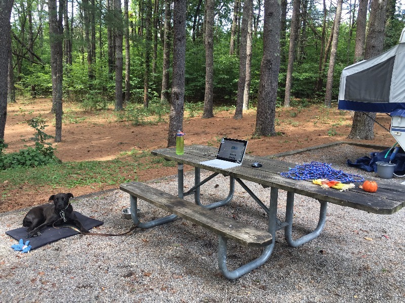
If all goes as planned, I will have rounded up the husband, the dog (we recently adopted one – more to come on that soon!), and a bunch of gear by mid-morning. I’m pointing Chief the Jeep and the currently nameless pop-up camper towards New Mexico and embarking on an extended working/camping/exploring road trip to the Southwest for a wonderfully indefinite amount of time!

So I thought there was no better time than the present to share a guest post from the founder of an Tuscon, Arizona-based adventure travel company I recently connected with by the name of Mitch Stevens. Mitch is the founder and lead guide of Southwest Discoveries, and he was kind enough to share some Arizona hiking expertise with me and my readers. Whether on this upcoming trip or a future one, I hope to check out some of these awesome-sounding Southwest hikes very soon.

——————————————————————————————————————–

Arizona Day Trips – 5 Awesome Hikes in the Southwest 
By Mitch Stevens of Southwest Discoveries

It’s a well known fact that Arizona is beautiful, often breathtakingly so. In this post, we will introduce five of the most awesome, wondrous and secluded hikes in the southwest. From the fascinating Sonoran Desert in southern Arizona to the red rock country near Sedona and the Grand Canyon, Arizona features a staggering diversity of landscapes, perfect for Arizona Day Trips and adventures. But with so many amazing places to trek, just where to you draw the line? Allow us the opportunity to present to you five of the most awesome, wondrous and secluded hikes in the southwest that are perfect destinations for your next hiking adventure.

The first of our five Day trips in Arizona offering big, uninterrupted space, plenty of cactus and southwestern flora to experience and the unspoiled splendor of one of Earth’s major ecosystems.

1. Mt. Ajo – Organ Pipe Cactus National Monument

Ajo Sunset (1 of 1)

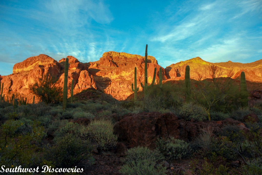
As a trip leader and interpretive guide, Beth Krueger knows the desert. She once spent four days camped at Organ Pipe Cactus National Monument, surveying birds and other wildlife. While most hikers avoid summers in this part of the world, this is Beth’s favorite season. At this time of year, she can savor the fruit of the organ pipe cactus, purported to be the best tasting in the world.

Beth and I collaborated on a late winter outing at the park’s nearly pristine desert wilderness, celebrating the life and landscape of the Sonoran Desert. Our group hiked to the summit of Mt. Ajo, an incredibly beautiful trek which enabled us to experience the Sonoran Desert at it’s finest.

We marveled at magnificent organ pipe and saguaro cacti as well as a rich assortment of extraordinary plants. The preserve is a showcase for plants and creatures who have adapted to the extreme temperatures, intense sunlight, and little rainfall that characterize this southwest region. Located between Arizona’s Ajo Mountains and the Mexico border, Organ Pipe is the only place in the United States where the organ pipe cactus appears, rare in the United States but common in Mexico

A hiker can explore many sections of this international biosphere preserve where big views, uninterrupted space, lots of the namesake cactus and one of the Earth’s major ecosystems survives in almost unspoiled splendor. The monument lies next to Cabeza Prieta National Wildlife Refuge, which is connected to the Barry Goldwater Air Force Range. Together, these lands represent a large, unbroken desert habitat, home to species such as the endangered Sonoran pronghorn, Quitobaquito pupfish and desert bighorn sheep.

Our group hiked one and a half miles through dense stands of giant columnar cactus to the Bull Pasture overlook. There are exceptional views in every direction. The immediate surroundings are filled with smaller peaks, canyons, and other rocks formations; and in the distance are more mountains. If winter rains are generous, this vicinity of the park erupts with dense stands of Mexican Gold Poppies and other gorgeous wildflowers.

After we left Bull Pasture, the official trail ended and the unofficial cairned route began. A series of switchbacks quickly took us up several hundred feet, and the views just kept getting better. Before long, boulders and rock formations that were part of the backdrop at the beginning were now right in front of us. After a few short, steep switchbacks with some loose footing, the route meandered alongside amazing rock outcrops, including windows, arches and a series of huge cone-like stone formations.

At this point, the awesomeness factor jumped to a whole new level. After another mile of hiking on a ridgeline with stunning views, a short but fun boulder hop landed us atop Mount Ajo, the tallest mountain in Organ Pipe Cactus National Monument.(http://www.nps.gov/orpi/index.htm) We scrambled a short distance on the summit and more grand views emerged.  There was a large and colorful rock slab that looked like a spaceship, covered in lime green lichen. This made for a great resting spot.

On the return hike, we completed a loop hike by taking the Estes Canyon Trail to the trail head.  Estes Canyon is spectacular for birding and has many beautiful organ pipe and saguaros. It’s a great place to observe the unique botany and ecology of this fascinating region. For a brief cyber journey of this southwestern wonderland, turn up your speakers and enjoy Organ Pipe Magic. https://youtu.be/tnMc680-TXE


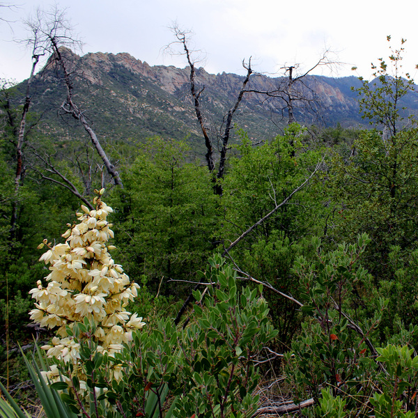
2. Wet Beaver Creek – Paradise Found

Wet Beaver Creek - swimming

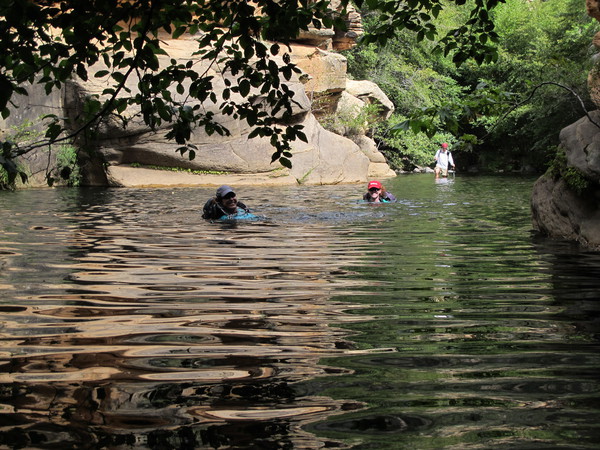
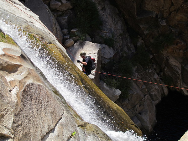
Arizona’s Wet Beaver Creek Wilderness is paradise found. Located on the western escarpment of the Mogollon Rim, the perennially flowing Wet Beaver Creek drains an area of 250 square miles and descends more than 5,000 feet in its 30 mile tumble to the Verde River. What makes this stream particularly appealing for hikers is that it’s a backcountry swimmer’s dream; no fewer than twenty five plunge pools (25 to 75 yards across) must be negotiated. Although a day hike at Wet Beaver Creek is very enjoyable, the entire wilderness hike can encompass a 2 or 3 day backpacking trek, an unforgettable adventure.

Wet Beaver Creek, from start to finish, crosses the divide between the Colorado Plateau to the north and the Basin and Range country to the south. If completing the entire journey, a hiker will trek from verdant ponderosa pine forest at the rim to Sonoran Desert and descend through five geological formations: Basalt, Kaibab, Toroweap, Coconino and Supai.

On a beautiful early fall day, a group of us started our day hike on the Bell Trail in the popular lower end of Wet Beaver Creek. The walk started out mellow and flat but after a mile, the scenery become increasingly colorful. Red Supai sandstone rock formations comprised the rim of the canyon and the walls steepened. We reached the famous Crack, an amazing swimming hole cut out of the Supai formation.

Continuing upstream, true adventure began. The rugged character of this riparian wilderness revealed itself as we splashed, waded and swam across huge plunge pools. The forest canopy thickened and red rock outcrops soared overhead. We swam through a huge pool which was especially charming; a balanced rock towered above us.

At our lunch spot and turn-around point, we scrambled to a remote prehistoric Indian Ruin. Wet Beaver Creek lies within the ancestral lands of the Sinagua culture and archaeologists are still investigating evidence of their prehistoric occupation at Wet Beaver Creek. The Sinagua were hunters and gatherers, utilized extensive irrigation systems and were believed to be the first to trek and swim the length of Wet Beaver Creek. Throughout the Verde Valley, Sinagua rock art and extensive ruins are abundant. Nearby Montezuma Castle National Monument and Montezuma Well are outstanding examples.

An exploration of Wet Beaver Creek is an astonishingly beautiful trek and well worth the time and effort. To view highlights of this epic adventure, turn up your speakers and enjoy this three minute video. Happy trails!
https://youtu.be/ksxI7eIpIYk


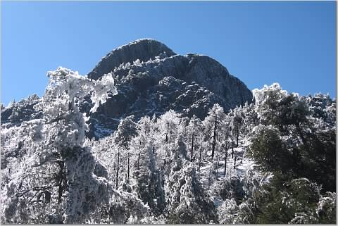
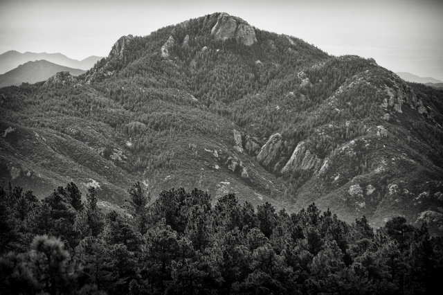
3. Finger Rock – Tucson’s Best Trek

Finger Rock - alpenglow

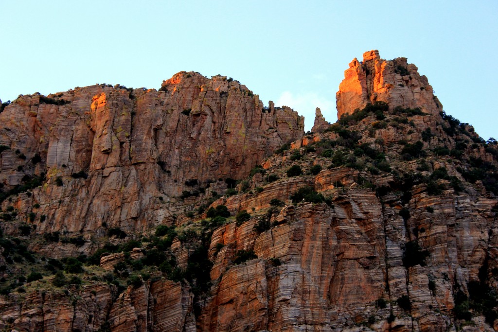
Superlative landscapes, beautiful sunsets, grand views and an exhilarating short climb to a lofty stone pinnacle are the drawing cards of Tucson’s Finger Rock Trail. Late fall through spring are the best times to pull off this trek.

We started early in the cool dawn air and hiked to Linda Vista Saddle, a steep and invigorating workout. In three miles we ascended over 3,000 feet and arrived at one of the few level spots along the trail. If we continued two more miles on the Finger Rock trail, we would have topped out at Kimble Peak, a worthy destination in its own right.

However, our goal today was to scale Finger Rock itself. We left the established trail and headed off to the northwest, down a gully then up a sketchy route, climbing another 1,000 feet. An hour and a half of scrambling and bushwhacking later, we were at the foot of Finger Rock, a slender pillar of lichen encrusted granitic gneiss which juts up 250 feet in spectacular fashion.

Guiding us on this perfect autumn day was Don Smith, an accomplished rock climber, caver, canyoneer, backpacker and avid adventurer. Don has been known to take lengthy sabbaticals and journey to fantastic locales such as the Yukon, Alaska and Belize. He takes folks to some remarkable places, including Tucson’s Finger Rock!
Don went first, set the anchor and belayed the rest of the group. We completed the first pitch then reached the midpoint of the climb. Don clambered up the rock, achieved the near high point of the Finger and secured the rope at strategically placed bolts. The rest of our crew, one by one, scrambled up to a high perch offering marvelous panoramas of numerous rock formations, the lofty crest of the Santa Catalina Mountains and the Tucson valley and beyond.

From there, it is a short scramble to the actual high point of Finger Rock, a precarious roost which can only accommodate one or two people. After spending about an hour enjoying the incredible spectacle, we rappelled 100 feet to the bottom of Finger Rock.

Three and a half hours later, after witnessing an awesome sunset, we all safely returned to the Finger Rock trailhead, rejuvenated after another splendid day of adventure in the mountains.

For an exciting glimpse of this astonishing trek, click on https://youtu.be/8plEYNCcxHw­. Turn up your speakers and enjoy!


4. Rogers Canyon – Spirits of the Past in the Superstition Wilderness

Arizona day trips - group at Rogers ruins

Most folks have hopes and dreams, some more grandiose than others. But few people are fortunate enough to realize all of their dreams. Elisha Reavis wanted to live off the land in a beautiful place far away from the hordes of humanity. He lived out his dream in a high mountain valley in Arizona’s Superstition Mountains where he farmed, grazed and tendered an orchard. Ponderosa pines graced his ranch and a beautiful clear spring-fed creek watered the fruit trees he planted. He died in 1896; his grave-site is located in a place few people will ever see. Thanks to Randy Weber, a Tucson hiker, historian and naturalist, we were one of the few.

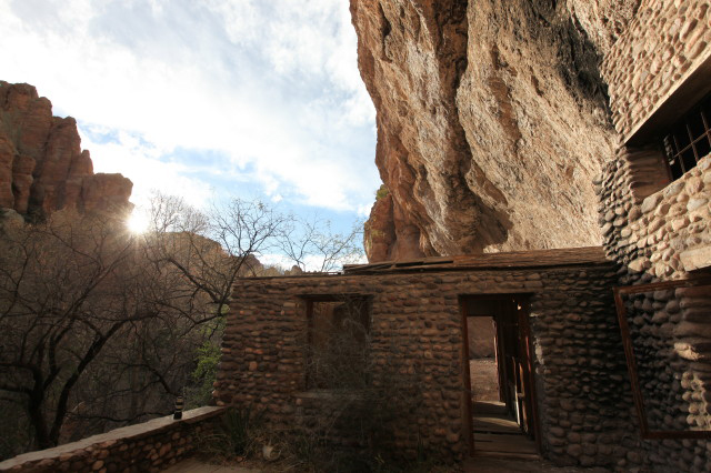
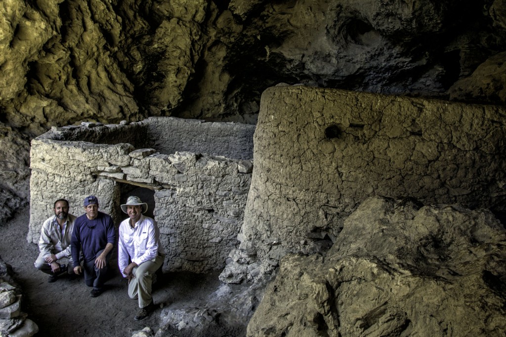
500 years before Reavis departed, the Salado peoples were eking out a living in Rogers Canyon. So we headed left at the Rogers Canyon trail junction to observe the fascinating cliff dwellings. Gradually, the character and look of the landscape transformed from high desert grassland to riparian. Huge old sycamore trees, juniper, oak and mountain laurel appeared. As we ventured deeper into the thick of Rogers Canyon, spectacular volcanic rock formations made their appearance. Various shapes chiseled by the elements resembled a teapot, Queen Victoria’s crown and a huge boulder perched precariously high up on the canyon wall.

Finally, we arrived at the Salado cliff dwellings. These well preserved ruins, located in a huge cave above the canyon floor, were the highlight of our day. At one time, as many as 100 people lived here and there were more than 65 rooms when it was constructed over 600 years ago. Most of the ruins have all but vanished but there is still a lot to see. The view from the ruins, looking out across the canyon was fantastic, a sight to behold. The ruins are fragile and irreplaceable; the forest service asks that hikers tread lightly and respect this magnificent place.

The long and bumpy drive from Rogers Trough trailhead is almost as striking as the hike itself. To the west views of saguaro studded Byous Butte, especially at sunset, are glorious. About six miles down the road on the right, we observed a picturesque stone arch. Numerous ridges and peaks of the Superstitions as well as other sky islands in the distance were prevalent throughout the journey back to civilization.


5. Adventuring at Nankoweap

Nankoweap - Fred and the canyon

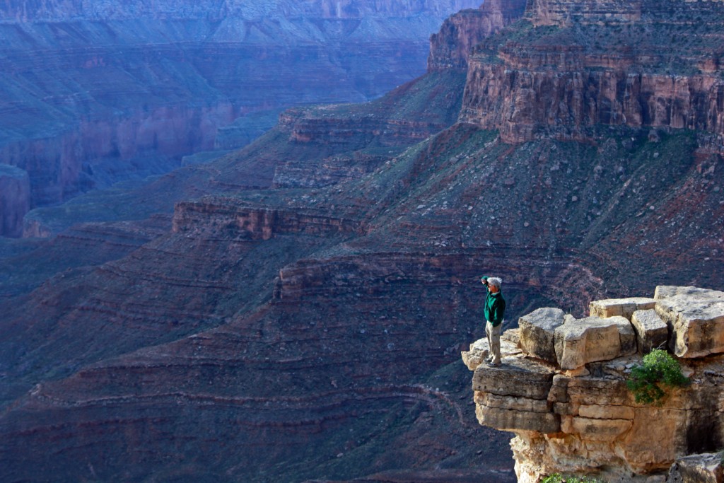
For hikers wanting to experience raw adventure and avoid crowds, the Nankoweap trail at the Grand Canyon is one of the most enjoyable and epic treks in the southwest. Spectacular geology and out of this world views are the calling cards of this magnificent place. Nankoweap is located at the North Rim of the Grand Canyon.

The trail was originally constructed by Major John Wesley Powell, the one armed civil war veteran and explorer in 1882. It was created so that Charles Doolittle Walcott, a geologist in the Powell party, could easily be able to access the canyon and study its rock layers. Powell is best known for his epic explorations down the Green and Colorado Rivers and is credited with leading the first group of men down the Colorado River in 1871, through present day Grand Canyon.

Julie Dobson, who runs a travel adventure website called Escaping the Midwest, (http://escapingthemidwest.com/2016/01/22/the-words-of-john-wesley-powell/), recently posted a few of Powell’s most famous quotes about the Grand Canyon. Powell wrote, “the elements that unite to make the Grand Canyon the most sublime spectacle in nature are multifarious and exceedlingly diverse.”

In 2015 I had the pleasure of guiding a group of adventurers down the Nankoweap Trail. The first three miles were a delightful romp through a high elevation forest of ponderosa pine, juniper and aspen. Then suddenly, the trail took on an entirely different character. The route plunged off the rim of the Grand Canyon and a long ridge-top traverse ensued. After hiking two more miles, all the while gazing at amazing far reaching views, we arrived at Marion Point. Coming into contact with the geology in this part of the Grand Canyon was incredible, rock layers reached far back into our planet’s past from 300 million to 750 million years ago.

Wonderful and unbelievable panoramas unfolded. The visible green ribbon along Nankoweap Creek was 2,500 feet below us. The forks of Nankoweap Creek extended far back toward the plateau, each separated by colorful rocky ridges and lofty buttes. The most striking of these was Mt. Hayden, a distinct and slender 400 foot Coconino sandstone spire at an elevation of over 8,000 feet. Marion Point can also be the turn around location for hikers interested in a spectacular but rigorous ten mile roundtrip day hike.

But our group’s plan was to trek further into the heart of the Grand Canyon (backpacking experience and appropriate gear are highly recommended). Our long ridge-top traverse continued. After we reached Tilted Mesa in just over two miles, the route led steeply down to Nankoweap Creek and the Colorado River. Near the river, high cliffs of Redwall Limestone and beautiful exposures of Muav Limestone and Bright Angel Shale were the dominant features. Our first view of the emerald green Colorado River in the distance was mesmerizing. Not only did we finally see the river but we heard the roar of Nankoweap Rapids, amplified by red and tan walls at Marble Canyon.

Our group camped at the Colorado, which proved to be an excellent base for exploring further afield. We trekked seven miles upstream along bubbling Nankoweap Creek and discovered intriguing places such as Mystery Falls, a set of cliff top Anasazi granaries, and a fascinating cave featuring a stream running through it.

Should the Grand Canyon be included on your bucket list? Most certainly. And the spectacular and uncrowded Nankoweap trail is one of the best ways to experience the real Grand Canyon, the raw and unspoiled grandeur of this most magnificent gorge, one of the seven natural wonders of the world.