New Orleans isn’t exactly known for its biking, and the Crescent City never manages to squeeze its way onto any bike-friendly cities lists. But as 2013 came to a close and 2014 was on the horizon, I found myself along the bayou with my bike.
If you run a quick search for bike trails in the New Orleans area, you won’t exactly be overwhelmed with options. A few small parks came up in my search, but most notably, the New Orleans Levee-Top Trail – also known as the Mississippi Levee Trail and a small portion of the Mississippi River Trail.
It was just shy of 60-degrees on a breezy day in late December. I parked my Jeep for free in the parking lot for Audubon Park, right next to the New Orleans zoo. But to check out the trail, you need to head the opposite direction, ride under the gates, across the railroad tracks, and hang a right.

Trail closed? WTF?!
Shortly after doing so, this is the site you’ll see. Orange and white “road closed” barriers and ominously “danger” signs staring you in the face.Since summer 2013, the US Corps of Engineers have been working upriver from the Huey P. Long Bridge at Powerline Drive and the River Levee.
But never fear! You can still bike along this peaceful levee trail…you just have to do a little off-roading to get there.
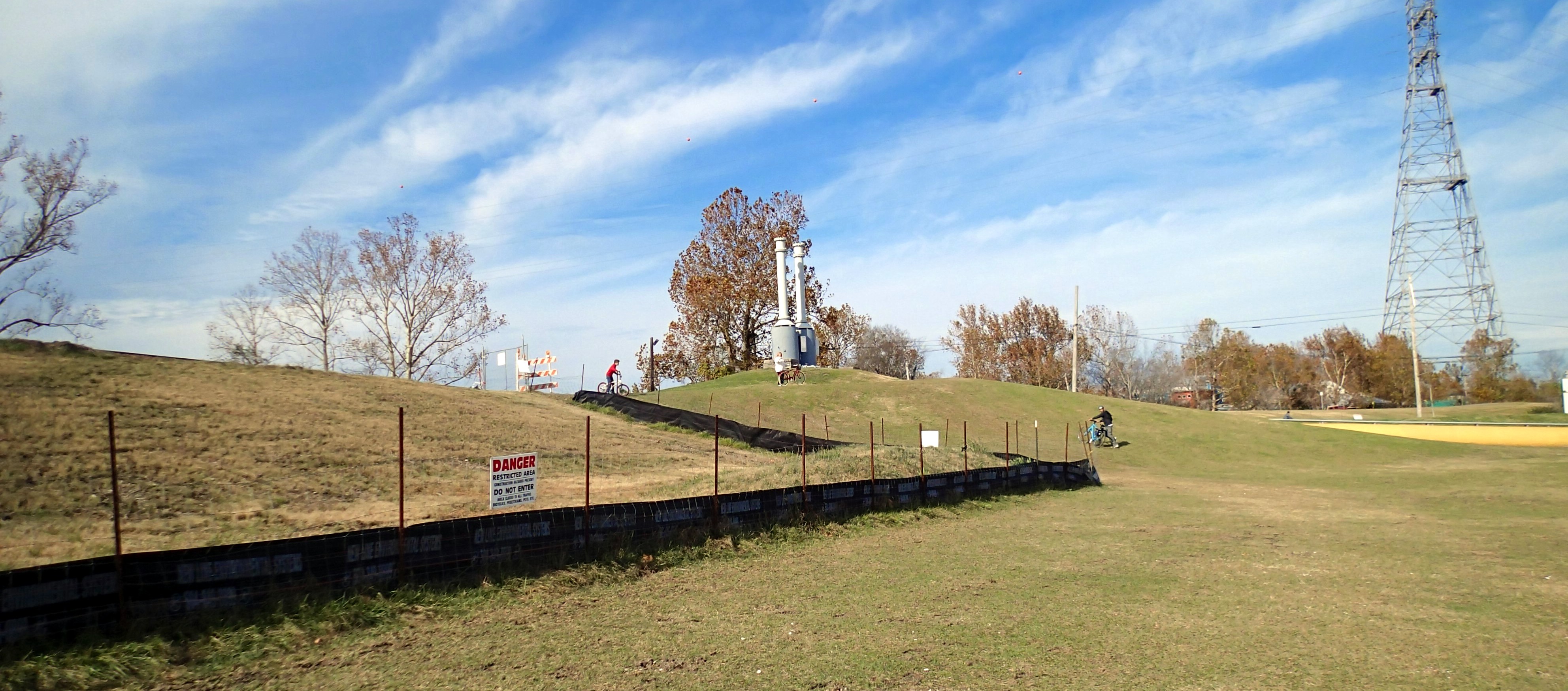
Secret Trail Access Point
One access road is downriver from the construction area at Brookhollow Esplanade, and another is less than a mile upriver at Imperial Woods. To get through the closed-off area, you can take a detour on River Road, which is about a mile along.
Or you can do what I did and ride in the grass, dirt, and gravel on the lower road-side of the trail. This is a ‘yes’ for mountain bikes, a ‘no’ for road bikes, and a ‘sorta-kinda-maybe’ for hybrids like mine. If it’s a weekday, you’ll probably encounter some construction traffic around Powerline Drive, but that drops away once you ride further along.
The drainage project construction will be ongoing until 2015, so in the meantime the New Orleans Bicycle Club posted this suggested detour map.

Horse Stables Along the Trail
As you haul your bike the top of the trail, you’ll see a couple horse stables and lots of industrial buildings.
“There’s this huge mile-wide river next to us, that over the decades we’ve protected ourselves from—so any opportunity to get to the river is very important,” says Jennifer Ruley, a pedestrian and bicycle engineer who works as an advisor to the city of New Orleans. “It really helps us to connect to the geography and history of the city.”
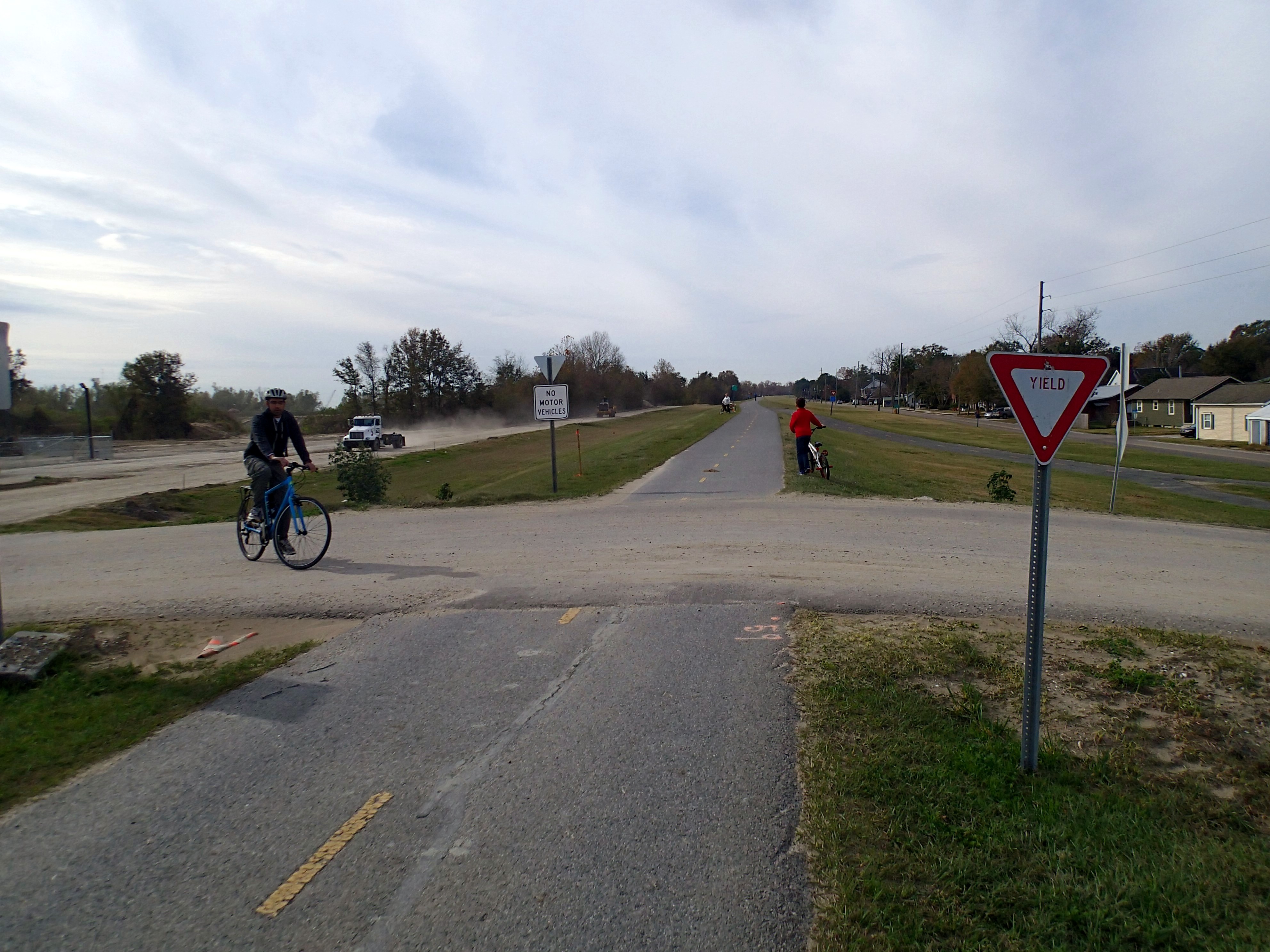
Beware of Spontaneous Truck Crossings
The Levee Top Trail forms a vital link in the 3,000 mile-long Mississippi River Trail, which is an ongoing venture to establish pathways along the entire north-to-south length of the Mississippi River. As you ride, you’ll get behind-the-scenes access to the lesser-known sights of New Orleans: residential areas, commercial wharves, hospitals, shopping centers, golf courses, chemical plants, and parks. If you ride far enough, you’ll even go past the old Destrehan Plantation, which at 227 years old, is the oldest plantation home on the lower Mississippi River.
Many of the industrial areas that span the first six miles of the trail are still active today, so you’ll need to yield and watch for low-flying aircraft when signage prompts you to do so. While the detour path to reach the trail is a bit rocky and unpredictable, the actual trail is paved and in awesome condition.
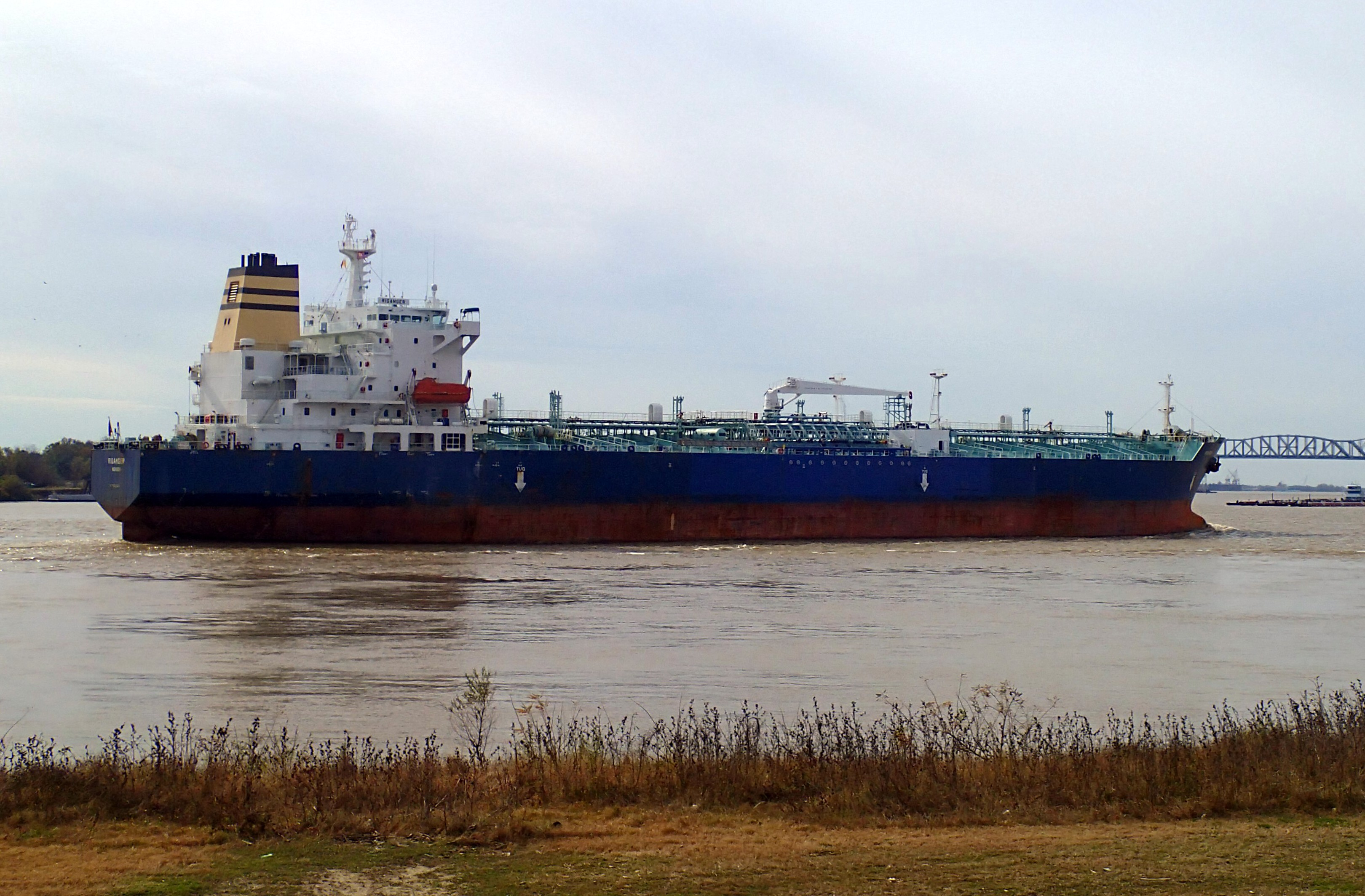
Boats Along the Mighty Mississippi
Although the Mississippi isn’t the most attractive river in the world (unless you’re a weird fan of brown water), it’s definitely cool to watch the enormous ships and barges still operating under the city’s expansive bridge system. Rumor has it that there are future plans to build out the levee top trail between New Orleans and Baton Rouge, which is about 130 miles upriver. Whenever this is completed, it will be a great way to explore tiny Louisiana towns that rarely draw the partying tourist demographic.
For now, cyclists gravitate towards the Colonial Country Cub, which has some great views of the Mississippi River boat traffic. Go six miles further and you’ll reach Rivertown , which has a pier with benches along the river for a quick stop…and a restored museum and restaurant area in Kenner for a longer one.
When most people think of New Orleans, images of Mardi Gras, Bourbon Street, and enormous frozen daiquiris come to mind. Since this was my third visit to the city, I longed to see if New Orleans had a hidden outdoorsy side tucked away somewhere off the grid.
The Mississippi Levee trail is that place – a place where cyclists, joggers, and dog walkers can take a break from the craziness downtown and reconnect with nature and history. And after experiencing it for myself, I can see New Orleans for more than its sparkily masks and liberal open container laws.